


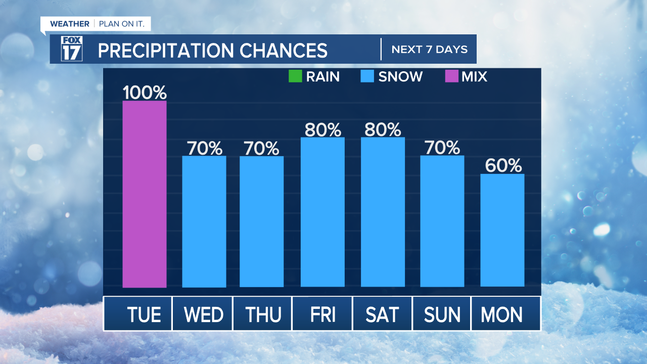
WEST MICHIGAN — This week will feature a sharp turn to winter with accumulating snow, wind, and colder temperatures. The FOX 17 Weather Team has been tracking a large winter storm moving into Michigan for today and tomorrow. Take a look at our precipitation chances below this week. Quite high! Friday and the weekend looks to have the most impact and widespread snowfall.
When will the storm arrive?
Forecast models are in agreement that a widespread winter storm will keep up today and continue into Wednesday morning. This storm looks to bring mainly a heavy, wet, high-moisture content snow with plenty of rain mixing in. The best chance of a rain/snow mix will be around and south of I-96. Strong winds with gusts at the lakeshore of 40 to 45 mph are possible. The freezing line, where rain turns to snow or mixes, is still variable, but the general consensus is from Muskegon-Grand Rapids-Greenville to the southeast.
Models suggest the system continues as snow, with a quick burst of 1" to 3" throughout this morning. It will then mix with rain showers through the afternoon. See image below valid for 12 p.m. today.

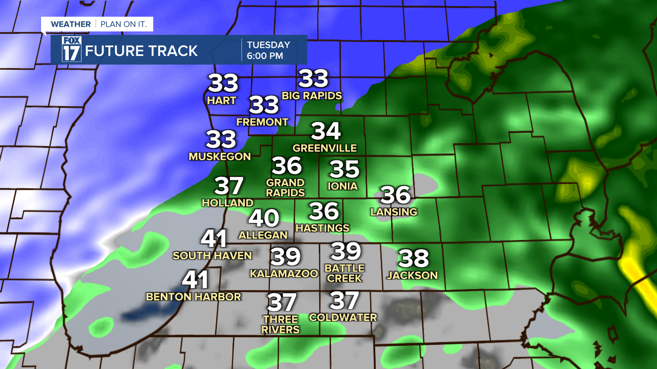
Some slightly warmer air will wrap in today as this will mix or transition our initial snow over to a period of rain and snow. The blue and purple colors on the map suggest snow, the light pink indicates a mix of rain and snow, and green represents rain. The image below is valid for 6 P.M. today.
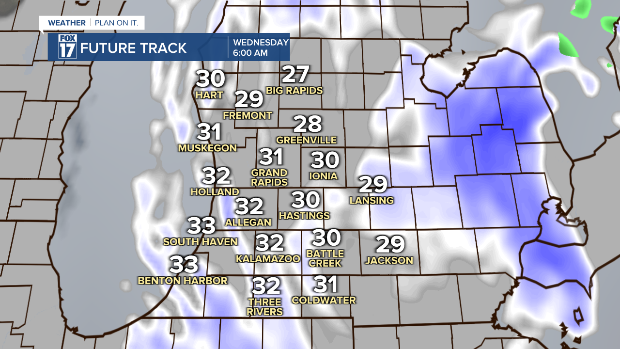
Colder air will wrap into the state overnight into Wednesday. This will transition all precipitation back over to snow. Travel conditions could be tougher late tonight through Wednesday morning. See image below valid for 6 A.M. Wednesday.
The system finally pulls away later Wednesday afternoon. See image below valid for 6 P.M. Wednesday.

While the winter storm will depart Wednesday afternoon, that is not the end of snow chances this week. The latest forecast trends show more light snow possible on Thursday, with an even bigger more impactful system arriving Friday and Saturday. More wind and perhaps even heavier, widespread snow is possible with this second storm. See image below. This storm may follow a similar track as Tuesday's storm but have colder air accompanied with it giving us mainly more snow.

How much snow?
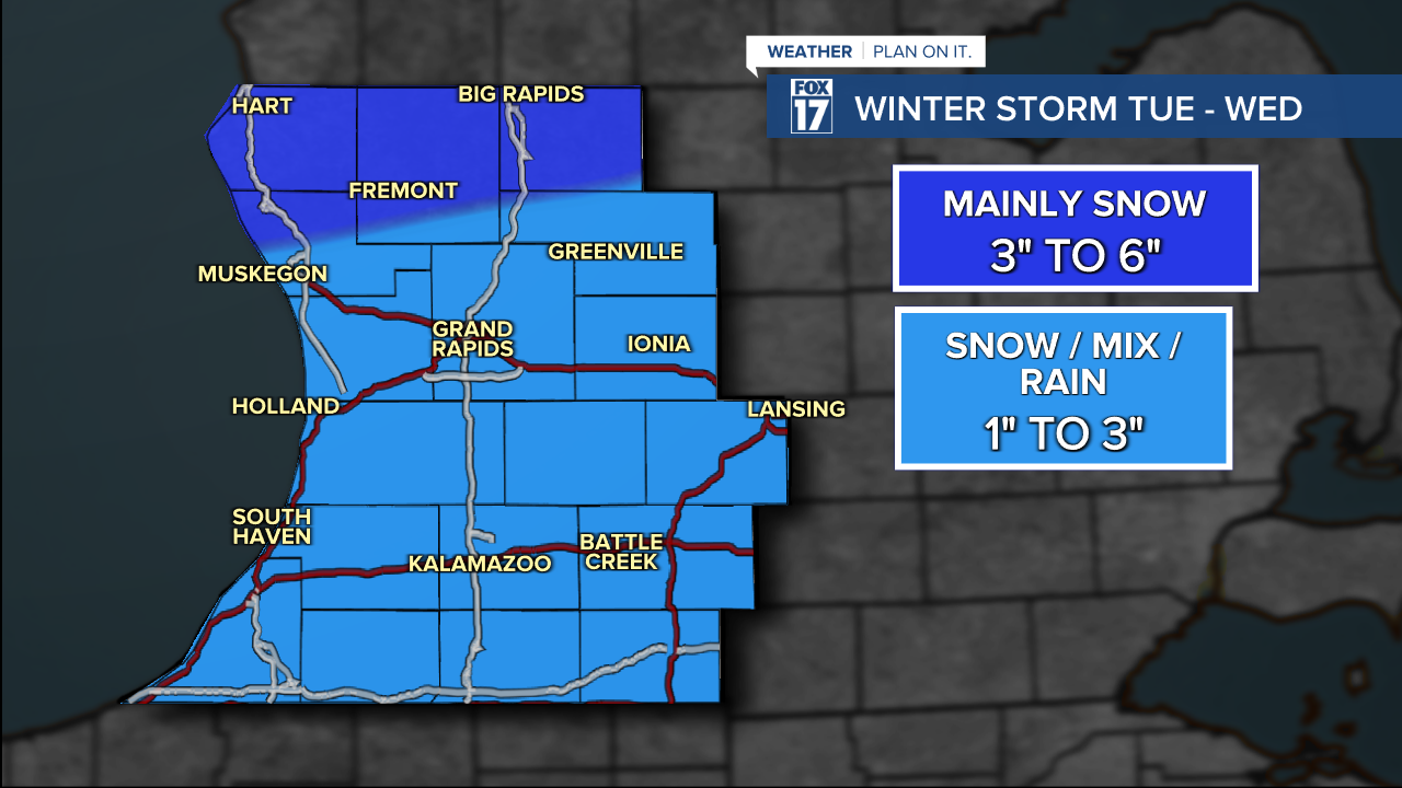
As mentioned above, there are factors that will adjust how much snow we receive in West Michigan. Most temperatures will end up being on the warmer side Tuesday early evening, we will see more rain mix in, and reduce/melt any snowfall accumulations overnight. If temperatures lean on the cooler side, we will see more snow. We don't think this will be a snowstorm for most of our area. We believe with rain mixing in, many areas will see about 1" to 3" of snow with higher amounts further north. See our map below.
Take a look at our watches and and advisories issued. More advisories for the remainder of our area will likely be forthcoming today.

How strong will the wind be?
Reduced visibility when snowing will be a factor in the forecast today and Wednesday due to the strong wind gusts. Forecast models suggest strong winds from the east this morning.

The winds will shift direction by this afternoon, eventually drawing in colder air from the northwest tonight into Wednesday, turning any rainfall back to snow for the rest of the 7-day forecast.
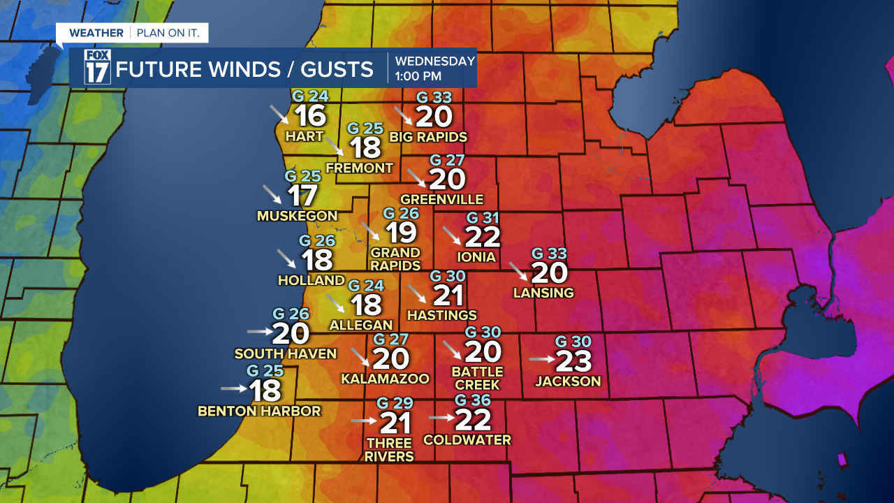
Strong winds are likely on Wednesday from the northwest. This could generate steady bands of lake effect and lake enhanced snow. Wind gusts over 40 mph are possible in isolated area. Again, that may reduce visibility significantly at times.
Stay tuned with the FOX 17 Weather Team! You can download the FOX 17 News app for your latest forecast video.
