


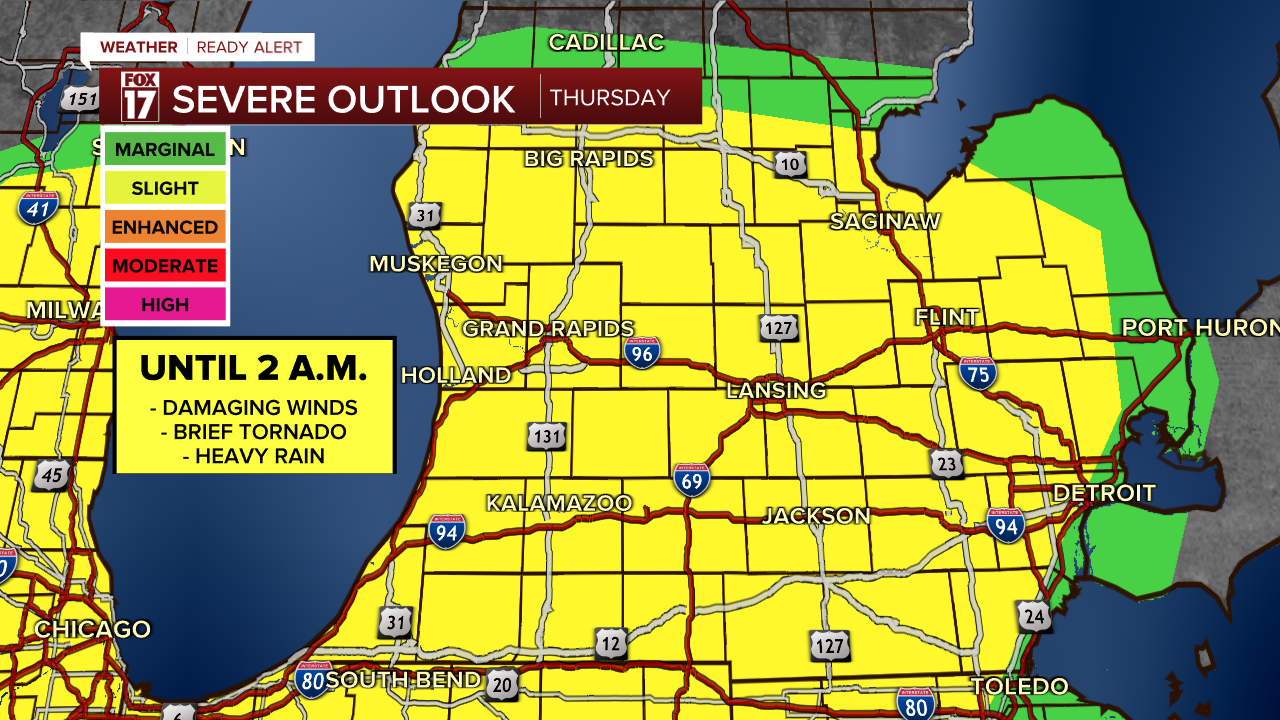
WEST MICHIGAN — The FOX 17 weather team is continuing a Weather Ready Alert tonight for additional strong to severe thunderstorms in West Michigan. After a busy evening of tracking tornado warnings and severe thunderstorm warnings along a warm front, the next round of storms comes along the cold front.
The Storm Prediction Center continued the level two slight risk (yellow) for West Michigan overnight, for a wind and brief tornado threat.
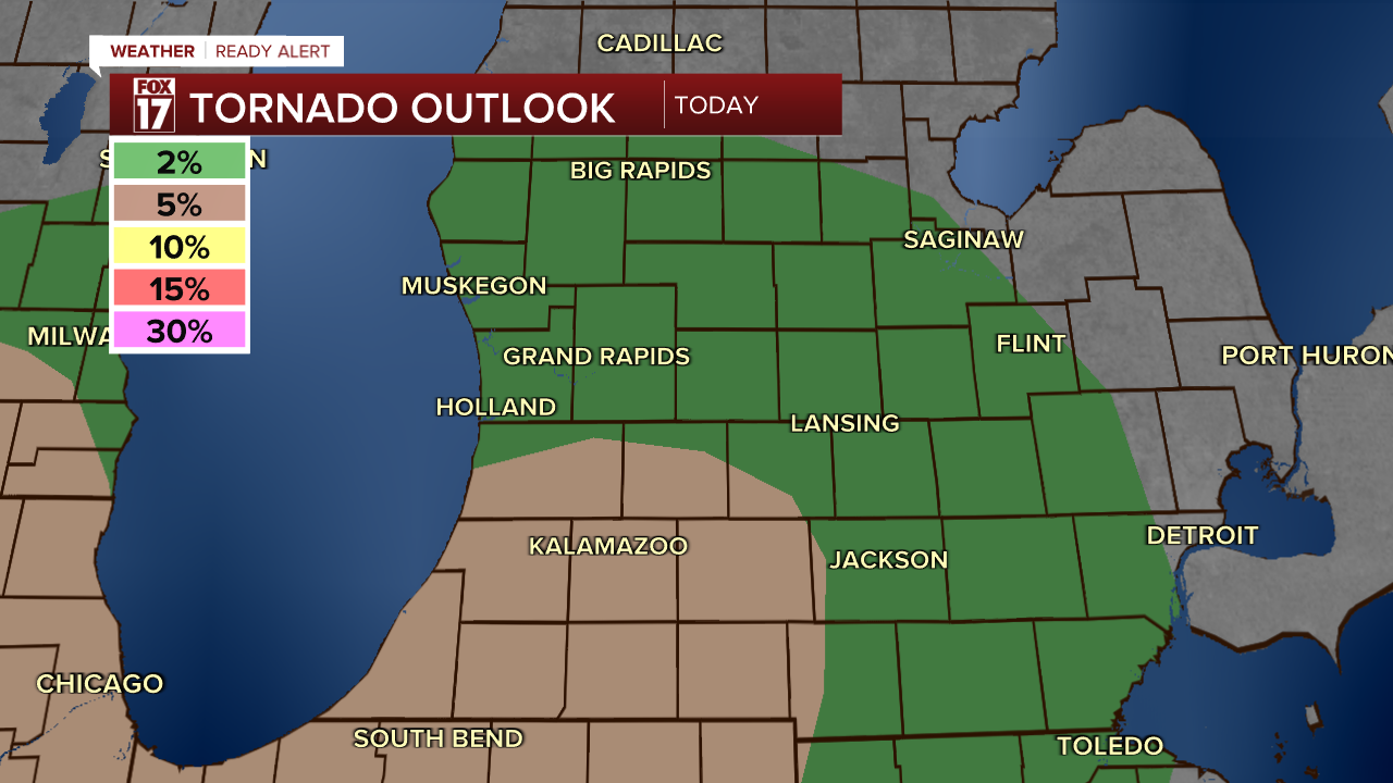
There is more spin in the atmosphere with this system than with previous systems, especially in southwest lower Michigan in the brown highlighted area (below).
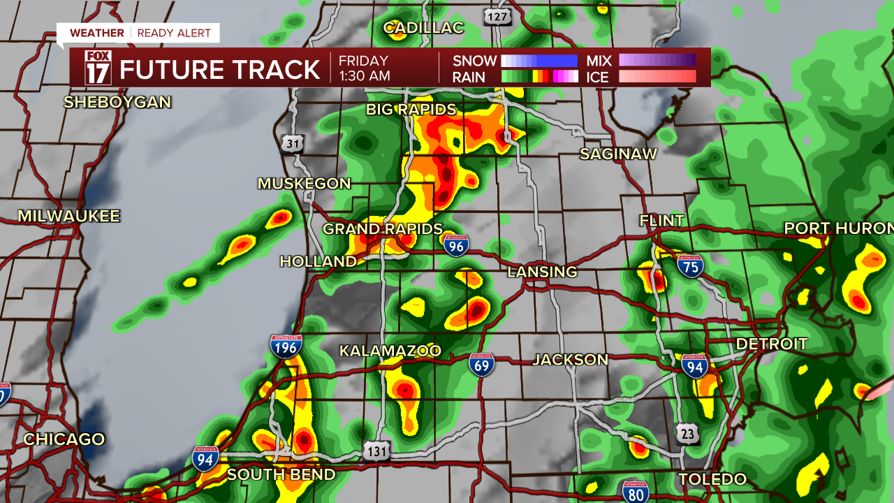
A few more storms from midnight to around 2 a.m. could be briefly strong as the cold front moves closer.
These storms have the potential for gusty winds, especially near the lakeshore. A brief spin-up tornado can't be ruled out but is not expected to be the primary threat.
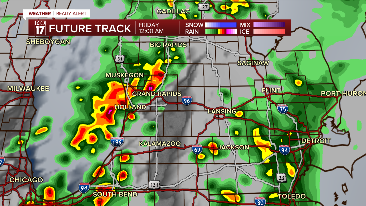
Rain and storms will come to an end early Friday morning.
Heavy rain could lead to ponding on the roads in lower lying areas, but widespread flooding is not likely.
Stay with FOX 17 for more updates as we get closer to another chance for severe thunderstorms in West Michigan.
Want alerts when inconvenient or severe weather is headed your way? Download the FOX 17 Weather app and set up notifications for where you live.
For the latest details on the weather in West Michigan, head to the FOX 17 Weather page.
Follow FOX 17: Facebook - X (formerly Twitter) - Instagram - YouTube
