


WEST MICHIGAN — The FOX 17 Weather Team has issued a WEATHER READY ALERT for today, March 31. A few rounds of rain and thunderstorms will move through West Michigan, and some storms that develop could be severe.
There will be a stretch of dry time on today between mid-morning and early afternoon. Then a passing cold front will bring our next round(s) of showers and storms during the second half of the day.
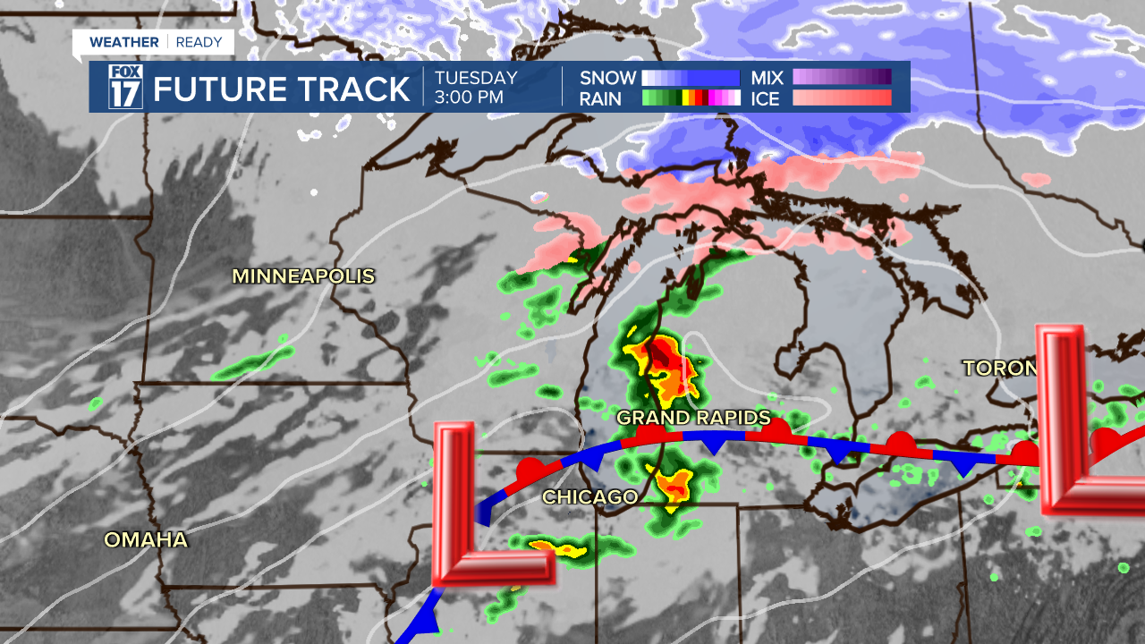
The image below shows our FOX 17 Future Track model at 3PM this afternoon.
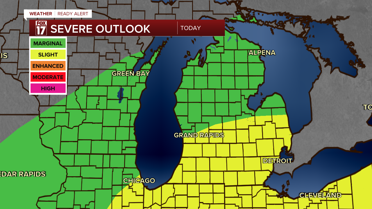
The southern half of the state is in a Slight risk (level 2/5) for severe weather for this afternoon/evening. Hail and damaging winds remain the primary threats with any of these storms that develop. There is a low isolated tornado threat! Some heavy downpours will be possible too.
The time frame for rain and storm activity will be between 2PM-10PM. This could impact the afternoon/evening commute, so plan accordingly.
The image below shows our FOX 17 Future Track model at 10PM this evening.

Make sure you have multiple ways to receive warnings in case any are issued.
Want alerts when inconvenient or severe weather is headed your way? Download the FOX 17 Weather app and set up notifications for where you live.
For the latest details on the weather in West Michigan, head to the FOX 17 Weather page.
Follow FOX 17: Facebook - X (formerly Twitter) - Instagram - YouTube
