


WEST MICHIGAN — Another heat wave anchored across the Midwest is impacting West Michigan as we close out July. High temperatures eclipsed 90 degrees Sunday, and low 90s are on the menu again across the board today and Tuesday.
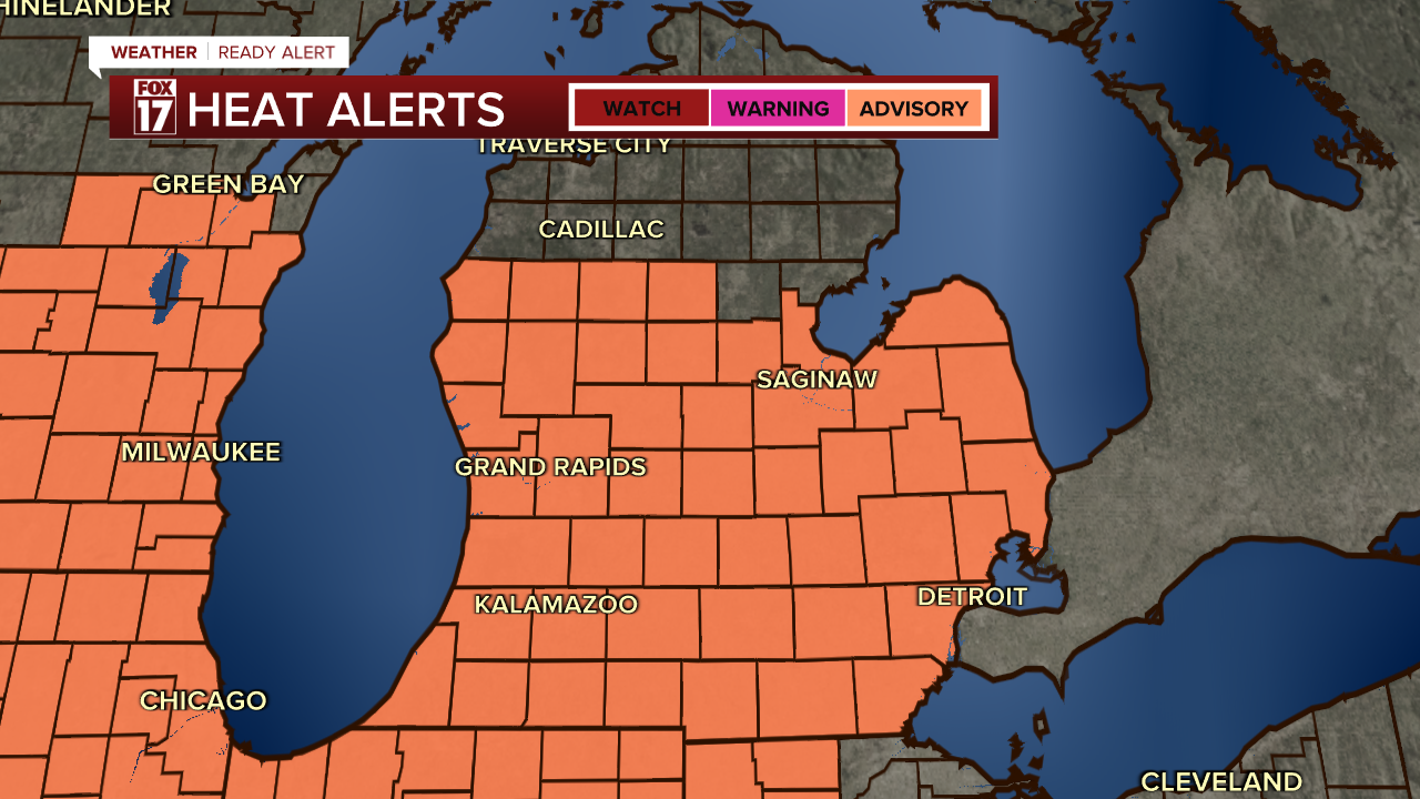
A HEAT ADVISORY will be in effect from Noon - 9 p.m. for all of Central and Southern Lower Michigan, due to the extreme heat and humidity levels. We anticipate another Heat Advisory to be issued Tuesday.
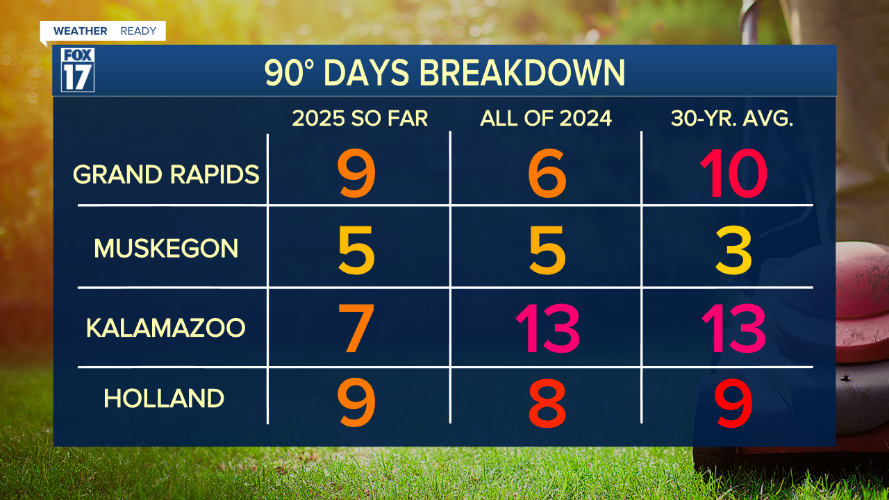
Monday's 90-degree heat will be the 10th for Grand Rapids and Holland, but only the 8th for Kalamazoo. this is due to more rainfall along I-94 limiting the heating ability with a lot more moisture in the atmosphere. The average for Grand Rapids for the year is 10 while Kalamzoo's average is 13! Look at how this year's heat compares to last year, and the 30 year average, below.
June's stretch of 90-degree days included the hottest day of the year, with a high temperature of 95-degrees on June 23rd during a four-day stretch which did not see a single temperature below 70-degrees.
This week will be our 2nd stretch of 3+ days with 90-degrees or warmer in 2025, the other being June 21-25. 2025 is the third year in a row to have 2 such streaks in a given year, and the 10th in the last 20 years.
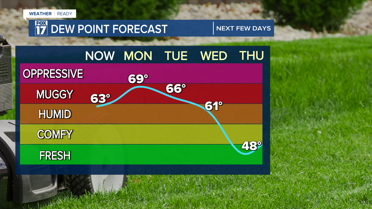
In addition to the hot temperatures, humidity levels will be very high as well; boosting the "feels-like" readings close to the 100-degree mark for Monday and Tuesday.
Heat relief finally comes in the middle of the week with a stronger cold front. We will finally be able to give the air conditioners a break for the second half of the week, with highs slipping into the upper 70s and overnight lows in the comfortable 50s.
More importantly, dew points will drop into the upper 40s as well meaning the air will feel much less humid and more refreshing than the last few weeks!
For the latest details on the weather in West Michigan, head to the FOX 17 Weather page.
Follow FOX 17: Facebook - X (formerly Twitter) - Instagram - YouTube
