


WEST MICHIGAN — The FOX 17 Weather Team has issued a Weather Ready Alert for today March 26, due to the possibility of strong to severe storms south of I-94 through the evening.
Scattered thunderstorms developed along a cold front this afternoon, and will continue on and off through the evening.
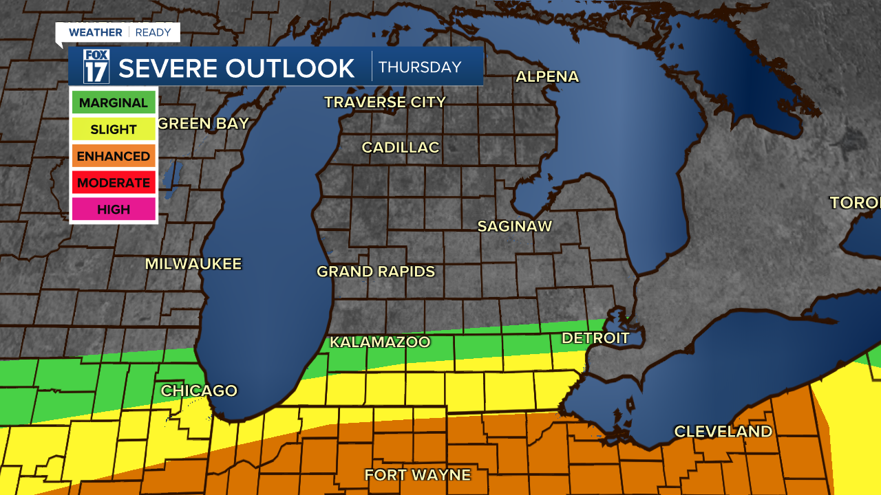
Neighborhoods along I-94 and south near Kalamazoo are under a Marginal Risk (level 1/5) for a briefly severe storm, with quarter-size hail. A slightly elevated chance for severe weather. exists along the Michigan-Indiana state line where a Slight Risk (level 2/5) is in place. That said, we expect most (maybe all) of the severe storms to remain south of the Michigan Indiana border.
The main storm threat is the chance of large hail, bigger than quarter size. Park your car inside if you have that opportunity!
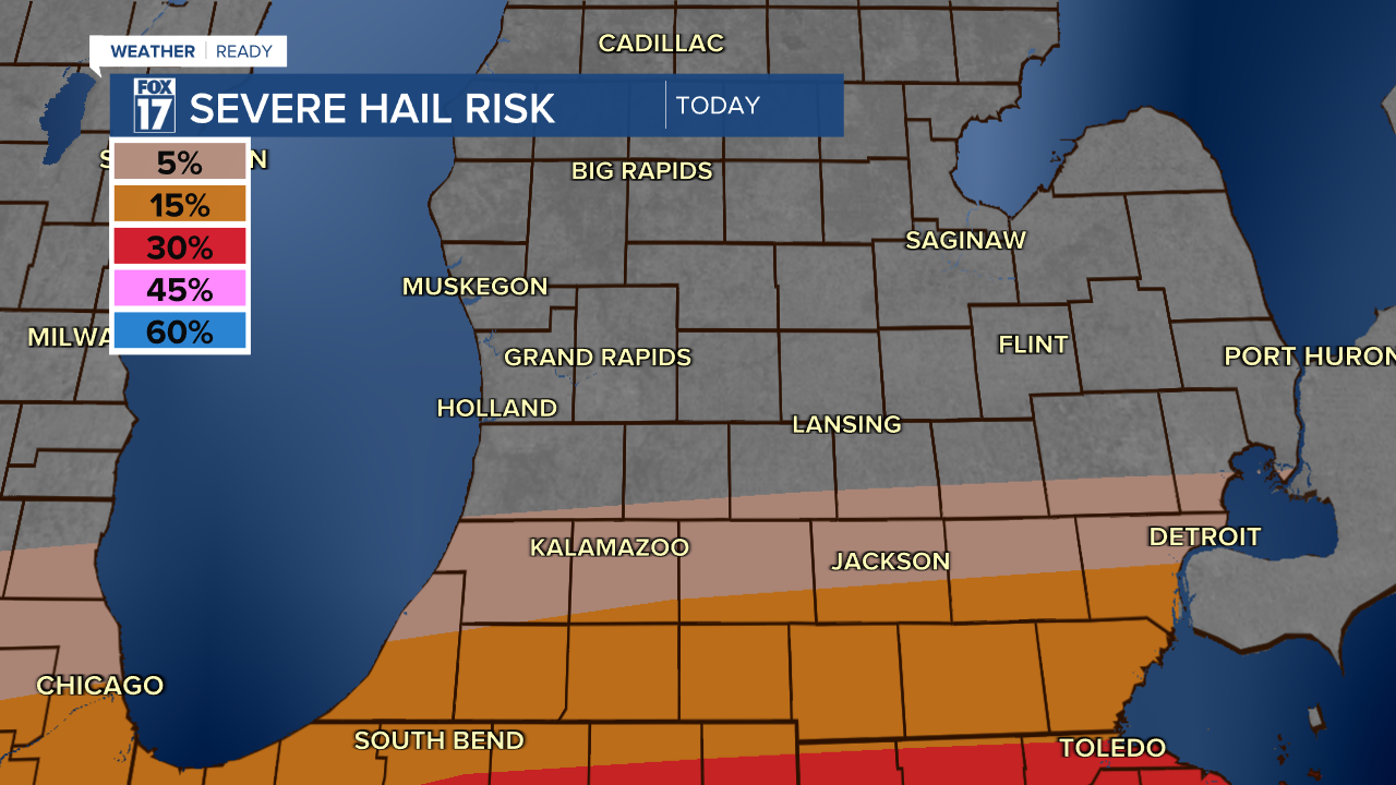
The best environment for more widespread severe storms is south, into northern Illinois, Indiana, and Ohio. Hail in these storms could be bigger than golfballs (1.75"), and there is an elevated tornado threat there as well.
Temperatures have remained a little too cool for West Michigan today for widespread severe storms to form, but there is still a few hour window where storms with large hail could move through near the Indiana state line.

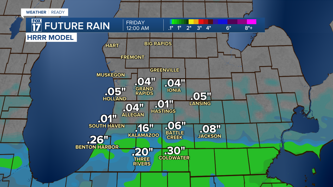
Rain amounts have already reached a quarter to a third of an inch from this afternoon's rain. By the time everything wraps up tonight, another 0.25 to 0.5" of rain is possible, especially south near I-94 where additional rounds of rain and storms are most likely. These can change depending on where the heavier corridors of rain set up.
Any lingering showers or storms will be tapering down by midnight at the latest.
Make sure you have a way to get watches, warnings, and advisories. Download the FOX 17 weather App, or use a NOAA weather radio.
For the latest details on the weather in West Michigan, head to the FOX 17 Weather page.
Follow FOX 17: Facebook - X (formerly Twitter) - Instagram - YouTube
