
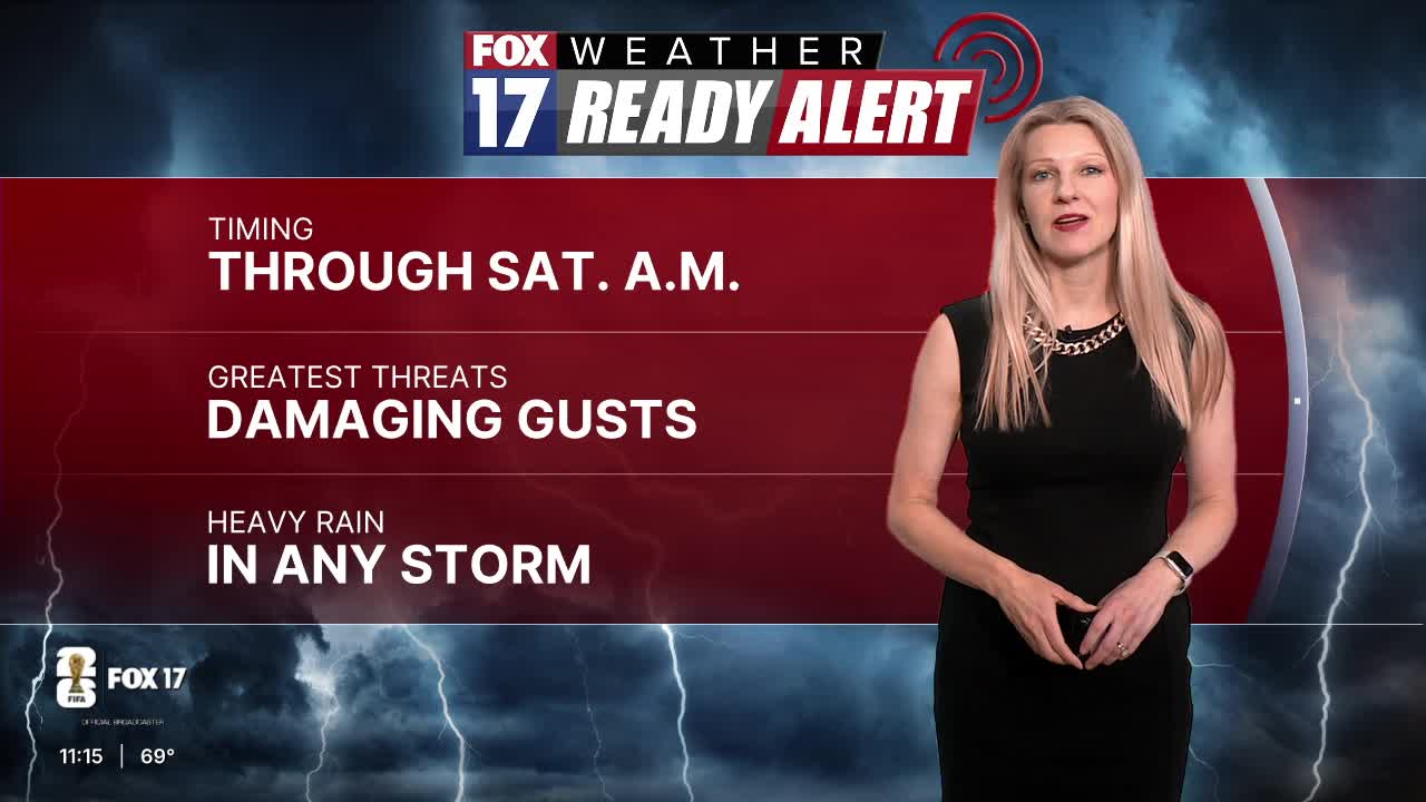


WEST MICHIGAN — FOX 17 is continuing the Weather Ready Alert overnight due to the risk of strong to severe thunderstorms in West Michigan.
All of West Michigan is included in the Marginal Risk (level 1 out of 5) for isolated severe thunderstorms overnight. Storms with damaging wind gusts and small hail are the main threats, especially after midnight.
Clouds, rain and cool temperatures earlier Friday limited the severe weather risk. Storms overnight will have more wind energy to work with and could briefly become strong to severe.
Widespread severe storms are not likely, but a few could strengthen enough to contain damaging wind gusts or small hail.

The wave of storms continues to move toward the I-94 corridor in the early morning hours Saturday. Storms could still be strong during this time.

The final push of storms into Indiana happens around 7-8 a.m. Once the cold front passes through West Michigan, our storm threat ends for the day.
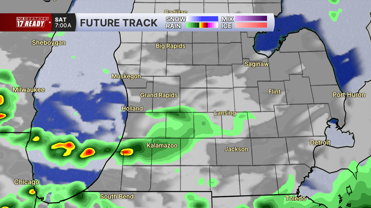
If the front slows down slightly, the threat for storms will continue through the late morning to around noon, mostly south of I-94.
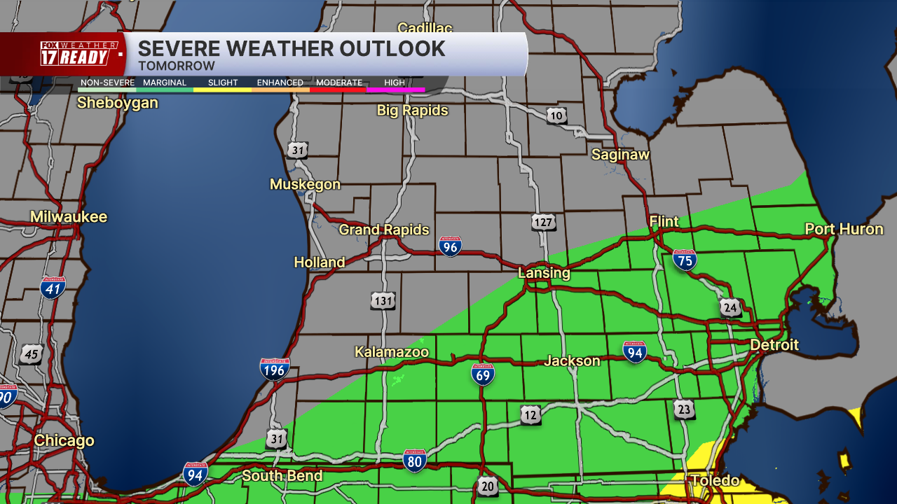
The storms along the cold front early tomorrow morning could also be briefly strong to severe, but the better chance for severe storms will be southeast of Grand Rapids, from Kalamazoo over toward Lansing.
Rain should come to an end by lunchtime at the latest tomorrow and we will be dry for the rest of the day, and the weekend. Rain totals from this system are looking to be between 0.5-1", with some isolated higher totals possible.
Follow FOX 17: Facebook - X (formerly Twitter) - Instagram - YouTube
