


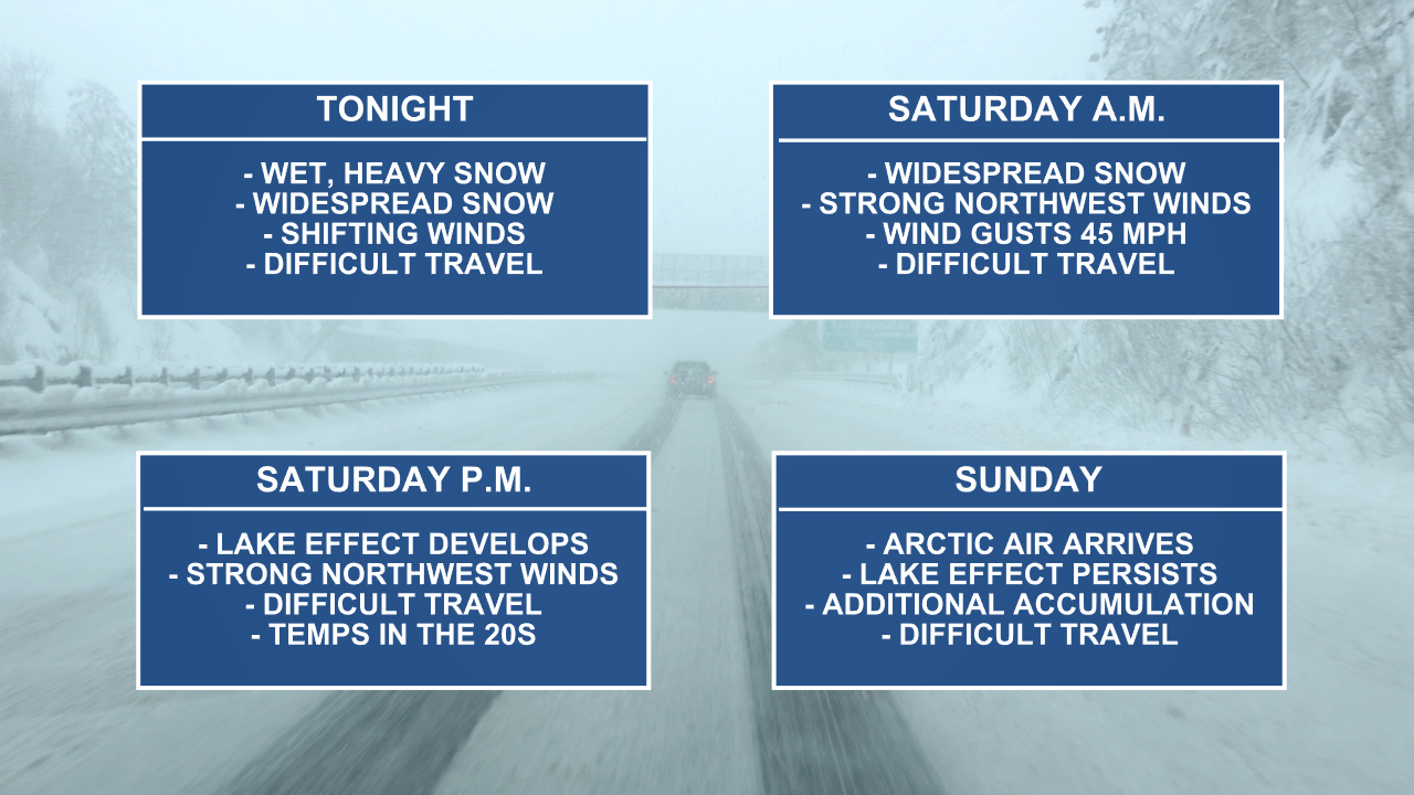
WEST MICHIGAN — Old man winter finally arrived this week and we expect to see more of his wrath. Our next storm is expected to pack a punch, lasting into Saturday afternoon. Widespread, heavy snow and strong wind gusts are anticipated with this system, along with a blast of Arctic air to follow. Below is a timeline of how and what will unfold. Additional details and storm specifics are below.
WINTER STORM WARNINGS and WINTER WEATHER ADVISORIES have been posted for West Michigan through 7 p.m. Saturday.

How long will the snow last?
Snow continues Friday night into Saturday as the system lifts to the north and our east. Below is a look at future track valid at 6 a.m. Saturday morning.

Widespread snow will stay consistent through the day on Saturday as snow accumulations stack up and gusty winds continue. Below is a look at future track valid at 6 p.m. Saturday evening.

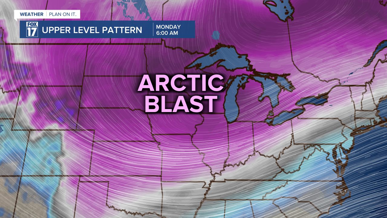
As we work to the backside of this system on Sunday, Arctic air is likely to settle in. This will fire up persistent lake effect snow bands through Sunday and Monday. We can expect additional snowfall ... probably several more inches, primarily along and west of U.S. 131. Below is a look at future track valid at 6 p.m. Sunday evening.

How much snow will fall?
Forecast models are in agreement that heavy, widespread snow is likely for West Michigan. Below is the snowfall estimate from Friday morning through Saturday evening. Most of the region will pick up 8" to 12" of snow between Friday and Saturday afternoon. Isolated higher amounts are likely. Parts of West Michigan could receive up to 14" of snow.

The image above does not include the lake effect snow accumulation that is anticipated for Sunday and Monday, where several more inches may fall. The blast of Arctic air on Sunday and Monday will set off the lake effect snow machine, which will result in additional accumulation. The heaviest snow on Sunday and Monday will be along and west of U.S. 131.
How cold will temperatures drop?
In order for lake effect snow to develop, we need specific atmospheric ingredients. One of the key ingredients is how cold temperatures are high up in the atmosphere. We are expected to have significantly colder air by Sunday, Monday, and Tuesday. High temperatures will only be in the teens with overnight lows in the single digits.

That air is certainly cold enough to set off the lake effect snow machine. In addition to the cold air, we will have ample moisture from our Great Lakes. Lake Michigan has very limited ice this season and the lake remains warm. This will also add to lake effect snow development.
How strong will the wind be?
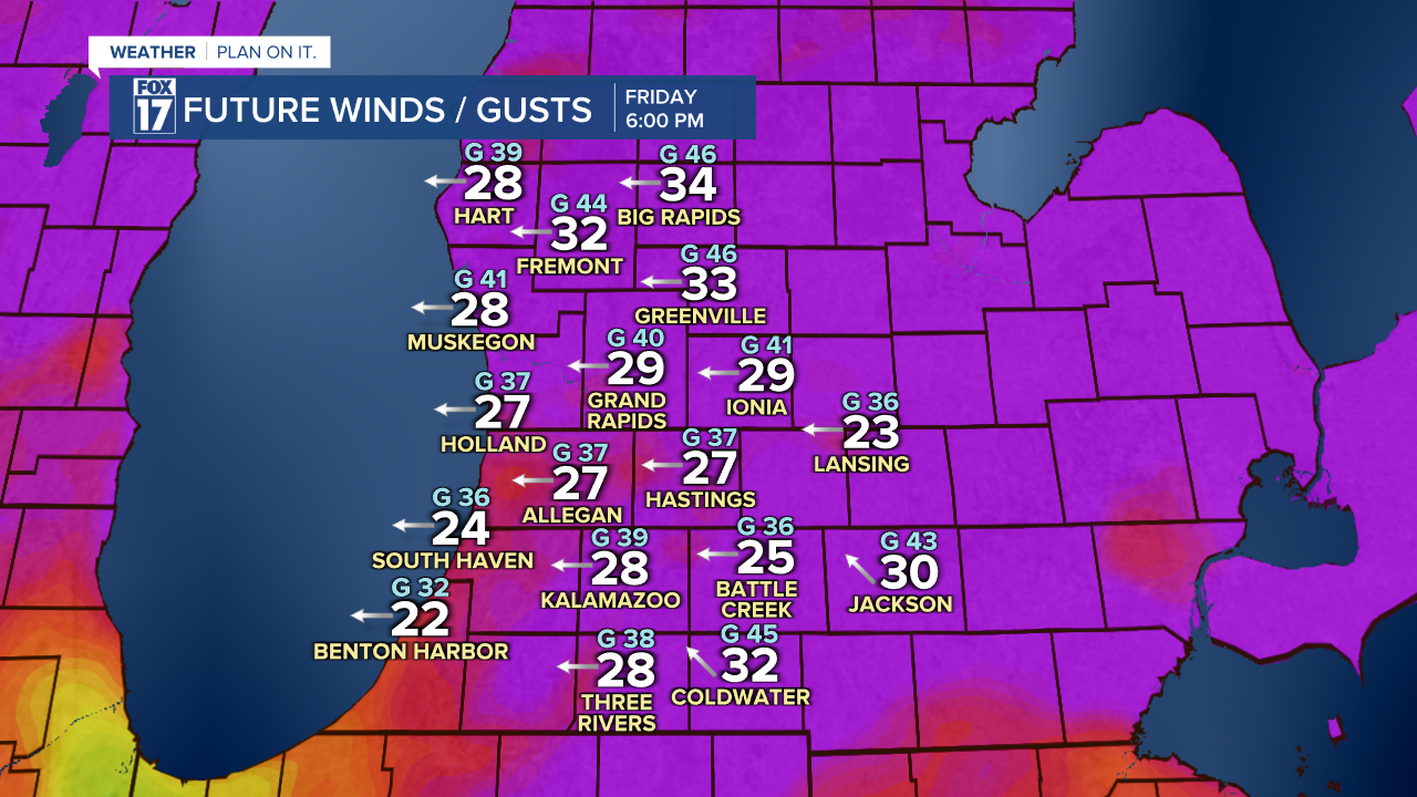
When the storm arrives on Friday and Saturday, plan on strong, gusty winds! we may see power outages with the widespread heavy snow weighing down trees and power lines! The wind on Friday afternoon will primarily be from the east with wind gusts over 40/45 mph.
As the system continues to travel east and northeast, the wind will shift direction. Below is the anticipated wind speed and direction by Friday evening. Image below valid for 6 P.M. Friday. The larger, whiter numbers are sustained winds, the "G" number represents the gust, and the arrow shows the direction the wind is coming from.
The wind will shift by Saturday, drawing in colder air from the northwest. This could allow for lake enhanced snow, as well. Wind gusts could range to 45/50 mph on Saturday morning.
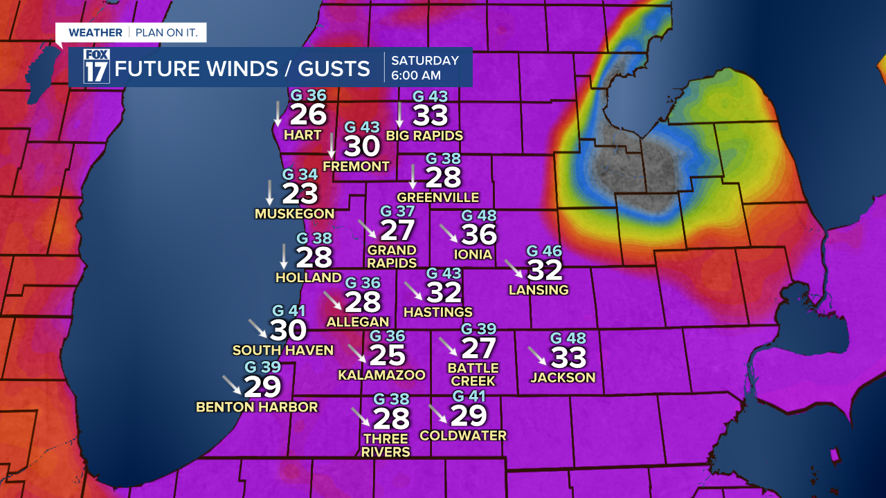
Winds will diminish slightly by Saturday evening, but still be strong and brisk. See image below valid for 6 P.M.

Could this storm be considered a blizzard?
It is possible that brief blizzard conditions or near blizzard conditions could develop on Friday and Saturday. In order for a storm to be considered a blizzard, it MUST meet specific criteria. The definition of a blizzard includes wind speeds at least 35 mph and visibility down to one quarter of a mile or less for at least three hours in duration. Without that criteria met, the storm is not a blizzard.

Stay tuned for updates with the FOX 17 Weather Team! Several aspects of this storm could change, so you'll want to check back in. You can download the FOX 17 News app for your latest forecast video.
