
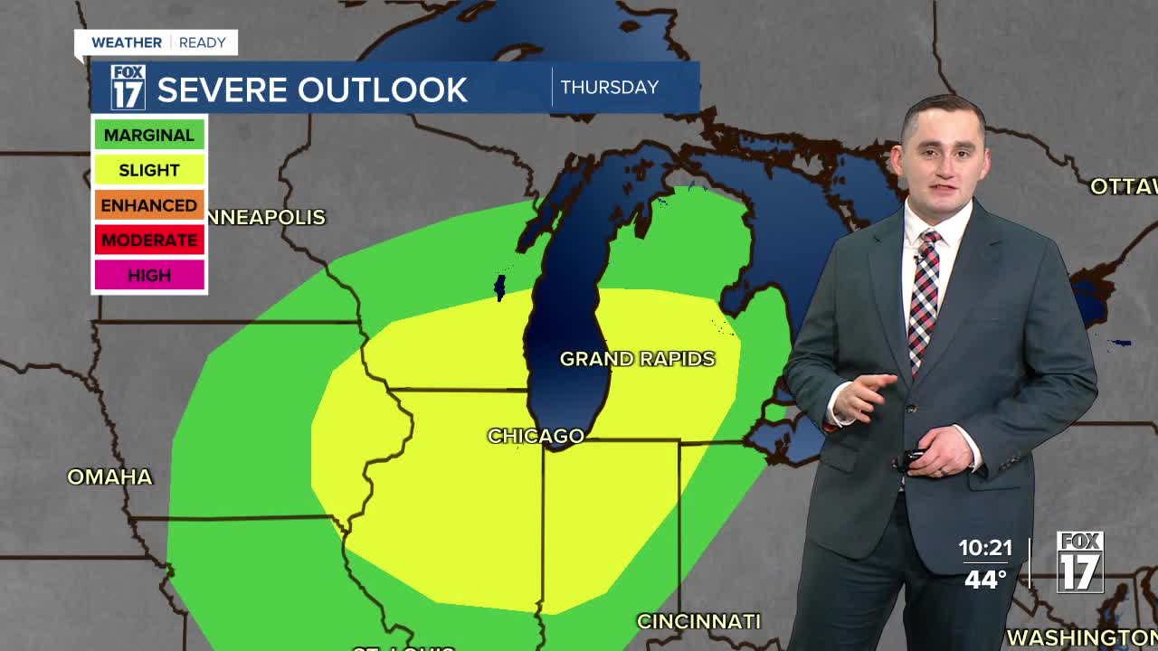


The forecast from FOX 17 Weather Ready Meteorologist Colton Cichoracki: The threat for severe thunderstorms has ended in West Michigan for Tuesday evening. A cold front has brought showers and storms into the area. This front is also bringing much colder air into the area but we will dry out overnight. Temperatures will drop into the 30s overnight. Wednesday is dry but cold with highs only in the 40s under a mostly cloudy sky. A FOX 17 Weather Ready Alert has been issued for Thursday due to another risk for strong to severe thunderstorms in the afternoon and evening. The Storm Prediction Center has highlighted West Michigan in a level two slight risk for severe thunderstorms. That system will move out Thursday night and we will see yet another system with some rain and storms on Saturday.
TONIGHT: Drying out and mostly cloudy. Much colder. Lows in the mid/upper 30s. Winds northwest/north at 10 to 15 mph.
WEDNESDAY: Mostly cloudy and cooler. Chance of P.M. and nighttime showers. Highs in the mid/upper 40s. Winds east-northeast at 10 to 15 mph.
THURSDAY: Weather Ready Alert: Cloudy and mild with some snow showers or freezing rain possible early, otherwise changing to all rain. Strong thunderstorms possible in the evening. Highs in the mid to upper 60s.
FRIDAY: Showers early, otherwise some late day clearing possible. Highs in the lower 60s.
SATURDAY: Cloudy with rain and thunderstorms likely. Highs in the low/mid 60s.
SUNDAY: Mostly cloudy and cooler. A few sprinkles or flurries possible early. Highs in the middle 40s.
MONDAY: Partly cloudy to partly sunny. Highs in the low 50s.
TUESDAY: Partly cloudy. Highs in the upper 40s.
Want alerts when inconvenient or severe weather is headed your way? Download the FOX 17 Weather app and set up notifications for where you live.
For the latest details on the weather in West Michigan, head to the FOX 17 Weather page.
Follow FOX 17: Facebook - X (formerly Twitter) - Instagram - YouTube
