


WEST MICHIGAN - If it seems as if we've a snow deficit for a month or so, indeed that has been the case. The last appreciable snow we got was the pre-Christmas blizzard in December. A developing storm system is currently located east of Texas. This system will scoop up moisture from the Gulf of Mexico and track into the Ohio Valley by late today. We'll remain on the cold side of this system, which will bring widespread snow showers across our area today.
Take a look below, at our forecast model for 6 P.M. this evening. Snow will develop through our morning commute and continue most of the day. The heaviest will occur well south/east of Grand Rapids.
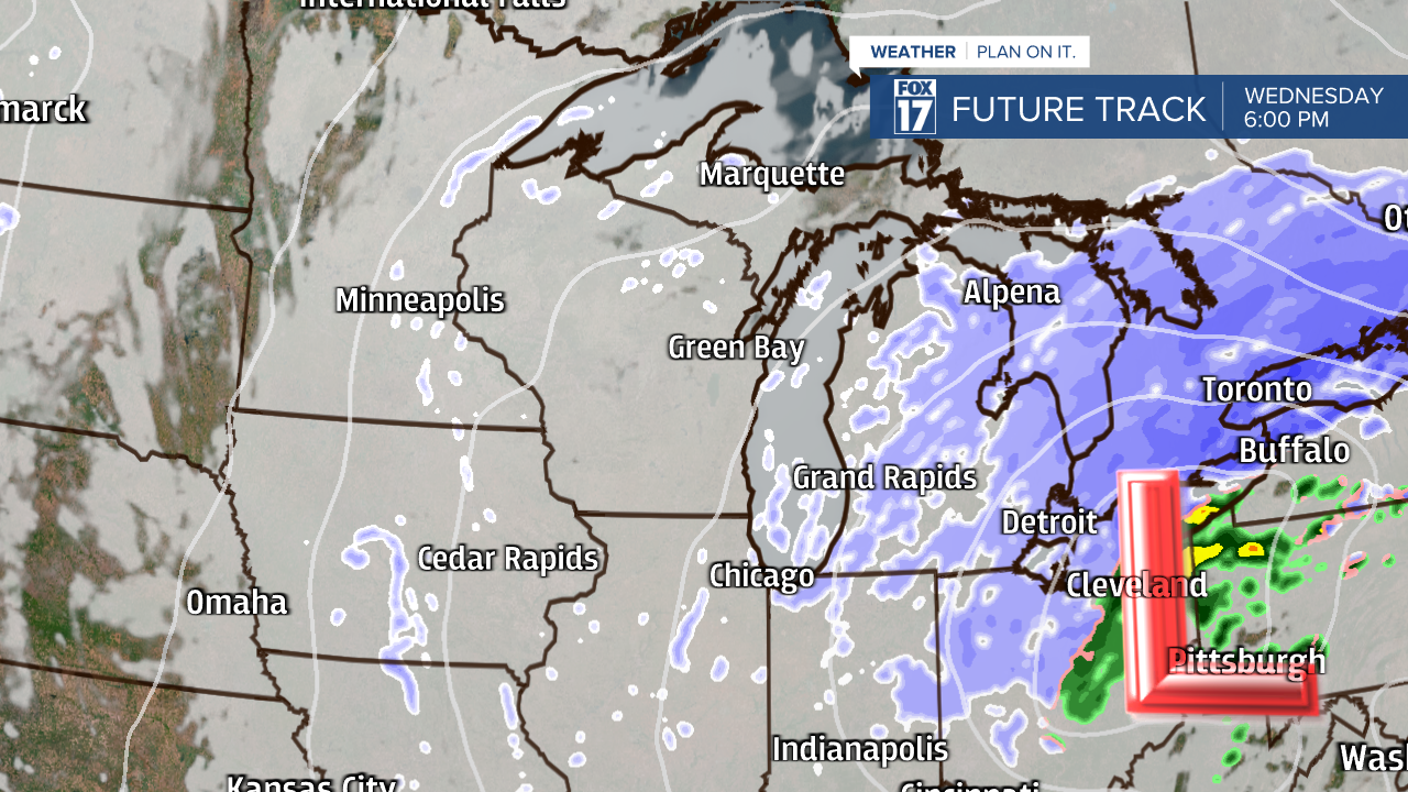
Since this system will track into Ohio, locations a little closer to Detroit and Ann Arbor will see the heaviest snow. Perhaps 6 inches of snow accumulation or more will develop near Adrian, Monroe, Detroit, and Toledo. Lesser amounts are likely further north and west.

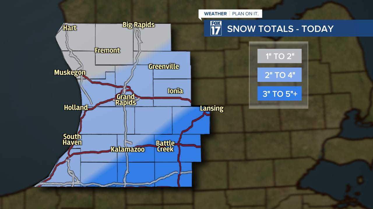
A WINTER WEATHER ADVISORY has been posted for Branch and St. Joseph counties through 8 p.m. Wednesday. An additional 1 to 2 inches of snow accumulation is possible in those counties.
A WINTER WEATHER ADVISORY has been posted for Kent, Ionia, Clinton, Barry, Eaton, Ingham, Kalamazoo, Calhoun and Jackson counties through 10 p.m. Wednesday. An additional 2 inches of snow accumulation is possible in those counties.
A WINTER WEATHER ADVISORY has been posted for Allegan and Van Buren counties through 4 a.m. Friday. Up to 5 inches of snow accumulation is possible in those counties by Thursday.
A WINTER WEATHER ADVISORY has been posted for Cass and Berrien counties through 4 a.m. Friday. A total of 5 to 8 inches of snow accumulation is possible in those counties with isolated higher amounts.
A WINTER WEATHER ADVISORY has been posted for Mason and Oceana counties from 4 a.m. to 4 p.m. Thursday. Lake Effect snow could bring locally heavy snow up to 4 inches.

Remember, if the system tracks a little further south and east, our totals will be lower. A track further north and west will place higher amounts over the area. That said, we expect a general 2" to 4" across most of the area.
Breaking this system down by commute times, your evening travel is likely to be the most hazardous. Communities north of Grand Rapids and near M-20 are likely to receive the least amount of snow and therefore the roads will only see minor impacts. As the day progresses and snow continues to accumulate, I-96 and I-94 have the greatest potential of poor or hazardous travel. Roads will be snow-covered and slick at times.

Make sure to stay up on later forecasts! Get more at www.fox17online.com/weather.
