


WEST MICHIGAN - You'll need to hang on to your hats this weekend, especially on Saturday. A WIND ADVISORY has been issued for our lakeshore counties from Noon through 8 P.M. this evening. We expect sustained winds in these locations of 15 to 25 mph from the southwest with gusts of 45 mph possible. While our inland counties are not included in the advisory, we still expect winds on the order of 15 to 25 mph with lower gusts around 35/40 mph. See map below.

Take a look at our forecast model below that estimates the wind speeds, gusts, and direction. The first image is valid for 6 P.M. today.
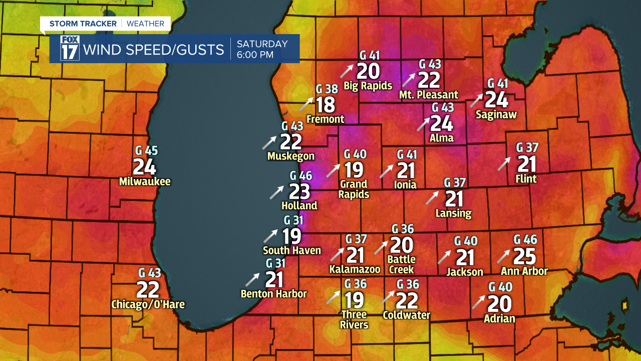
The next image is valid for midnight Sunday morning at midnight. The colors on the map correspond to the actual wind speeds and gusts. So the warmer colors of red and magenta indicate stronger wind speeds.

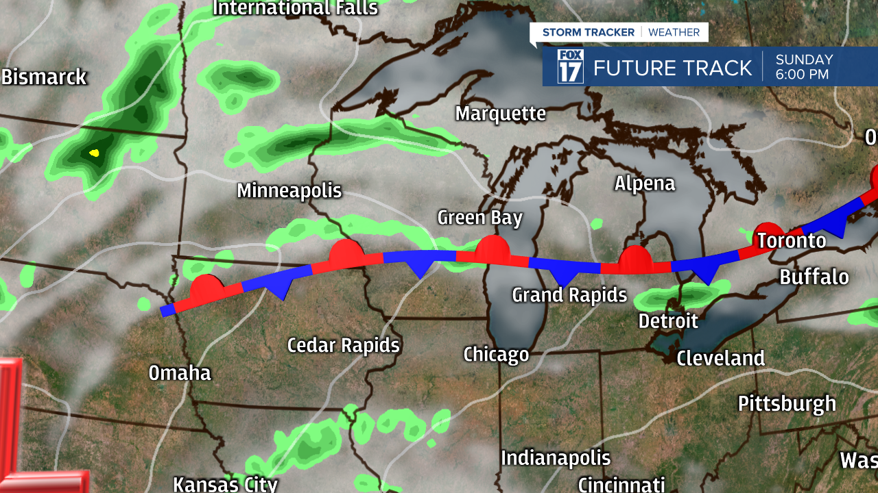
By Sunday morning, winds have come down just a bit, but we still expect somewhat breezy conditions through the day. See image below.

Those winds will help drive our temperatures to around 70 on Saturday, and in the upper 70s to near 80 on Sunday. The best chance of 80 will be from Grand Rapids to the south, or mainly south of a stalled out stationary front. See image below valid for 6 P.M. on Sunday.
The next image below shows more abundant rainfall chances Sunday night into Monday as an area of low pressure rides along the front into southeast lower Michigan. The image below is valid for 6 P.M. Monday.

Any rain showers should wrap up by Tuesday morning, but we expect temperatures to run below average most of next week. Get the complete West Michigan forecast at www.fox17online.com/weather.
