


WEST MICHIGAN - Winter weather carries on through the weekend and into next week. Now as the synoptic winter storm moves out West Michigan will be set up with lake effect and lake enhanced snow plus bitter cold arctic air and gusty winds. Additional snowfall, gusty winds and dangerous feel-like temperatures are all expected with this set up. A WINTER STORM WARNING and WINTER WEATHER ADVISORY remain in effect through midday Sunday.

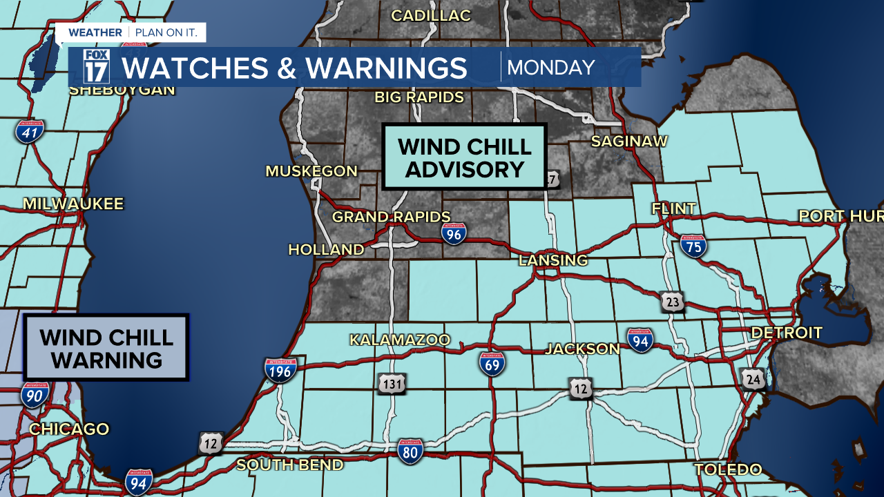
WIND CHILL ADVISORY posted for portions of West Michigan from 12 a.m. Sunday to 1 p.m. in St. Joseph and Branch counties. The NWS will likely expand this advisory further north into our viewing area as we get closer to Sunday.
How long will the snow last?
With Arctic air settled in, persistent lake effect snow bands brought a foot of snow overnight into Sunday for some, and it hasn't let up west of U.S.-131. Gusty winds are helping reduce visibility at times with fluffier snow being blown around easier. We can expect additional snowfall ... likely several more inches, primarily along and west of U.S. 131.
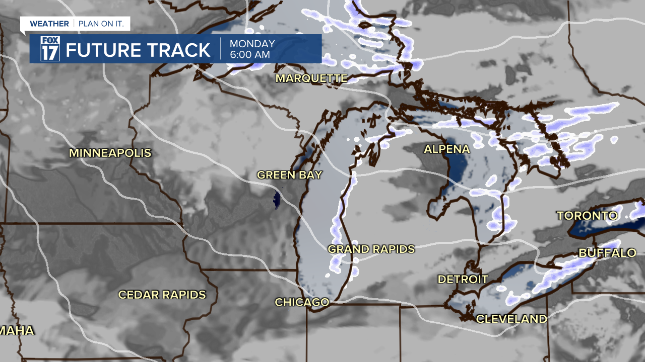
Winds and arctic air will keep us set up for lake effect / lake enhanced snow heading into the beginning of next week as well. We will continue to accumulate more additional snow mainly along and west of US-131. Below is a look at future track valid at 6 a.m Monday. The models struggle to show how much lake effect, but it will be variable bands of moderate snow all day Monday.
How much snow will fall?
The snow continues to fall in chunks giving crews time to catch up and try to keep up with the road ways. However, more accumulating snow is likely. Below is the FOX 17 forecast of additional snow from Sunday evening through Monday evening.

The continued blast of arctic air into next week will keep the lake effect snow machine going, which will result in additional accumulation. The heaviest snow on will be along and west of U.S. 131. The trend is giving us another additional half a foot to foot of snow over the next 5 days with most of the totals being along and west of US-131 but this snow will still push far enough inland to impact most of West Michigan.
What will the temperatures feel like?
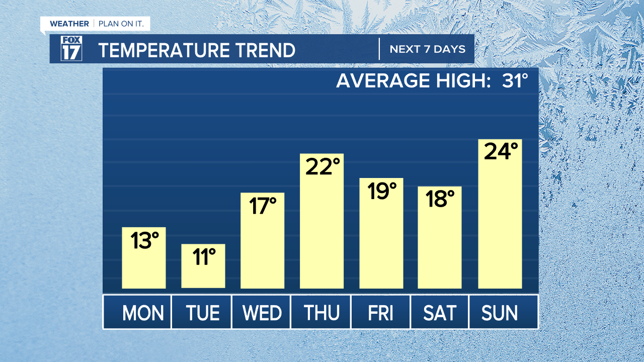
Temperatures with this Arctic air will drop into the teens for daytime highs and at times feeling well below zero.
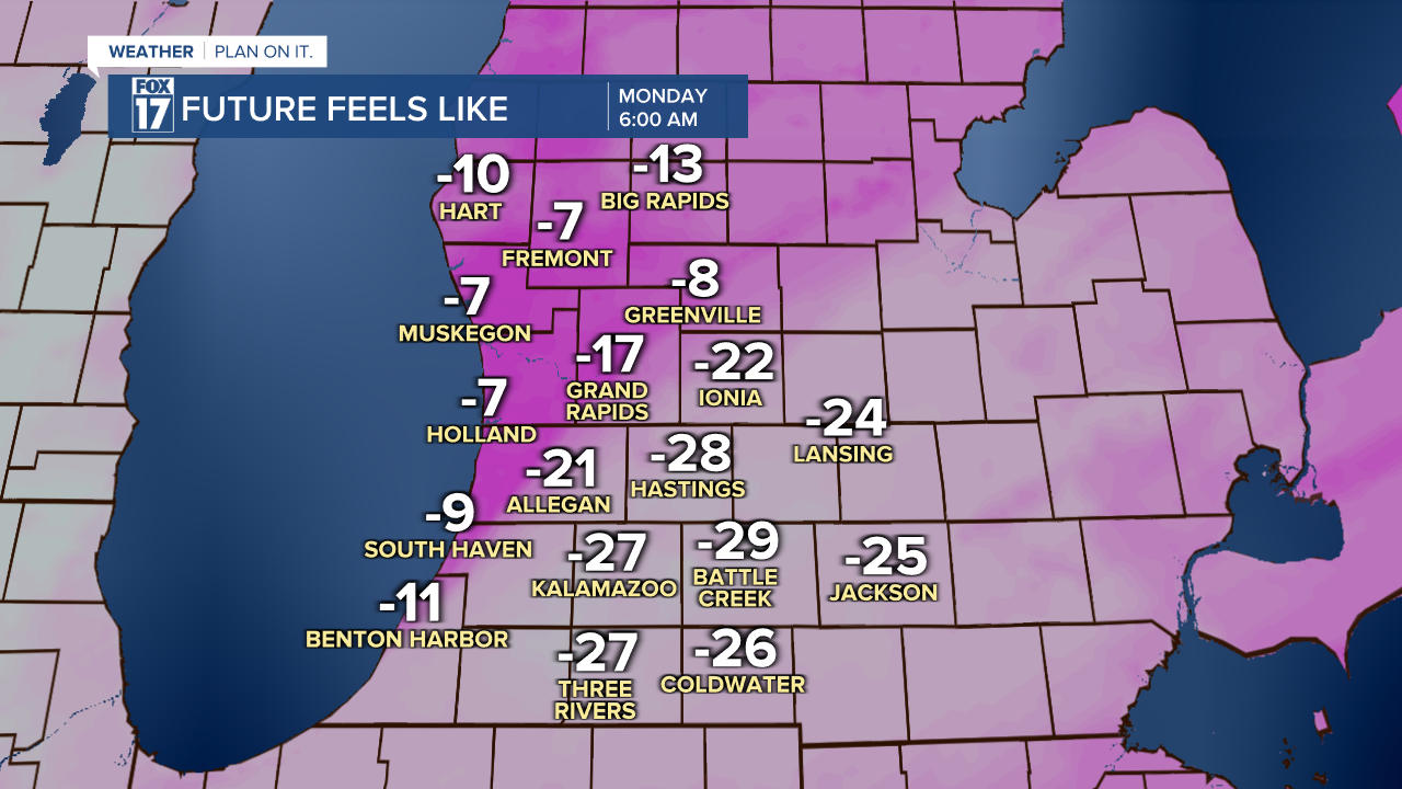
When we factor in the gusty winds temperatures will feel well below zero on Sunday especially for those around the I-94 areas as others will be protected by Lake Michigan and not dip back temperatures below zero as much. Below is a look at future feel like temperatures valid at 6 a.m Monday.
How strong will the wind be?
Plan on strong, gusty winds to continue as we may see more power outages with the widespread heavy snow weighing down trees and power lines. Winds with this arctic air will be out of thee west northwest with gusts upwards of 35 mph on Monday. This is going to keep the wind chill dangerously low for those south and east of Grand Rapids.
Stay tuned for updates with the FOX 17 Weather Team! You can download the FOX 17 News app for your latest forecast video.
