


WEST MICHIGAN — FOX 17 has issued a Weather Ready Alert for Wednesday, due to the risk for severe thunderstorms this evening and overnight. West Michigan was downgraded into a Marginal Risk (Level 1 out of 5) through tonight for a few storms capable of damaging winds. Quarter size hail is a secondary threat, along with heavy rain and flooding.
This comes after a very active weather day/night on Tuesday, when we had an areawide Tornado Watch, many Severe Thunderstorm Warnings, and several Tornado Warnings. 3 tornadoes have been confirmed so far in West Michigan: An EF-0 in southeast Allegan County, an EF-1 in Allegan County near Otsego and Plainwell, and an EF-1 in eastern Montcalm County near Carson City/Fenwick. More surveys are being done, and additional tornadoes may be confirmed. We also picked up around 1-3" of rain that has led to flooding.

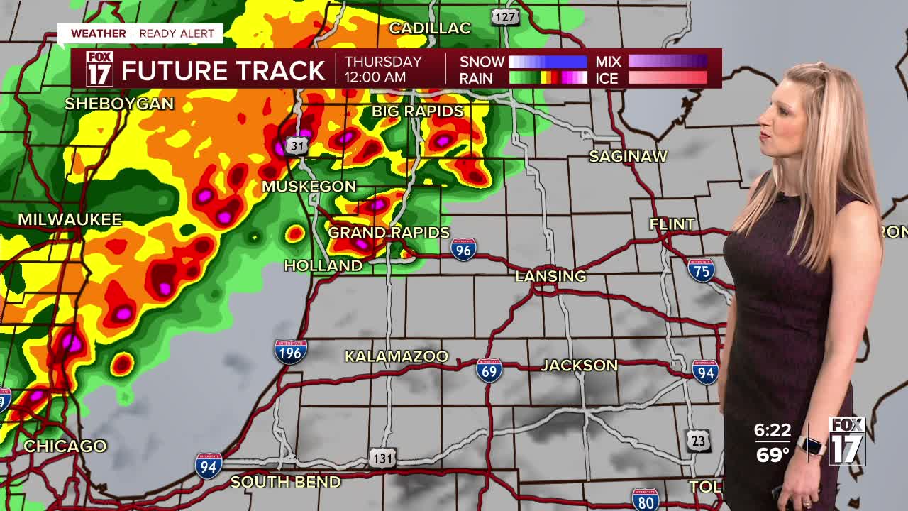
Additional storms are likely later tonight, with isolated severe storms possible. West Michigan is in a MARGINAL RISK (level 1/5) from I-96/Grand Rapids south. Grand Rapids northward is not in a severe thunderstorm risk.

The main threats with these storms will be damaging wind gusts, from now through around 3 a.m.


Rain totals will be 0.5" to 1", which will be enough to keep river and creek basins running high.
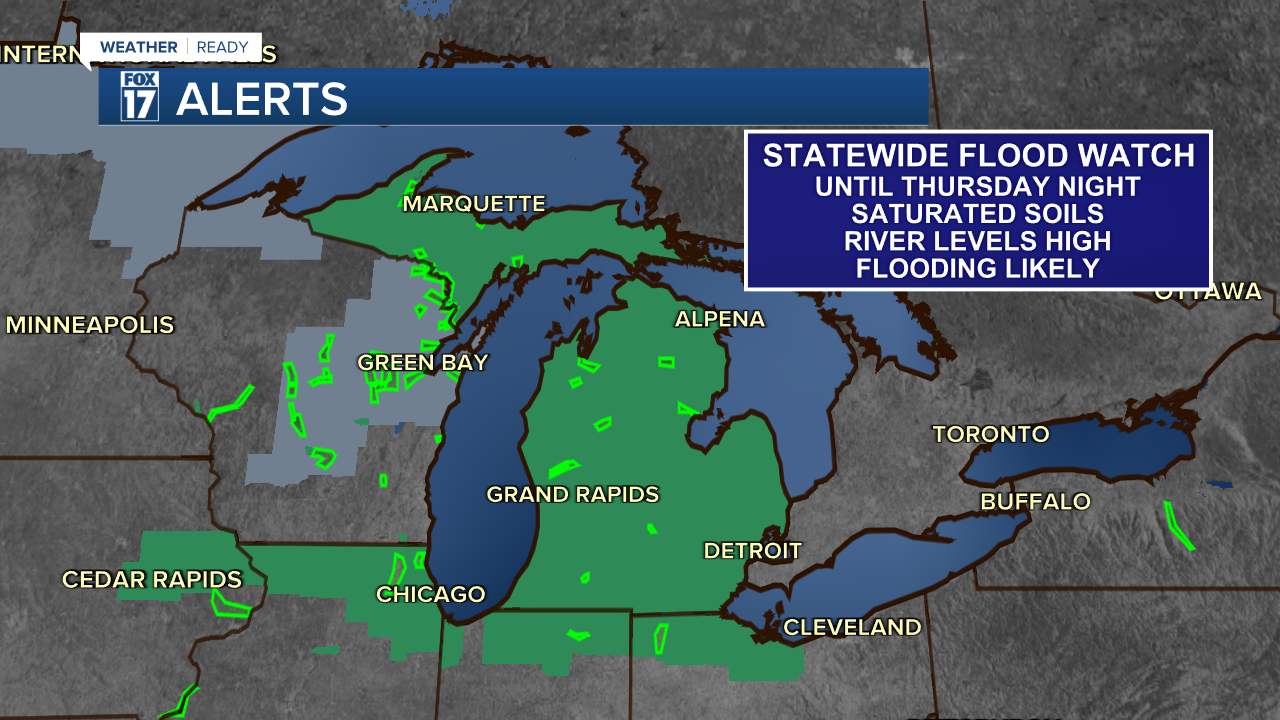
A Flood Watch continues for the entire state of Michigan until early Friday morning. The Muskegon River at Newaygo and Croton will likely see record crests, and major flooding by the weekend. Minor to moderate flooding is expected along the Grand River and Thornapple River.
More showers and storms will be possible on Thursday. Right now, southeast Michigan is under a Marginal risk (level 1/5) for severe weather Thursday afternoon and evening.

Then more rain and storms are in the forecast on Saturday. Between now and then, another 1" to 3" of rain is likely, so flooding will remain a concern through the rest of this week.

Make sure you have ways to receive alerts and warnings. This is especially important during nighttime weather events, so you're able to be woken up if you're asleep. Stick with the FOX 17 Weather Team for more updates.
Follow FOX 17: Facebook - X (formerly Twitter) - Instagram - YouTube
