


After a nice spring weekend filled with sunshine, the next storm system is about to move in to West Michigan. Rain and thunderstorms, some strong to severe, will be possible until early Tuesday morning.
A Wind Advisory is in effect for all of West Michigan until 8 p.m. Wind gusts of 50-60+ mph are possible as showers and storms move through during the late afternoon and evening.
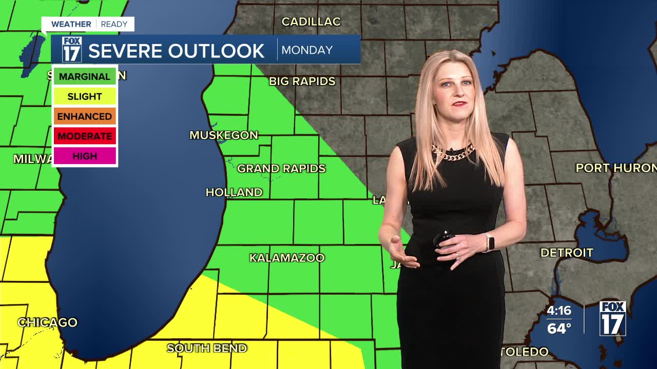
Most of West Michigan is under a Marginal risk (level 1/5) for severe storms, but a Slight risk (level 2/5) has now been expanded into southwestern lower Michigan including Berrien, Van Buren, Cass, and St. Joseph counties. The better chance for severe storms is in Illinois, Indiana, and Missouri where Enhanced and Moderate risks are in place.

A few isolated showers and thunderstorms are possible in the afternoon ahead of the main wave, with heavy rain and brief gusty winds. This could impact the afternoon bus stop and evening commute.
The better chances for widespread rain and storms are later in the evening by around 7 or 8 p.m..

It'll be a soggy, loud, and windy night as these storms move through. The time-frame for severe storms is from around 8 p.m. to 1 a.m. Tuesday.

Right now, the main threats from these storms would be 60 mph winds along with heavy downpours. Rainfall totals will be around 0.5"-1" across West Michigan, with some isolated higher amounts possible. This could result in street flooding and ponding on the roads, but should not be enough to push the Grand River or Muskegon River back into flood stage.

Rain will end early Tuesday morning, with gradual clearing throughout the day.
Keep an eye on the forecast for further updates!
Follow FOX 17: Facebook - X (formerly Twitter) - Instagram - YouTube
