


5:20 p.m. Update:
The National Weather Service issued a Severe Thunderstorm Warning for portions of Ottawa and Kent counties from 4:51 p.m. to 5:15 p.m.
Severe Thunderstorm Warning including Grand Rapids MI, Walker MI and Allendale MI until 5:15 PM EDT pic.twitter.com/9syBabY4o4
— NWS Grand Rapids (@NWSGrandRapids) July 19, 2025
That warning was allowed to expire with no extension, but the National Weather Service declared a special weather statement for the same cell as it moved into Marne, Walker and communities to the northeast, including Sparta and Comstock Park.
A special weather statement has been issued for Walker MI, Northview MI and Comstock Park MI until 6:00 PM EDT pic.twitter.com/h541B3kZv0
— NWS Grand Rapids (@NWSGrandRapids) July 19, 2025
ORIGINAL STORY:
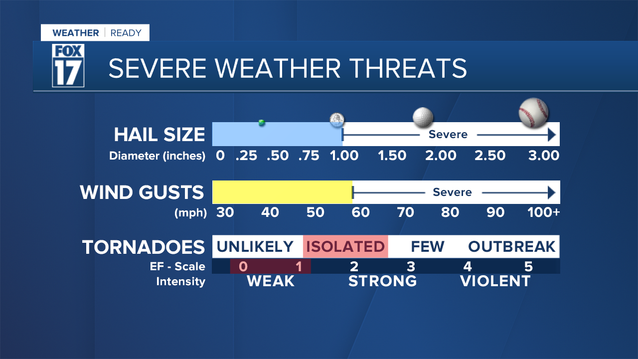
The Storm Prediction Center has placed all of central and southern lower Michigan in a MARGINAL RISK for strong to severe storms through Saturday late evening. Some storms may contain some gusty winds, large hail, or even an isolated tornado. See image below.
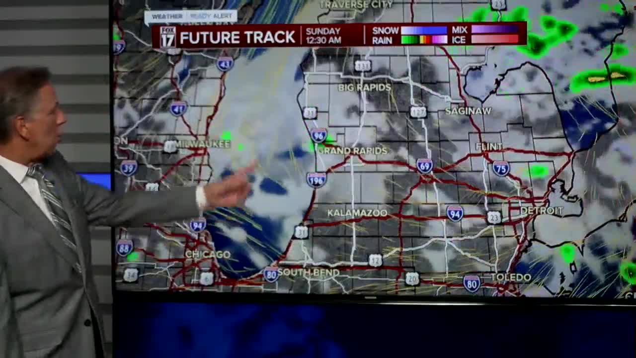
Due to the severe weather threat, we've issued a FOX 17 WEATHER READY ALERT DAY. Make sure you have a way to get watches/warnings/advisories. The timing of these storms looks to be anywhere from 1 P.M. until about 6/7 P.M. See our forecast model for timing of these storms at noon, 3 PM, and 6 PM.


You can always get more at www.fox17online.com/weather.
Follow FOX 17: Facebook - X (formerly Twitter) - Instagram - YouTube
