


WEST MICHIGAN — A large storm is producing a messy mix of rain, freezing rain, sleet, and snow across West Michigan. Ice is quickly accumulating, especially for communities between I-96 and I-94. As temperatures continue to fall through tonight, roads will become more challenging. Hazardous travel will be likely Wednesday night through Thursday morning. If you must travel, take it slow. Otherwise, it might be best to stay home! Below is the breakdown for what we can expect over the next couple of days.

By Thursday morning, most of the precipitation will shift north. Some freezing rain, drizzle, and light snow will be possible through early Thursday afternoon. Temperatures will gradually climb to nearly 40 degrees by Thursday afternoon, which will melt quite a bit of the ice accumulation.

Several alerts have been posted over the region due to this approaching storm.
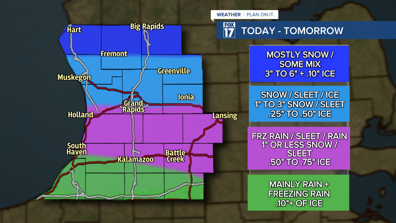
A WINTER STORM WARNING has been posted for Oceana, Newaygo, and Mecosta counties from until 1 P.M. Thursday. Total snow and sleet accumulations could range between 3" to 6" with isolated higher amounts. Ice accumulations up to .10" to .20" will be possible, in addition to strong wind gusts up to 45 mph.
A WINTER STORM WARNING has been posted for Muskegon, Montcalm, Ottawa, Kent, and Ionia counties from until 4 A.M. Thursday. Total sleet and snow accumulation will range between 1" to 3" with isolated higher amounts possible. Ice accumulations between 0.25" to 0.50" will be possible, in addition to strong wind gusts up to 45 mph.
An ICE STORM WARNING has been posted for Allegan, Barry, Eaton, Ingham, Calhoun, and Jackson counties until 4 A.M. Thursday. Significant icing is expected within these counties. Total ice accumulation of 0.50" is likely with isolated higher amounts possible. Total snow and sleet accumulations will be up to 1" with wind gusts up to 45 mph.
An ICE STORM WARNING has been posted for Van Buren and Kalamazoo counties until 4 A.M. Thursday. Significant icing is expected within these counties. Total ice accumulation of 0.50" is possible with isolated higher amounts possible. Some snow will be possible, with wind gusts up to 40 mph.

Take a look at our snowfall and ice map for West Michigan below. These are totals we believe will occur between Wednesday and Thursday. It is possible these areas shift a bit north or south depending on the exact track of the system and how much warm/cold air we can wrap into the state.
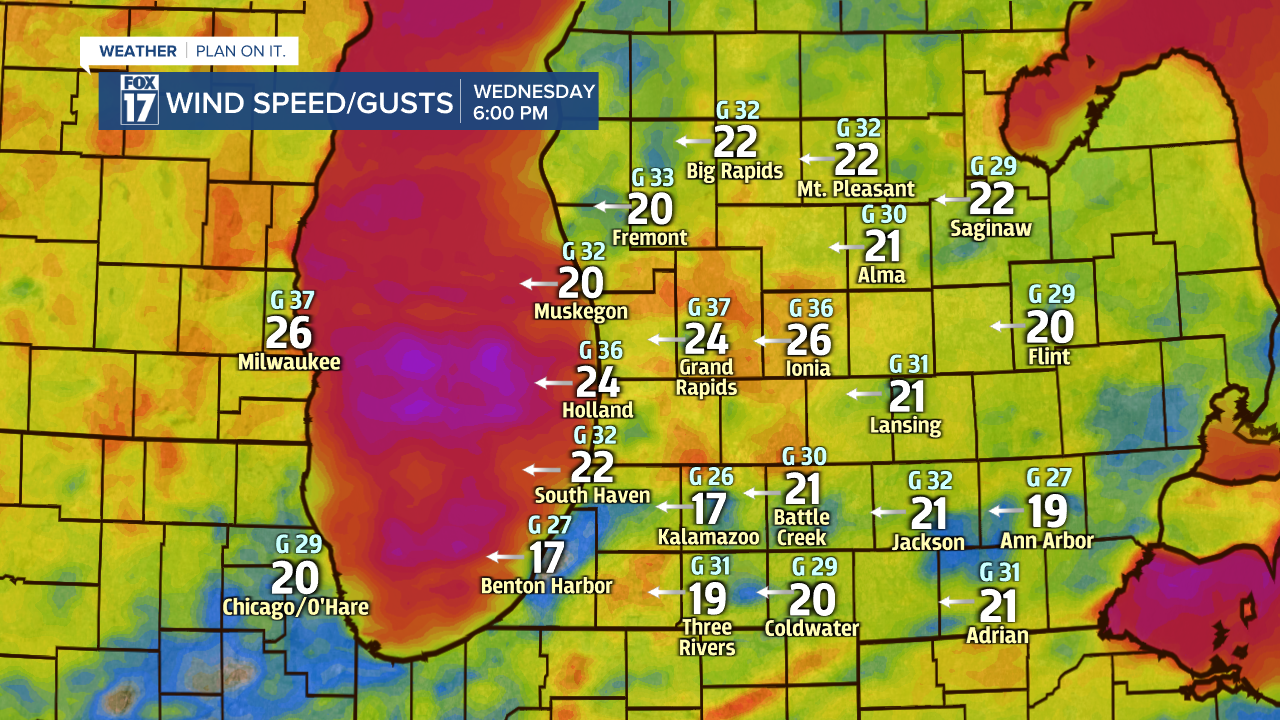
Wind will be another problem with this storm system. We expect sustained winds today and Thursday at about 20 to 30 mph with some gusts up to 45 mph. This means we may see several power outages (perhaps widespread) with the weight of ice on power lines and tree limbs/branches. See our forecast model images for various times on wind speeds below.

Travel conditions are likely to be the worst Wednesday night, with gradually improving conditions through the day on Thursday. Take it slow if you must travel.

Please plan accordingly and stay safe. This system has the potential to have a crippling effect of ice accumulation/accretion in some areas. Get more at www.fox17online.com/weather.
