
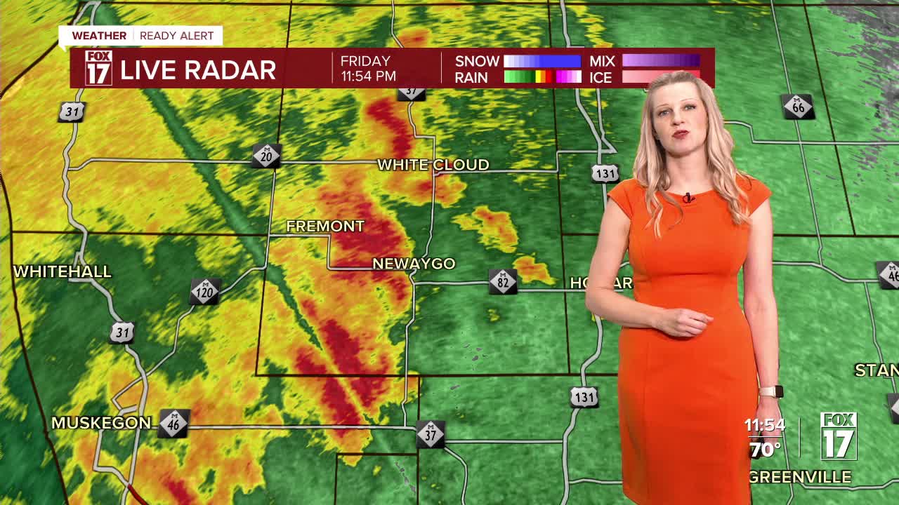


WEST MICHIGAN — FOX 17 has issued a Weather Ready Alert overnight, as there is another chance of a few strong to severe thunderstorms in parts of West Michigan. The good news is that this is the last chance for severe weather for a while.
In its latest update, the Storm Prediction Center has added parts of West Michigan in a Slight Risk (Level 2 out of 5) for severe storms tonight. This is for areas west of U.S. 131 (see image below).

The primary threat is damaging wind gusts, but a brief spin-up tornado within the line of storms can't be ruled out, especially near the lakeshore and in southwest lower Michigan. There is now a TORNADO WATCH for Berrien and Cass counties until 3 a.m.

The line of thunderstorms will move into West Michigan from the west before midnight.

The line of storms is expected to weaken as it moves from the lakeshore toward 131, but a few gusty storms will still be possible, along with a brief spin-up.

The severe threat should diminish by around 3 a.m. as storms move toward Central Michigan.

Heavy rain is likely with this round of storms, with totals of a half inch to an inch in some isolated spots. The good news is that after this goes by, the weather will quiet down for several days in West Michigan.
Want alerts when inconvenient or severe weather is headed your way? Download the FOX 17 Weather app and set up notifications for where you live.
For the latest details on the weather in West Michigan, head to the FOX 17 Weather page.
Follow FOX 17: Facebook - X (formerly Twitter) - Instagram - YouTube
