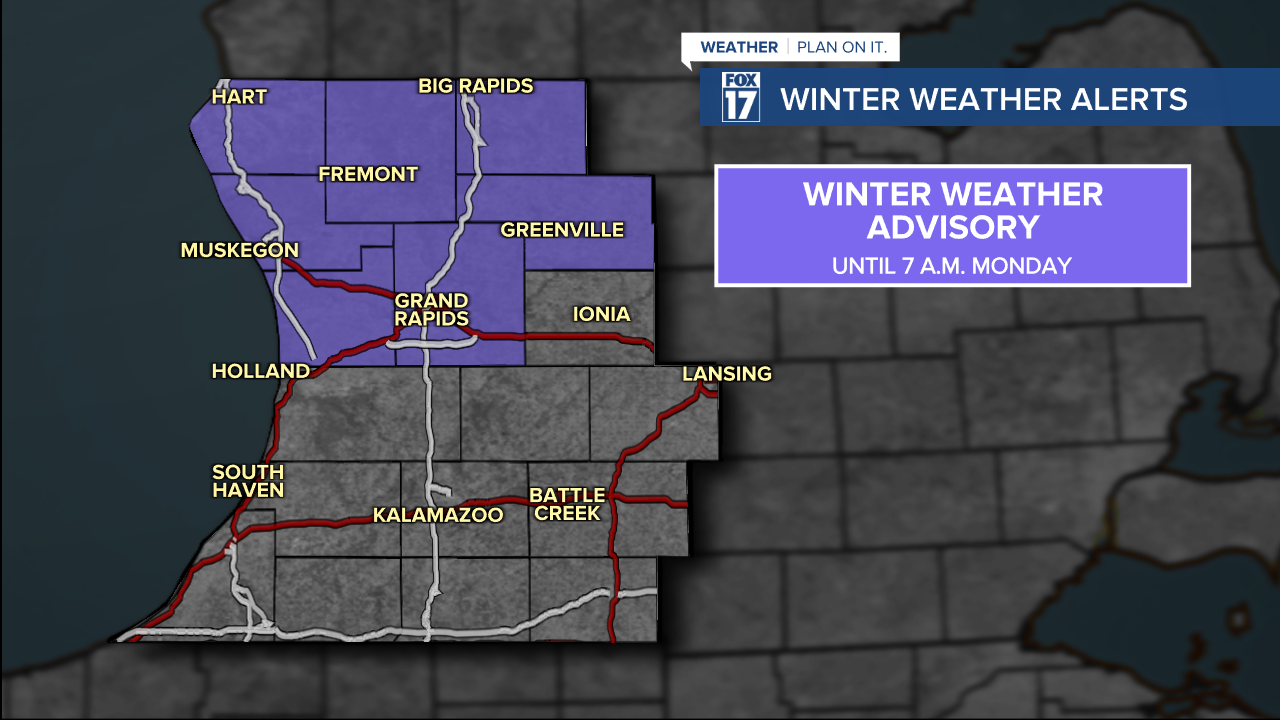
WEST MICHIGAN — Many across West Michigan have seen scattered snow showers this Sunday. Some accumulations have been reported, but the bigger focus into Monday is temperatures falling below freezing with a stronger westerly wind. Due to the wet pavement Sunday evening expected to freeze over, the National Weather Service is continuing a WINTER WEATHER ADVISORY until Monday morning. It will be important to stay on top of the latest forecast for slow downs and the latest radar.
We've seen reports of 2" from Muskegon to the north. Grand Rapids only recorded 0.2" at the Grand Rapids Int'l Airport. But, the majority of snow melted on contact, and is expected to freeze overnight.
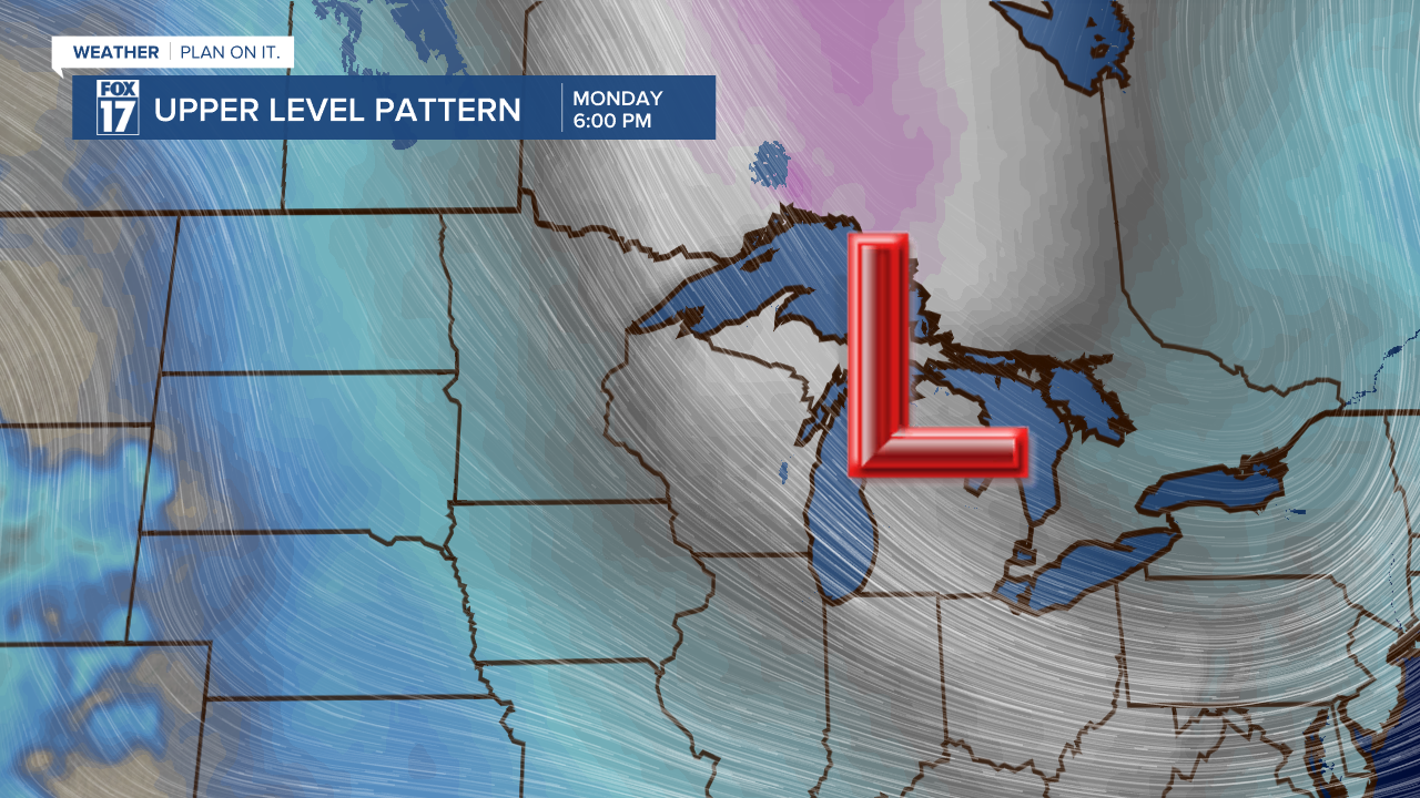
We will have a pause in the snow overnight as a cold front moves in from the west. As it moves east, more lake effect snow will redevelop into Monday morning. This could create minor travel impacts with snow-covered and damp/icy roads. Be especially careful on bridges and overpasses. Temperatures are expected to stay below freezing Monday afternoon, which will keep the slick road potential in place until Tuesday.

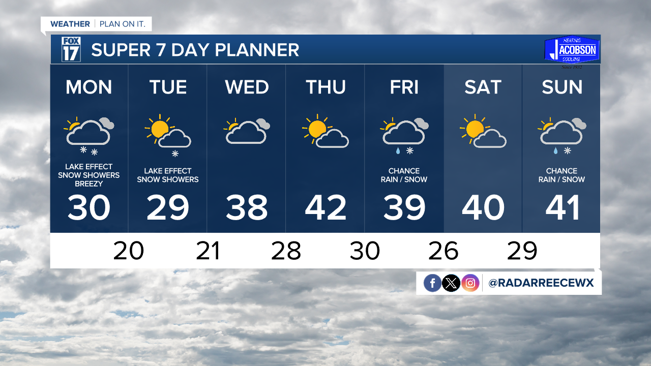
As for additional accumulations, don't expect much through midday Monday. However, Monday afternoon and evening we are expecting the cooler air mixed with a push of moisture in the upper levels to really kick start lake effect snow overnight into Tuesday. Tuesday will be the best chance at any school closings. Stay tuned to FOX17 for any closings or delays.

For a LIVE look at the current radar, click here.
A few lingering lake effect flurries are possible into Tuesday afternoon. However, the greatest likelihood for lake effect snow will be on Monday and Tuesday as winds shift throughout the day Tuesday, limiting lake effect accumulations.

How cold will temperatures be?
Get ready for a blast of cold air, West Michigan! High temperatures will only be in the upper 20s both Monday and Tuesday, with overnight lows in the upper teens and lower 20s. Wind chills will be a big factor as well, with feels like temperatures will be in the teens Monday afternoon! They will get even colder Monday night, feeling like the single digits Tuesday morning! Wind gusts at times between Sunday night and Tuesday will be up to 30 miles per hour.
Be sure to bundle up both Monday and Tuesday. Thankfully, a warm up arrives Wednesday into the weekend. Stay tuned to FOX17 for later updates.