


The National Weather Service confirms that a tornado touched down at 12:40 a.m., seven miles northeast of Marshall.
WEST MICHIGAN — More than 6,000 Consumers Energy customers were without power around 1 a.m. Wednesday, according to the Consumers Energy Outage Map.
The Tornado Warnings for Calhoun, Kalamazoo and Van Buren counties have now EXPIRED.
The National Weather Service issued a severe thunderstorm watch Tuesday evening for the following counties:
- Allegan
- Barry
- Calhoun
- Eaton
- Ionia
- Kalamazoo
- Kent
- Montcalm
- Ottawa
- Van Buren
The watch is set to remain in place through 5 a.m. Wednesday.
Damage could include fallen trees, downed power lines and golf ball-sized hail denting roofs, siding, etc.
One of our FOX 17 crews captured the video below of hail falling in the Kalamazoo area:
Within the state of Michigan, the greatest potential for severe storms resides throughout almost all of West Michigan as we have some of the greatest potential of a thunderstorm meeting severe criteria in the SLIGHT risk for our southwest communities.

In order for a thunderstorm to be considered severe, there needs to be wind speeds at least 58 mph and/or hail at least one inch in diameter. The outlook issued by the Storm Prediction Center means that these conditions are possible.
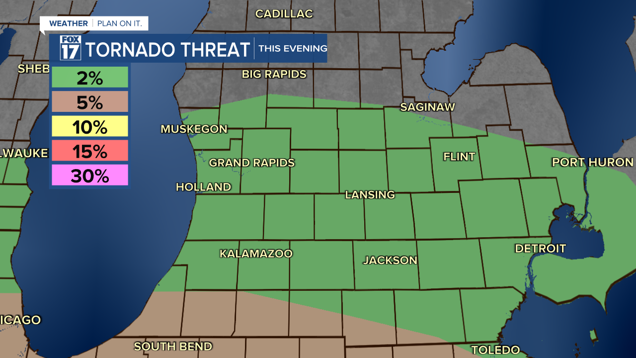
All of West Michigan holds the chance of a thunderstorm this evening mainly overnight as wind, hail, lightning and thunder plus an isolated tornado are all possible.
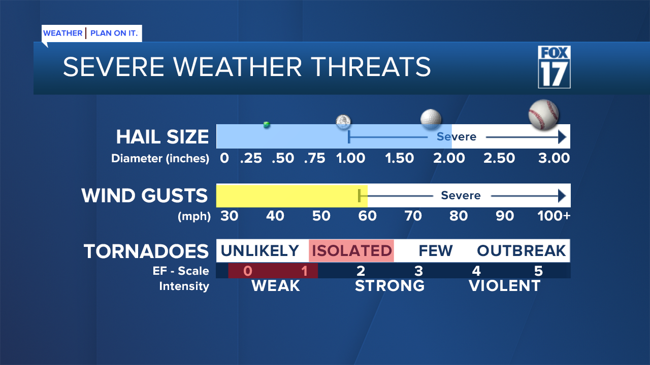
Finally we have a 2% isolated tornado risk with better chances along the state line where a 5% chance lives.
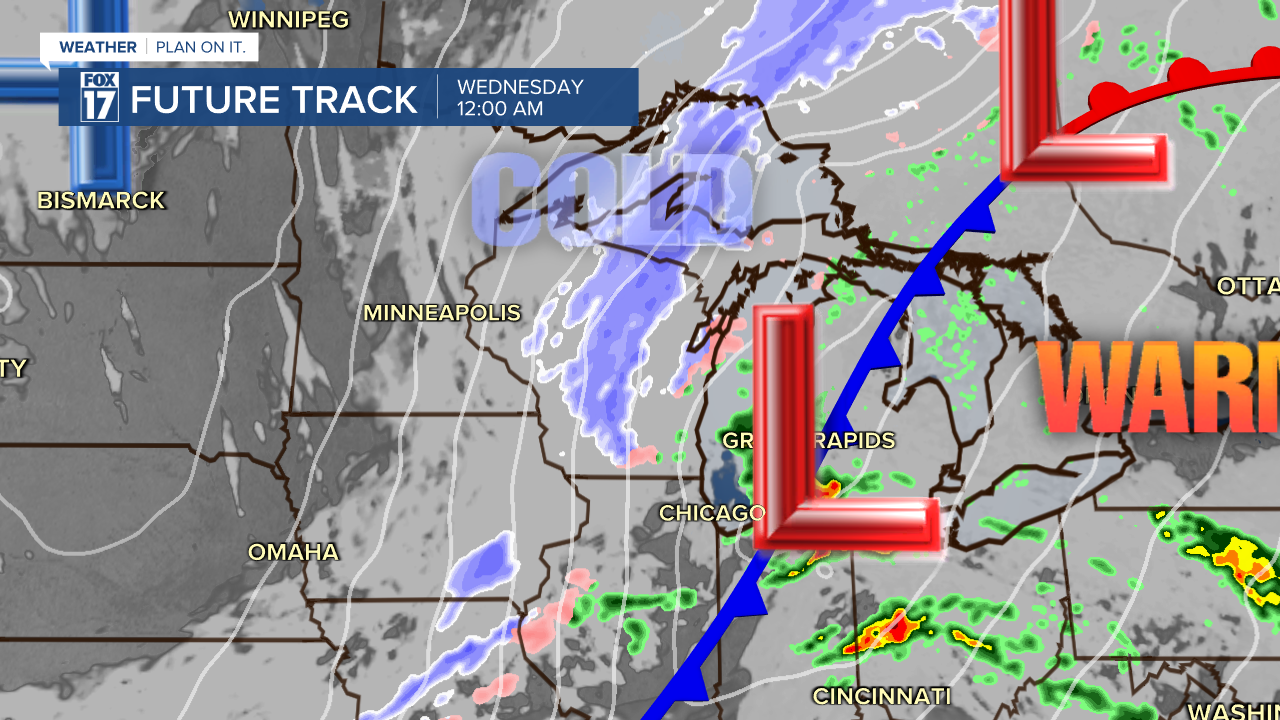
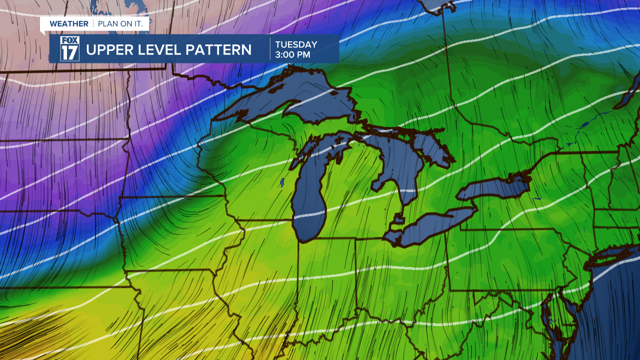
Showers and thunderstorms will progress through Tuesday night before a large cold front passes. That strong cold front will be a driving force for the strength of our severe weather potential.
The sharply colder air will transition rain over to snow overnight into Wednesday. While snow accumulation will be minor, the greatest snow development will likely be along and west of US-131 around an inch or snow mainly on grassy surfaces.
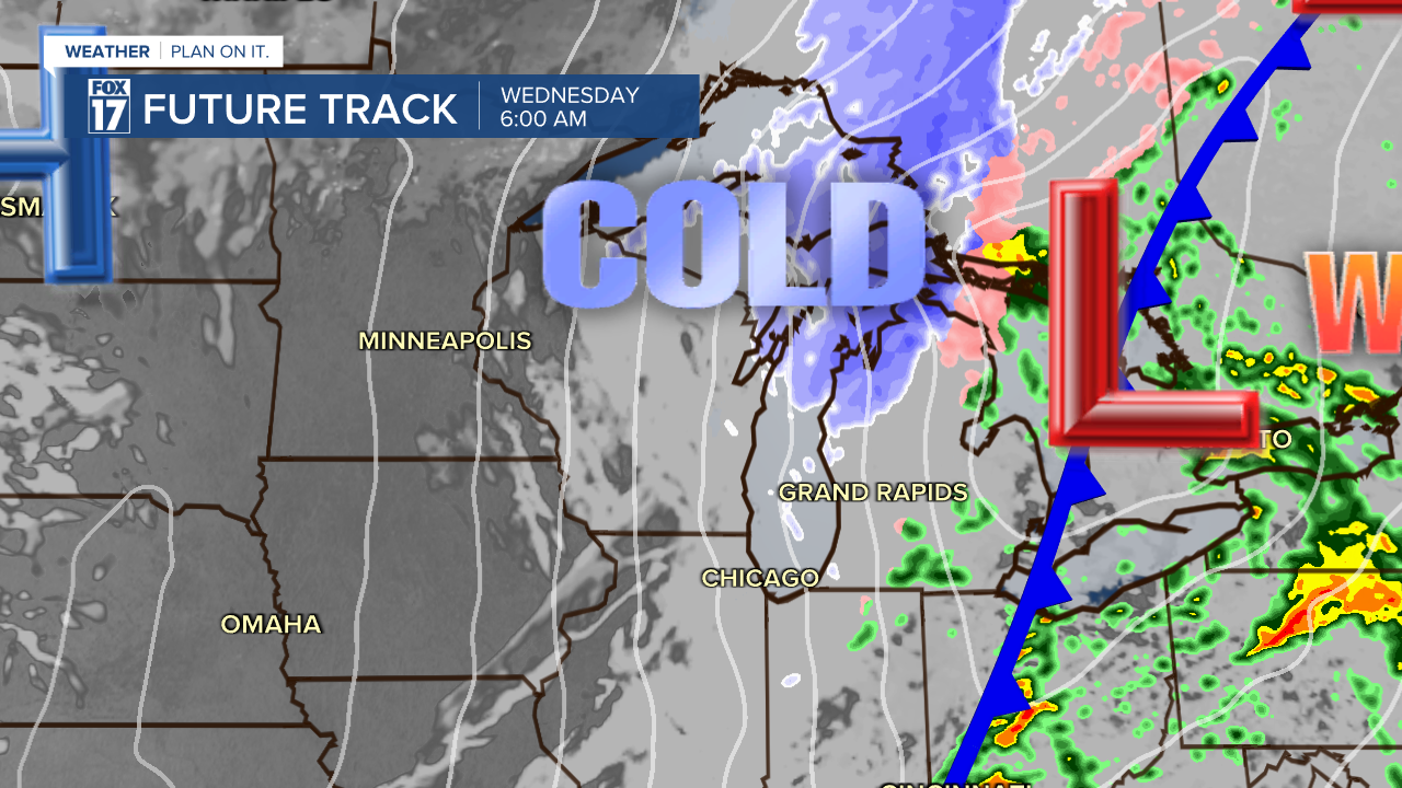
The colder air will push into the region fast and also may cause a flash freeze with any water on the roadways turning to icy conditions. A difficult morning commute can be possible for Wednesday morning leading into a very windy and bitter cold afternoon.
How will the temperatures change?
Today brings the warmest air of the week as high temperatures climb to the upper 60s maybe even 70 degrees for some. This warmth is expected to break records and if a city hits 70 degrees it will be the first time ever to happen in February since record keeping began.
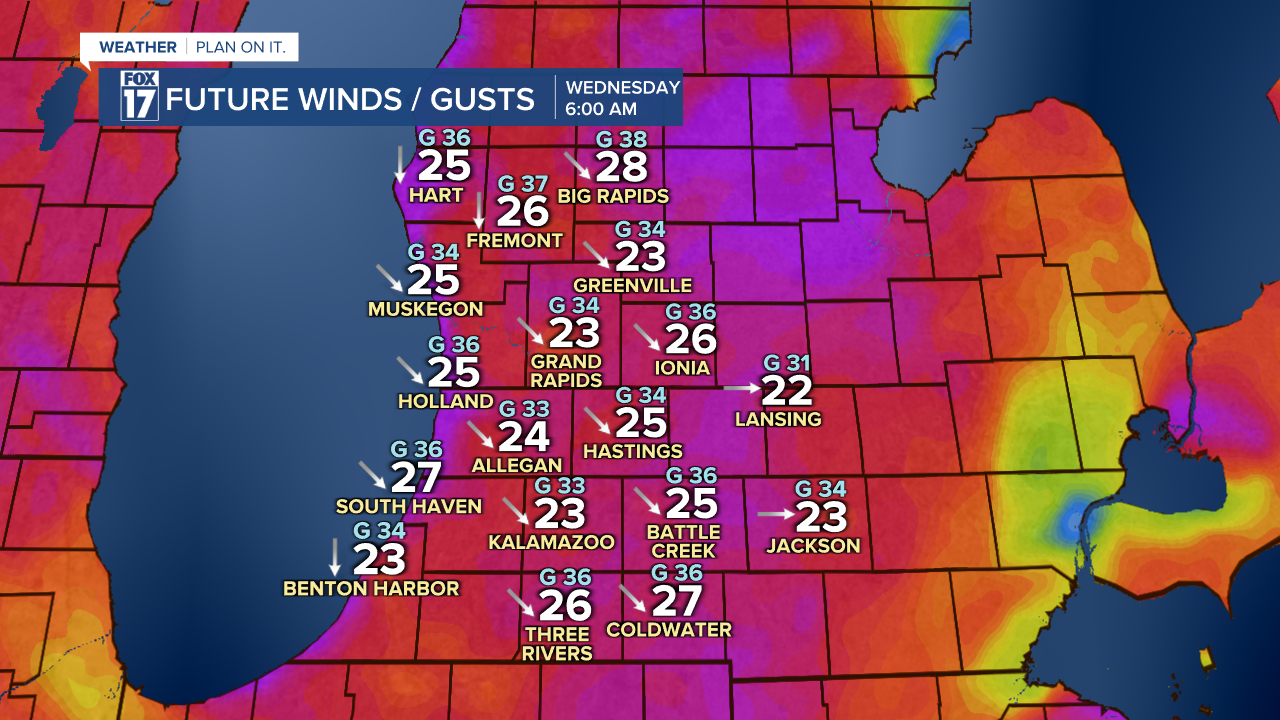
A strong cold front will pass overnight into Wednesday, which could drive our atmosphere to produce thunderstorms. Temperatures will be sharply cooler by Wednesday afternoon. Temperatures will be the warmest Wednesday early morning truly overnight, eventually falling to the 20s Wednesday afternoon. Winds are expected to be strong through this entire event as well really picking up strength heading throughout Wednesday. We could see Wednesday wind gusts upwards of 40-45 mph.
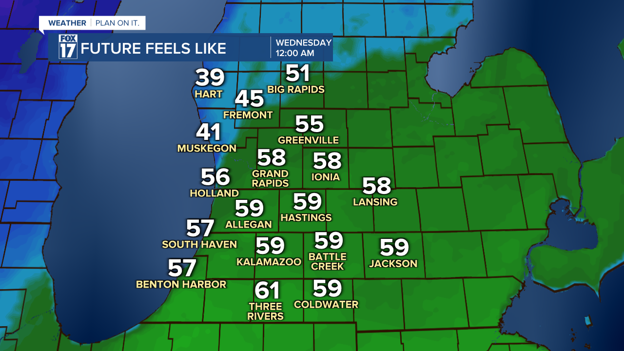
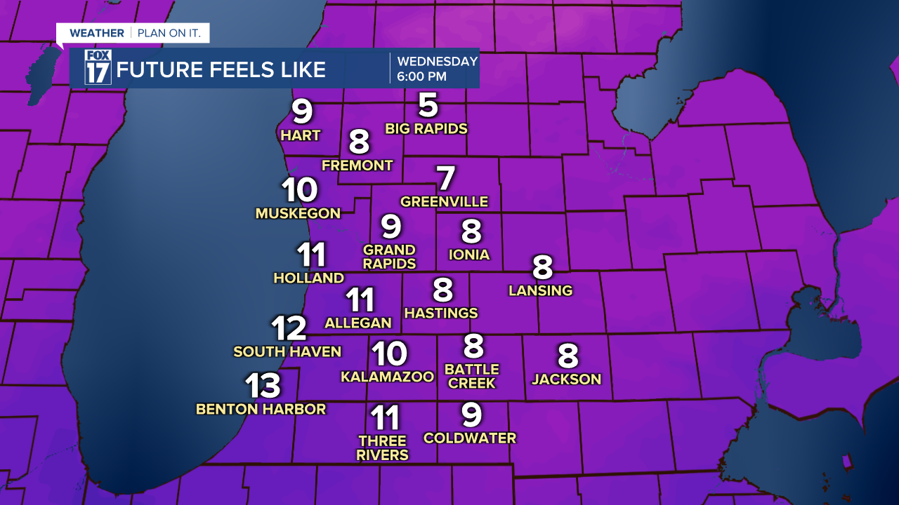
Once we factor in these winds it will make temperatures feel even colder as we drop into the already sharply colder temperatures for Wednesday. Below is a check on what temperatures will feel like at midnight.
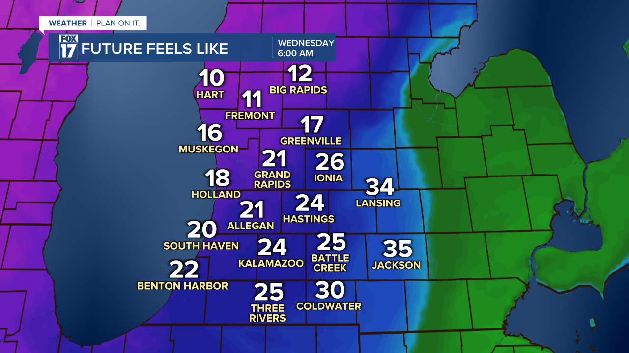
We will quickly drop into the colder air and feel like the single digits and teens for the morning and afternoon hours. A drastic turn around within 24 hours.
How can I remain informed?
To receive immediate updates on the FOX 17 Weather forecast, you can download our FOX 17 Weather App. The free app provides severe weather alerts, your own personal radar, and the latest forecast videos.
You can also visit our website for the latest alerts.
