
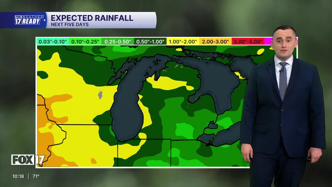


The forecast from FOX 17 Weather Ready Meteorologist Colton Cichoracki: The Omega blocking weather pattern that began last week will hold steady through tomorrow, before before breaking down and allowing rain and storm chances to increase. It's been 10 days since West Michigan received any rain. Look for sunshine with highs in the low 80s tomorrow, and a breezy southwest wind. With very low relative humidity and continued dry conditions, fire risk is elevated tomorrow. Be very careful when burning campfires or brush, as they have the potential to ignite surrounding vegetation quickly. A cold front pushing in from the west increases rain and thunderstorm chances Friday into Saturday. Rounds of heavy rain are possible, along with a few strong or briefly severe storms Friday evening and night. Parts of West Michigan are in a MARGINAL RISK (Level 1 out of 5) for severe storms Friday. Rain and storm chances continue Saturday, before drying out on Sunday. The heat and humidity turn up next week with highs in the mid to upper 80s.
TONIGHT: Mostly clear and comfortable. Lows in the mid/upper 50s. Wind: light southeast.
THURSDAY: Mostly sunny, warm, and breezy. Highs in the low/mid 80s. Winds southwest at 10 to 15 mph, with gusts to 25 mph.
FRIDAY: Partly sunny, warmer, and humid. A few morning showers possible, but better shower/storm chances arrive in the afternoon and evening. Some could be strong to marginally severe. Highs in the low/mid 80s.
SATURDAY: Mostly cloudy and humid with a showers likely and a chance of thunderstorms. Highs in the upper 70s.
SUNDAY: Mostly sunny to partly cloudy, warm, and humid. Highs in the low 80s.
MONDAY: Mostly sunny and warm. Highs in the mid 80s.
TUESDAY: Partly cloudy with chance showers. Highs in the mid 80s.
WEDNESDAY: Partly cloudy with chance showers. Highs in the mid 80s.
Want alerts when inconvenient or severe weather is headed your way? Download the FOX 17 Weather app and set up notifications for where you live.
For the latest details on the weather in West Michigan, head to the FOX 17 Weather page.
Follow FOX 17: Facebook - X (formerly Twitter) - Instagram - YouTube
