
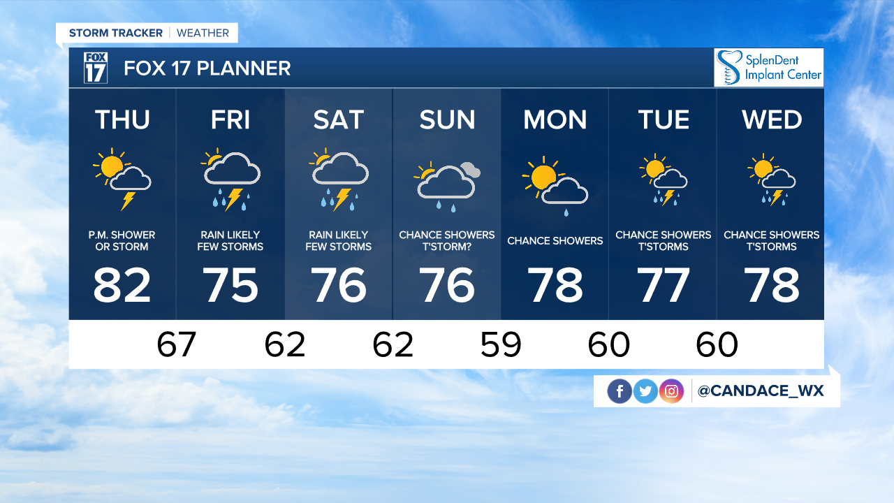


WEST MICHIGAN — The forecast from FOX 17 Chief Meteorologist Kevin Craig: Today starts with a mix of clouds and sun, but during the afternoon and evening, showers and a few storms will be possible. The heaviest of our rain will overspread the area on Friday as a front becomes stationary overhead. Saturday and Sunday also have the chance to bring additional rain and storms to the region. The chance of severe weather is not zero, but it remains fairly low. How much rain we see over the weekend remains in question as the track and strength of additional weather disturbances remains to be seen, but two to four inches is not out of the question at this point with locally higher amounts. Stay up on later forecasts.
THURSDAY: Partly sunny to mostly cloudy and breezy with highs in the upper 70s to lower 80s. Afternoon and evening showers and storms possible, especially near and west of 131 and north of I-96. Winds south at 10 to 20 mph.
TONIGHT: Mostly cloudy with a chance of showers and storms. Lows in the mid/upper 60s. Winds south at 7 to 14 mph.
FRIDAY: Cloudy with rain likely and a chance of thunderstorms. Highs in the mid 70s. Winds south at 10 to 15 mph.
SATURDAY: Cloudy with rain likely and a chance of thunderstorms. Highs in the mid 70s.
SUNDAY: Mostly cloudy with showers likely. Highs in the mid 70s.
MONDAY: Partly sunny with a chance of showers. Highs in the mid/upper 70s.
For the latest details on the weather in West Michigan, head to the FOX 17 Weather page.
