
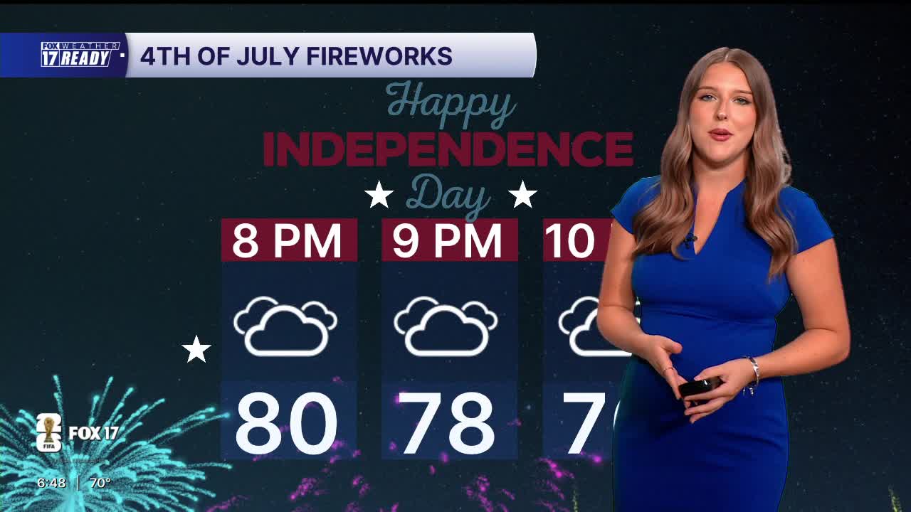


WEST MICHIGAN — The forecast from FOX 17 Weather Ready Meteorologist Gracyn Freund: Happy 4th! Other than a few lingering showers this morning, much of today will be dry under a partly to mostly cloudy sky. It will still be pretty warm with highs in the 80s, and peak heat indices in the lower 90s, which is definitely an improvement from the last few days! The chance for some pop up showers and storms will increase this evening into tonight, so keep an eye on the radar if you have any outdoor plans or will be attending any firework shows. Sunday will be mostly cloudy which will hold temperatures back to the lower 80s. Another round of scattered showers and storms possible in the afternoon and evening, mainly south of I-96. Dry and slightly cooler conditions return heading into next week.
TODAY (Independence Day): Partly cloudy with chance P.M. scattered showers and thunderstorms. Hot and humid, Highs in the upper 80s, lower 80s along the lakeshore. Wind W at 5-10 mph.
TONIGHT: Mostly cloudy with chance showers and storms. Lows in the upper 60s. Wind NE at 5-10 mph.
SUNDAY: Partly to mostly cloudy with scattered showers and thunderstorms, mainly south. Highs in the low 80s and humid. Wind ENE at 10-15 mph.
MONDAY: Chance A.M. showers, otherwise mostly sunny with highs in the low/mid 80s.
TUESDAY: Mostly sunny with highs in the mid 80s.
WEDNESDAY: Mostly sunny with highs in the mid/upper 80s.
THURSDAY: Partly cloudy with chance showers and storms, highs in the mid 80s.
FRIDAY: Partly cloudy with chance showers, highs in the mid 80s.
Want alerts when inconvenient or severe weather is headed your way? Download the FOX 17 Weather app and set up notifications for where you live.
For the latest details on the weather in West Michigan, head to the FOX 17 Weather page.
Follow FOX 17: Facebook - X (formerly Twitter) - Instagram - YouTube
