


The forecast from FOX 17 Weather Ready Meteorologist Kara James: Dew point temperatures have dropped into the upper 50s, and will hover in the lower 60s through tomorrow. Tomorrow will be another mostly sunny day, just warmer with highs in the upper 80s. Isolated thunderstorms are possible in the afternoon and evening south of I-96 as a front washes out but most stay dry. Humidity will be on the rise July 4th (Friday) into the weekend. The 4th of July looks mostly dry and hot, but thunderstorm chances are building for the weekend, with the best opportunity Sunday (but some areas may get missed again). Watch for feels like temperatures in the mid to upper 90s Friday and Saturday! Stay tuned to the FOX 17 Weather Ready Team for your latest forecast updates.
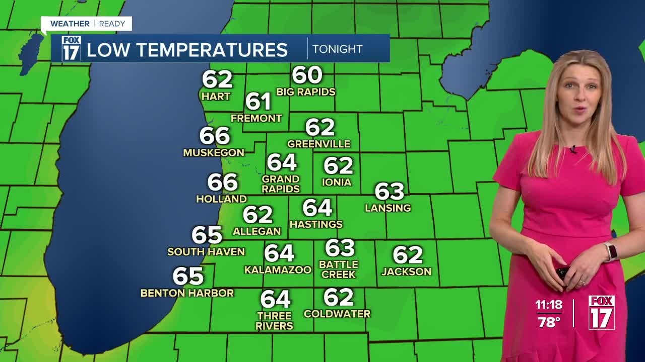
TONIGHT: An isolated thunderstorm possible through midnight, otherwise mostly clear. Lows in the mid 60s. Winds west at 5 to 10 mph.
THURSDAY: Mostly sunny to partly cloudy. An isolated gusty thunderstorm possible, but most stay dry. Highs in the mid/upper 80s. Winds west at 5 to 10 mph.
FRIDAY: Partly cloudy, hot, and more humid. Highs around 90.
SATURDAY: Partly cloudy, hot, and humid. Slight chance or a shower/storm, especially at night. Highs in the low/mid 90s.
SUNDAY: Partly sunny, warm, and muggy with a chance of showers/storms. Highs in the upper 80s.
MONDAY: Partly cloudy with a chance of a shower/storm. Highs in the mid/upper 80s.
TUESDAY: Mostly sunny and slightly cooler, with highs in the low to mid 80s.
WEDNESDAY: Mostly sunny with highs in the mid 80s.
For the latest details on the weather in West Michigan, head to the FOX 17 Weather page.
Follow FOX 17: Facebook - X (formerly Twitter) - Instagram - YouTube
