

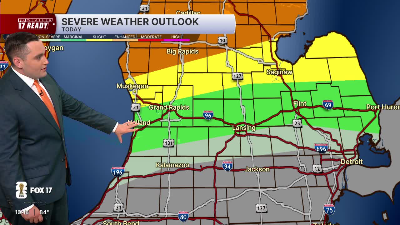


WEST MICHIGAN — The forecast from FOX 17 Weather Ready Meteorologist Colton Cichoracki: We are halfway through this major heat wave, with extreme heat and humidity continuing through the rest of the work week. Hot and humid days with highs in the low to mid 90s and warm and muggy nights in the upper 70s are expected through Friday. An Extreme Heat Warning remains in effect for all of West Michigan through 8 p.m. Thursday. The heat index values (feels like) will be 100 to 105 degrees through Friday because of extremely high humidity levels. Each day through Friday has a FOX 17 Weather Ready Alert. Drink plenty of water, limit time outdoors, wear loose fitting light colored clothing, and take care of your pets during this heat. In addition to the heat, scattered showers and thunderstorms will be possible tonight, and again tomorrow, Friday and Saturday as complexes of thunderstorms roll through the Midwest and Great Lakes. These could occasionally be strong to severe, with gusty winds and very heavy rain. At this point, no washout is expected for the 4th of July, but keep an eye on the forecast if you are planning anything outdoors. Storm chances continue into Sunday.
TONIGHT: Partly cloudy, warm and muggy. Lows in the mid 70s. Wind SW at 5-15 mph. Slight chance showers and storms.
THURSDAY: Weather Ready Alert: Partly cloudy, hot and humid. Highs in the low/mid 90s. Heat index 100 to 105 degrees. Chance P.M./night showers and storms.
FRIDAY: Weather Ready Alert: Partly cloudy with scattered showers and thunderstorms. Hot and humid, Highs in the low 90s and heat index around 100 degrees.
SATURDAY (Independence Day): Partly sunny with a chance showers and thunderstorms. Highs around 90.
SUNDAY: Partly cloudy with a slight chance for showers and thunderstorms. Highs in the upper 80s.
MONDAY: Mostly sunny with highs in the mid/upper 80s.
TUESDAY: Mostly sunny with highs in the upper 80s.
WEDNESDAY: Partly cloudy with highs in the mid to upper 80s.
Want alerts when inconvenient or severe weather is headed your way? Download the FOX 17 Weather app and set up notifications for where you live.
For the latest details on the weather in West Michigan, head to the FOX 17 Weather page.
Follow FOX 17: Facebook - X (formerly Twitter) - Instagram - YouTube
