


The forecast from FOX 17 Weather Ready Meteorologist Colton Cichoracki: Another chilly night is ahead, with the potential for frosty spots north of Grand Rapids. There is a Frost Advisory for Oceana, Newaygo and Mecosta Counties overnight into Friday morning. The rest of West Michigan will be in the upper 30s to around 40 overnight. A large upper low in southern Canada is continuing to funnel cool air in to the Great Lakes, but temperatures will be on the rise the next few days. Highs Friday will be in the low 60s, and mid-60s on Saturday! Friday is looking mostly dry but better chances for afternoon showers comes Saturday with a cold front. Mother's Day looks dry with highs in the low 60s. There are indications that we may warm back into the 70s by the end of next week.
TONIGHT: Partly cloudy. Chilly. Lows in the upper 30s. Winds southwest at 5 to 10 mph.
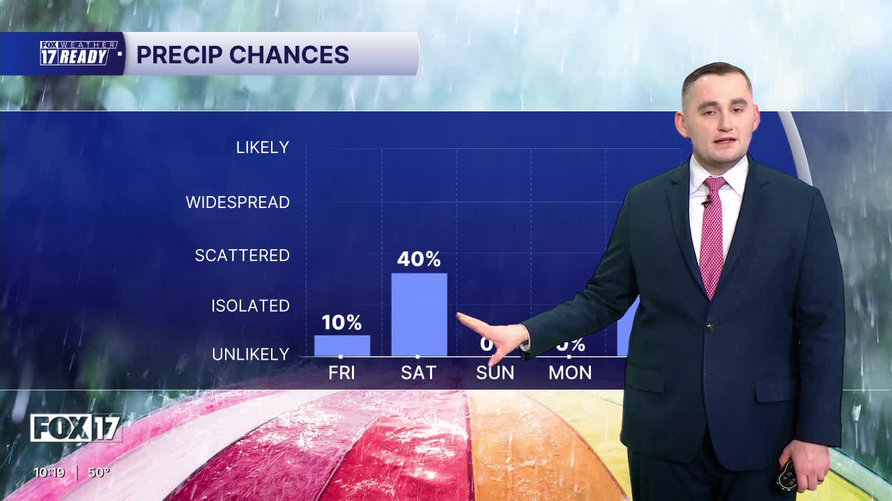
FRIDAY: Mostly sunny to partly cloudy. A bit warmer. An isolated P.M. shower possible. Highs in the lower 60s. Winds southwest at 10 to 15.
SATURDAY: Partly sunny to mostly cloudy and briefly warmer. Chance of afternoon showers. A thunderstorm possible. Highs in the mid/upper 60s.
SUNDAY: HAPPY MOTHER'S DAY! Mostly sunny to partly cloudy. Highs in the upper 50s to near 60.
MONDAY: Mostly sunny to partly cloudy. Highs in the upper 50s.
TUESDAY: Mostly cloudy with chance showers. Highs in the upper 50s to near 60.
WEDNESDAY: Partly cloudy. Highs in the mid 60s.
THURSDAY: Partly cloudy with highs in the mid 60s.
Want alerts when inconvenient or severe weather is headed your way? Download the FOX 17 Weather app and set up notifications for where you live.
For the latest details on the weather in West Michigan, head to the FOX 17 Weather page.
Follow FOX 17: Facebook - X (formerly Twitter) - Instagram - YouTube
