


The forecast from FOX 17 Weather Ready Meteorologist Reece Cole: Our next chance of showers/storms arrive Saturday as the next frontal system approaches. A few of those storms could be strong to marginally severe with wind/hail, an isolated tornado, along lightning and heavy rain. All of southern lower Michigan remains in a SLIGHT RISK (level 2/5) for severe storms Saturday. The timing is anywhere from late more 11 A.M. until about 5/6 P.M.. That means Saturday is a FOX17 WEATHER READY ALERT DAY! We may be able to start seeing the Perseid Meteors, but they don't peak until August 12/13. This is an annual event and stems from debris from the tail of the comet Swift Tuttle. Stay tuned to the FOX 17 Weather Ready Team for your latest forecast updates.
TONIGHT: Mostly clear, but cloudier by sunrise. Lows in the mid 60s. Winds south-southeast light.
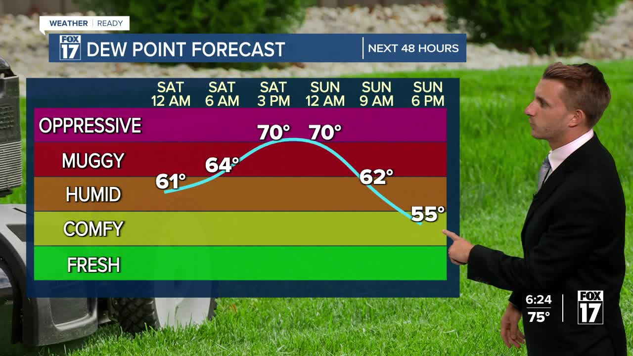
SATURDAY: Partly sunny to mostly cloudy and more humid. A few showers/storms likely. Some may be strong to marginally severe with wind/hail. Highs in the lower 80s. Winds southwest/west at 5 to 15 mph.
SUNDAY: Mostly sunny and pleasant. Highs in the lower 80s.
MONDAY: Mostly sunny to partly cloudy and pleasant. Highs in the low/mid 80s.
TUESDAY: Partly cloudy to partly sunny, warmer, more humid. Chance of a shower/storm. Highs in the upper 80s.
WEDNESDAY: Partly sunny, hot, and humid. Slight chance of a shower/storm. Highs around 90.
For the latest details on the weather in West Michigan, head to the FOX 17 Weather page.
Follow FOX 17: Facebook - X (formerly Twitter) - Instagram - YouTube
