

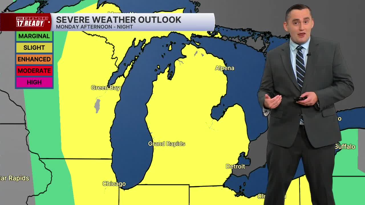


WEST MICHIGAN — The forecast from FOX 17 Weather Ready Meteorologist Colton Cichoracki: We are tracking two chances for strong to severe thunderstorms in West Michigan and Monday is a FOX 17 Weather Ready Alert. The first chance for severe storms will come very late Sunday night into early Monday morning. The Storm Prediction Center has the area highlighted in a level two slight risk for severe thunderstorms. This threat comes as a complex of showers and storms develops in northern Wisconsin. These storms could take a track that has them move into West Michigan well after midnight. If this were to occur, damaging winds and hail would be possible. It is possible these storms take a more westerly track and miss us completely. At this time, there is no clear favorite as to which route the storms will take so stay tuned for forecast changes. Monday's severe threat will be dependent on what happens with the first round of storms. If those storms do not occur, it could lead to more severe weather in the afternoon and evening in West Michigan. There is a level two slight risk for severe storms by the Storm Prediction Center as all types of severe weather would be possible. Stay with FOX 17 for updates. As for temperatures, we drop into the upper 60s overnight and then Monday is a warm and humid day with highs in the middle 80s. We will dry out Tuesday with some very pleasant weather. Storm chances will return towards the end of the week and into the weekend.
TONIGHT: Partly cloudy with chance showers and storms, a few strong to severe storms possible. Warm and muggy, lows in the upper 60s. Wind SW at 5-10 mph.
MONDAY: WEATHER READY ALERT: Partly cloudy with scattered showers and storms. Some P.M. strong to severe storms possible. Highs in the mid/upper 80s. Wind SW at 10-15 mph.
TUESDAY: Partly cloudy to mostly sunny with highs in the low to mid 80s.
WEDNESDAY: Sunny with highs in the low to mid 80s.
THURSDAY: Mostly sunny with highs in the mid/upper 80s.
FRIDAY: Partly cloudy with a chance for late day showers. Highs in the mid 80s.
SATURDAY: Partly cloudy with chance showers and storms. Highs in the mid 80s.
SUNDAY: Partly cloudy with highs in the mid 80s.
Want alerts when inconvenient or severe weather is headed your way? Download the FOX 17 Weather app and set up notifications for where you live.
For the latest details on the weather in West Michigan, head to the FOX 17 Weather page.
Follow FOX 17: Facebook - X (formerly Twitter) - Instagram - YouTube
