
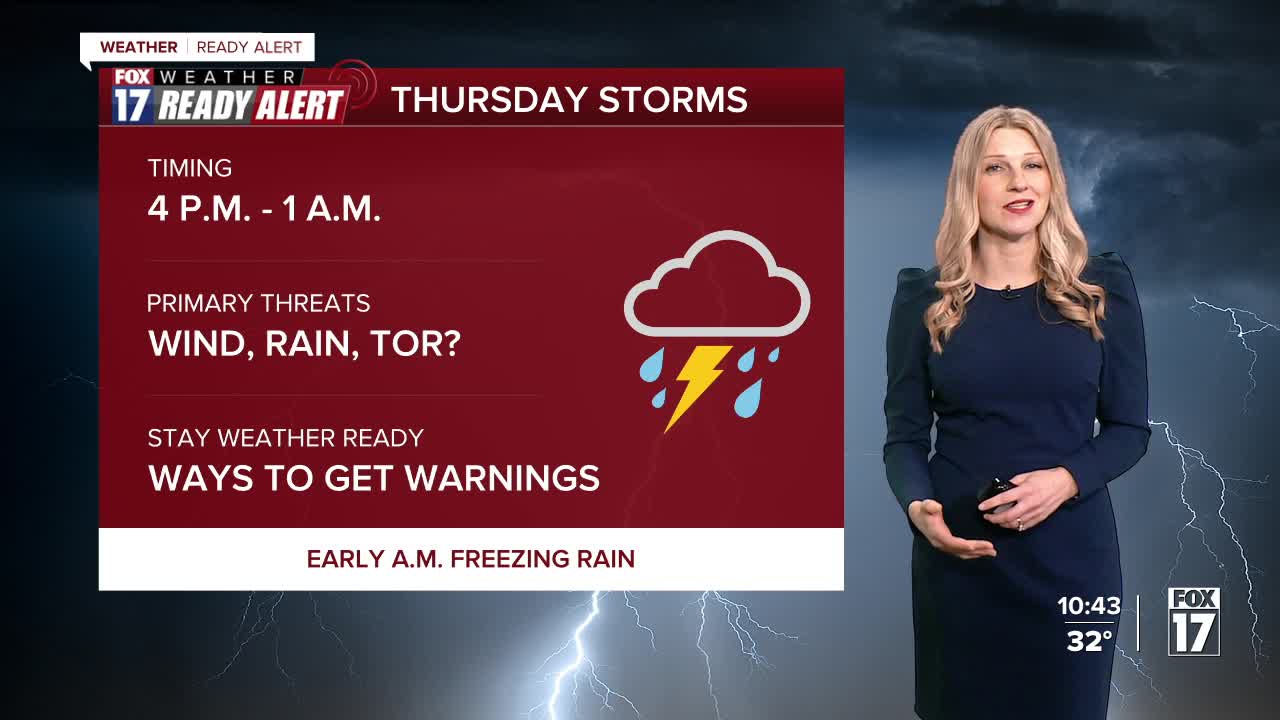


The forecast from FOX 17 Weather Ready Meteorologist Kara James: Tonight will be chilly and breezy with a few showers or areas of light freezing rain by dawn. Widespread impacts are not expected, but a few spots north of Grand Rapids may be briefly slick. A warm front will lift through during the day tomorrow as a low pressure system arrives, and A FOX 17 WEATHER READY ALERT has been issued due to another risk for strong to severe thunderstorms in the afternoon and evening. The Storm Prediction Center has highlighted West Michigan in a Slight Risk (level 2/5) for severe thunderstorms. Damaging winds are the primary threat, but tornadoes also look possible with the amount of spin in the atmosphere. Storms will end early Friday morning, with another system bringing rain and more storms Saturday. Rain totals could amount to another 1-2" before the weekend ends. Easter Sunday looks to be cooler and mostly cloudy, quiet stretch of days into early next week.
TONIGHT: Cloudy and breezy with showers developing. A light wintry mix of precipitation of snow showers or some freezing rain is possible north of Grand Rapids. Lows in the low/mid 30s. Winds east at 10 to 20 mph.
THURSDAY: Weather Ready Alert. Strong to severe thunderstorms possible from the afternoon through around midnight. Wind gusts, hail, a tornado possible. Highs in the mid/upper 60s. Winds east/south at 15 to 25 mph.
FRIDAY: Chance of early morning lingering showers, otherwise becoming partly cloudy. Highs in the lower 60s.
SATURDAY: Cloudy with rain and thunderstorms likely. Highs in the low/mid 60s.
EASTER SUNDAY: Mostly cloudy and cooler. Highs in the middle 40s.
MONDAY: Partly cloudy to partly sunny. Highs in the upper 40s to near 50.
TUESDAY: Partly cloudy to partly sunny and cool. Highs in the mid/upper 40s.
Want alerts when inconvenient or severe weather is headed your way? Download the FOX 17 Weather app and set up notifications for where you live.
For the latest details on the weather in West Michigan, head to the FOX 17 Weather page.
Follow FOX 17: Facebook - X (formerly Twitter) - Instagram - YouTube
