


WEST MICHIGAN - It's been almost four months since we've seen temperatures in the 60s, but we expect at least one, perhaps two days of those temperatures this week! While it may not be too unusual, we always see a thaw in the winter months, but the last several days has also featured dry, sunny conditions. Get ready for 50s and 60s most of this week.
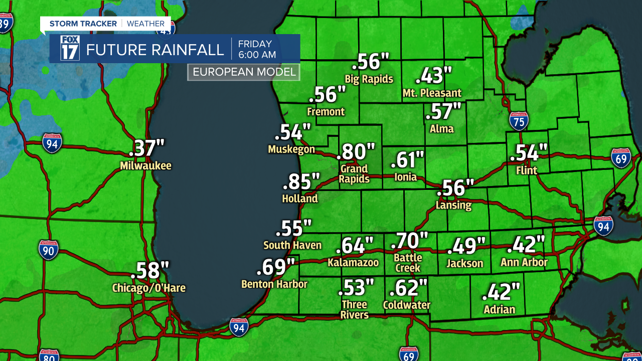
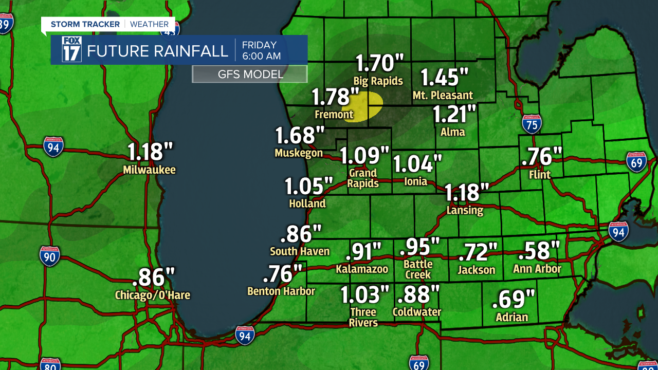
There is a rhyme and reason to the unseasonably warm temperature regime. A strong flow from the south/west along with a change in our upper level jet stream pattern will drive the warmer readings. Eventually, it will also bring rain into the region Wednesday evening/night and into Thursday. See our forecast models below for an idea of how much to expect into Friday morning.
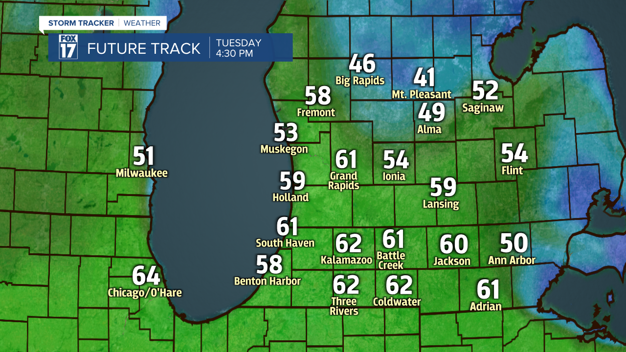
Take a look at our forecast model for high temperatures on Tuesday!
Take a look at the graphic below to see when the last time was West Michigan hit 60 degrees or warmer.

Temperatures will gradually decrease through the week, and especially once the rain system tracks through the state on Friday. Look for readings to return to around seasonable levels this weekend and into the beginning of next week. We may also experience some fog across the area Tuesday morning. While we expect most Tuesday morning temperatures to remain at/above freezing, some locations along/north of I-96 could briefly see readings dip below freezing, which would create some freezing fog.
Get the complete West Michigan forecast at www.fox17online.com/weather.
