


WEST MICHIGAN - While southern lower Michigan has been in a "severe drought" for the past few weeks, we may bust that completely this weekend with the potential of heavy rain Friday, Saturday, and Sunday. The chance of severe storms is relatively low, but a solid two to four inches (or more) of rain is possible by the time this system tracks out of the area Sunday or Monday.
Take a look at the image below. It's from our computer forecast model and is valid for 6 P.M. Friday. We expect a cold front to sag into the state late Thursday, then stall out for the weekend. This stalled front will be the focal point and genesis for low pressure areas to "ride" along the front and bring up a conveyor belt of moisture from the Gulf of Mexico. While a few thunderstorms are possible, the extensive cloud cover and moderate/heavy rain should mitigate any real severe weather threat a majority of the time.
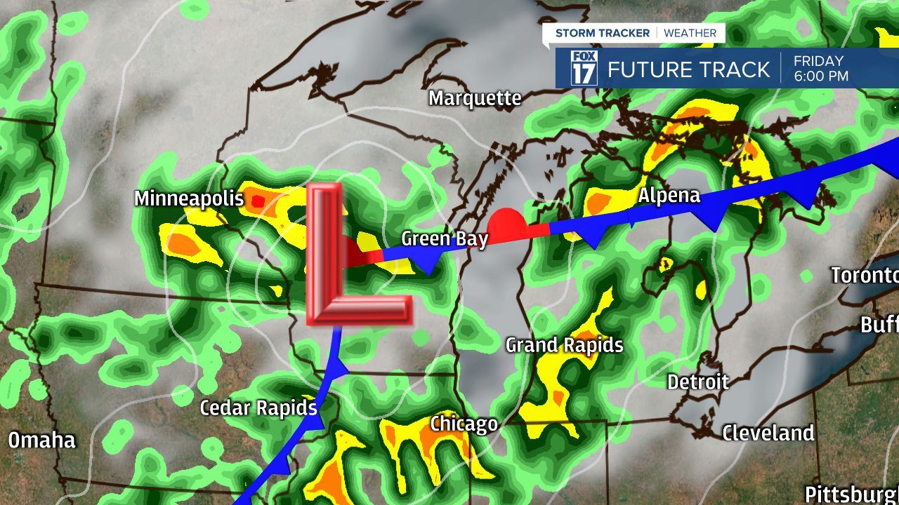
Parts of West Michigan and southern lower Michigan remain in a MARGINAL RISK of strong/severe storms on Friday, but anything significant, widespread, or prolonged is NOT likely. See image below.

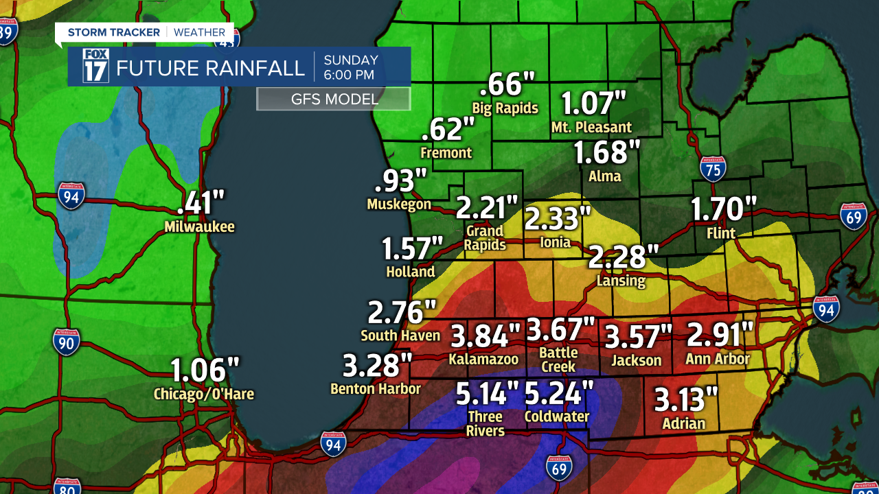
We're seeing some impressive rainfall totals from our forecast models this weekend. Two, three, four inches or more are possible from Thursday P.M. through Sunday as this system stalls over the state. Take a look at two of our most popular forecast models below. The first is the GFS.
Next, the European Forecast Model below. Notice, this model plots the higher precipitation totals further north (along/north of I-96). Don't get so caught up in the exact amounts for each city, rather note the overall moderate to heavy rain potential across the entire area. If these models verify, it will be a soggy weekend to say the least.

While the heavy rain will be a welcome sight for most of us across lower Michigan, our counties south of Grand Rapids already received heavy rain from strong/severe thunderstorms on Sunday, so the ground there is already saturated. Flooding concerns may continue to mount along/south of the I-94 corridor if these totals this weekend come to fruition. Make sure to stay up on later forecasts and get more details at www.fox17online.com/weather.
