


WEST MICHIGAN — Rounds of showers and thunderstorms are in the forecast in West Michigan over the next few days. Rounds of rain and thunderstorms will persist through the weekend. As of now, the severe weather potential is focused on Saturday night and early Sunday morning. You'll want to stay alert and weather aware.
Where is the greatest threat for severe weather?
The Storm Prediction Center has placed West Michigan under a severe weather outlook on Saturday. Southeast of Grand Rapids falls under a MARGINAL RISK, which is the lowest level severe storm risk category, represented by the color green.

The region including Allegan, Grand Rapids, Ionia and communities northwest fall under SLIGHT RISK, which is a greater risk for severe thunderstorms. For a detailed description of each severe weather risk category, click here.
As a reminder, while we may have some pop-up showers during the day, our severe storm concern is for thunderstorms after 8 p.m. Saturday, lasting into the early morning hours of Sunday.
When will thunderstorms develop?
Skies will dry for the middle of the day on Saturday. This will allow for heat and humidity to build, providing fuel for thunderstorms in the late evening. The more sunshine we see in the middle of the day on Saturday, the more instability that could form. Thunderstorms love heat and humidity!
High temperatures on Saturday will be climbing to nearly 80 degrees, along with plenty of sunshine!

A few pop-up thunderstorms will be possible after 5 p.m. Saturday, however the strongest thunderstorms are likely to be after 8 p.m. Saturday.

The strongest thunderstorms will be after sunset Saturday, while the greatest severe weather potential will be to the northwest of Grand Rapids These storms will develop in Northern Michigan initially, eventually approaching West Michigan from the northwest.

Be sure to have multiple ways to receive severe weather alerts on Saturday night. Even though this isn't the highest severe weather threat we've seen this season, this is the start of a very stormy week, and more rounds of severe weather are likely in the next 7 days. Remember to download the FOX 17 Weather App for severe weather alerts.
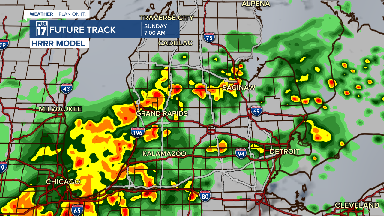
The line of thunderstorms will push south and east into Sunday morning.
What are the main threats?
As of now, the main threats for severe weather will be hail over one inch in diameter and damaging wind gusts. Heavy downpours and frequent lightning will also be possible. An isolated tornado is possible, however unlikely.

Check back in with FOX 17 for all forecast updates. The severe weather outlook map could adjust, along with the timing and strength of storms.
Have you ever wondered what makes a thunderstorm severe? Click here.
For the latest details on the weather in West Michigan, head to the FOX 17 Weather page.
Follow FOX 17: Facebook - X (formerly Twitter) - Instagram - YouTube
