


WEST MICHIGAN — The FOX 17 Weather Team continues to track a winter storm, expected to bring the greatest travel impacts this evening. In addition, the warmer temperatures and rain from Wednesday has created flooding concerns with standing/ponding water and snowmelt.
The amount of snow that accumulates will be directly related to the track of the storm and how quickly cold air settles into the region. After checking about a half dozen forecast models, below is our FOX 17 forecast for where the heaviest and lightest snow will fall by Thursday night.
The heaviest snow accumulation is likely south of I-94, where Winter Storm Warnings are currently posted. Winter Storm Warnings are in effect for Berrien, Branch, Calhoun, Cass, Hillsdale, Jackson, and St. Joseph counties through 1 a.m. Friday. This is where 4" to 6" of snow is expected, with isolated higher amounts possible.
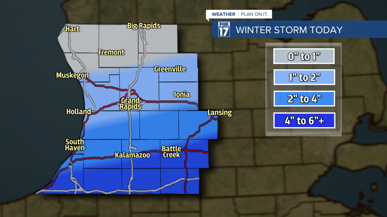
A Winter Weather Advisory is in effect through 1 a.m. Friday for Barry, Eaton, Van Buren, and Kalamazoo counties. Snow accumulation between 2" to 4" is expected, with isolated higher amounts possible.

Slick travel is likely, with the largest impacts for the evening drive time.
Make sure to stay up on later forecasts as we continue to track this developing storm system. Get more at www.fox17online.com/weather.
