


WEST MICHIGAN - Part one of this winter storm dropped a solid 4" to 8" of snow across the heart of our FOX 17 viewing area Wednesday and Wednesday night, now part two will commence today, tonight, and into Friday. Heavy lake-effect snow will occur west of U.S. 131 where another foot will likely fall.
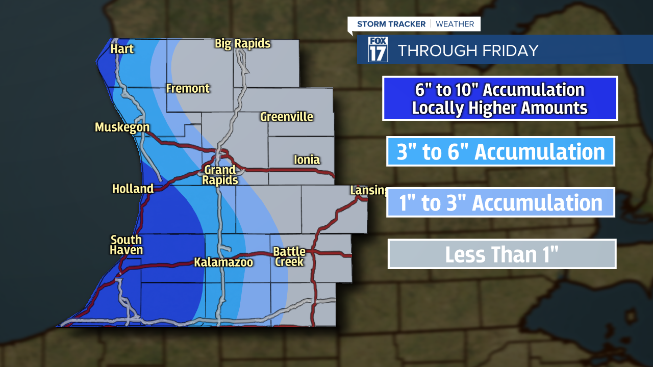
WINTER STORM WARNINGS are in effect until 10 A.M. Friday for all of our lakeshore counties, including Kalamazoo and Cass. We expect 6" to 10" in those areas, with locally higher amounts of 12" or more where these persistent lake bands set up. It likely won't shut down until Friday morning, and more likely in the afternoon. Kent County is under an ADVISORY through 7 P.M. this evening, while Barry, Calhoun, and St. Joseph Counties remain under a WINTER WEATHER ADVISORY through 10 A.M. Friday. Lighter amounts of snow will fall in these areas.
Take a look at our accumulation map below. With a defined northwest wind, Arctic air, and a trough of low pressure sliding through the Great Lakes, lake-effect snow will be enhanced to perhaps 1" to 2" snowfall rates per hour at times.
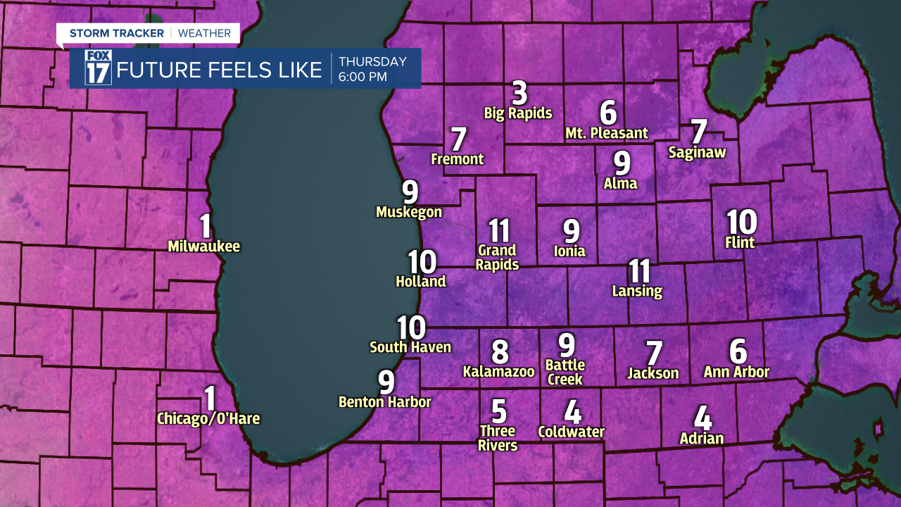
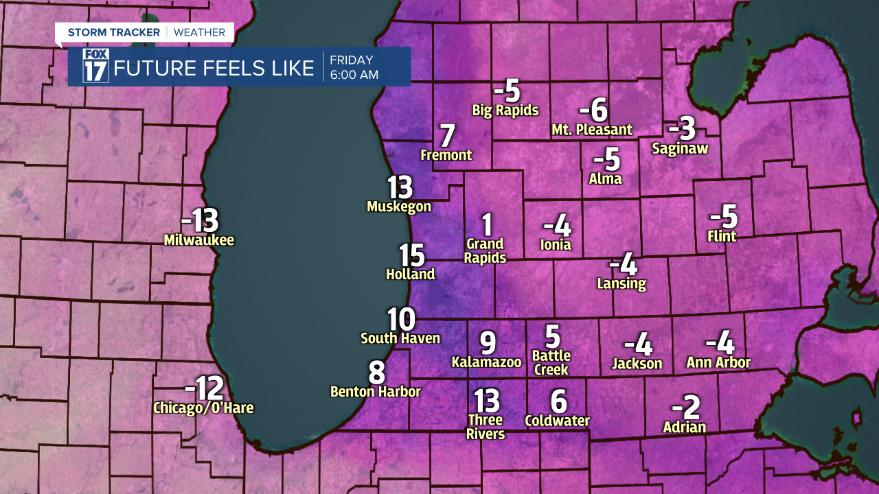
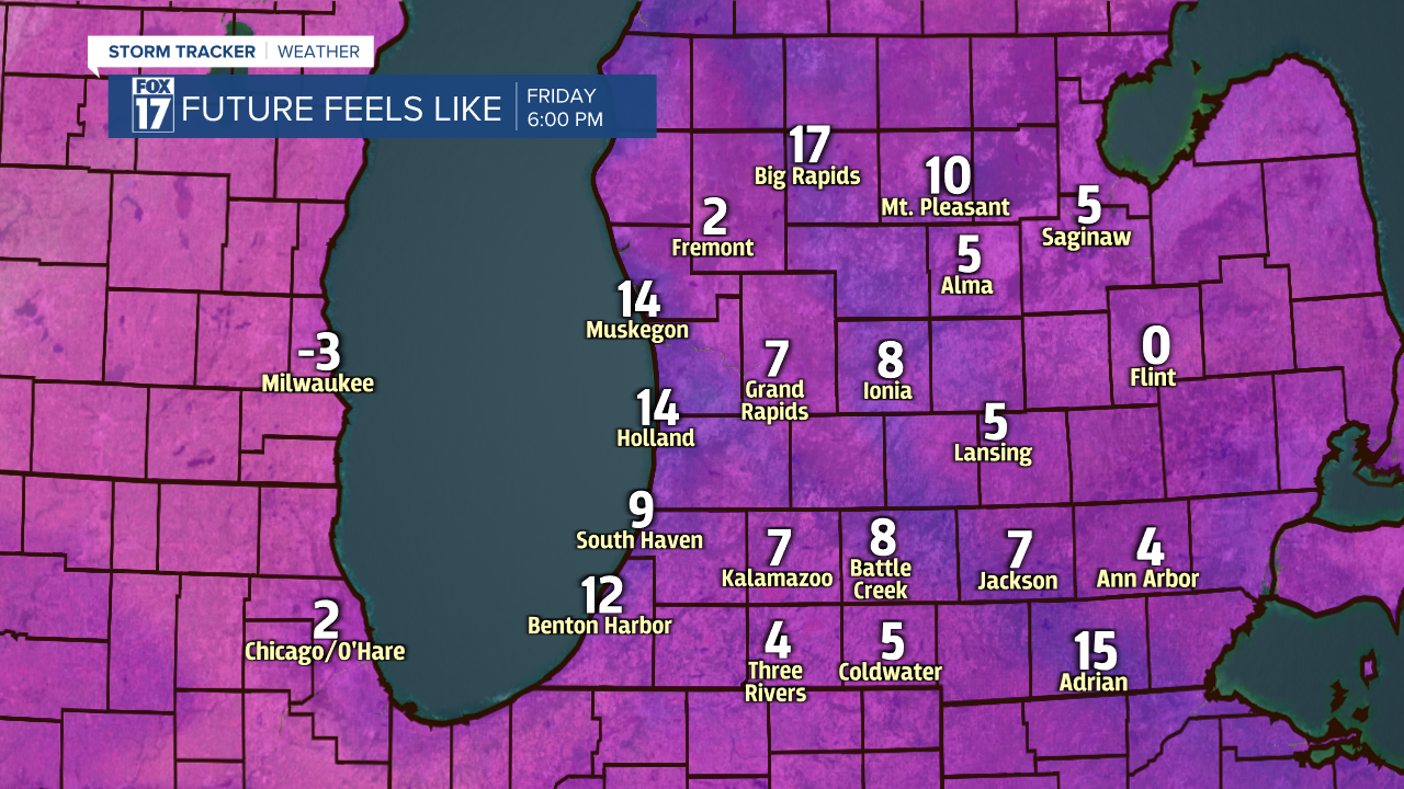
Wind chills the next two days ill be running in the single digits and teens, so make sure to bundle up. See the images below.
We expect a brief warm up above freezing on Saturday and early Sunday before another blast of Arctic air rolls in. Get the complete West Michigan forecast, along with temperature, wind chill, radar, and satellite maps at www.fox17online.com/weather.
