


WEST MICHIGAN - As the saying goes, if you don't like the weather, wait five minutes and it will change. While it may take a little longer than that, we expect snow showers with highs around 40 on Monday, then up about 30 degrees by Saturday to 70!
These huge temperature swings tend to be more common this time of year as we emerge from winter and progress through spring. It's also a good time to get severe storms. Normal highs for this time of year have us in the upper 50s.
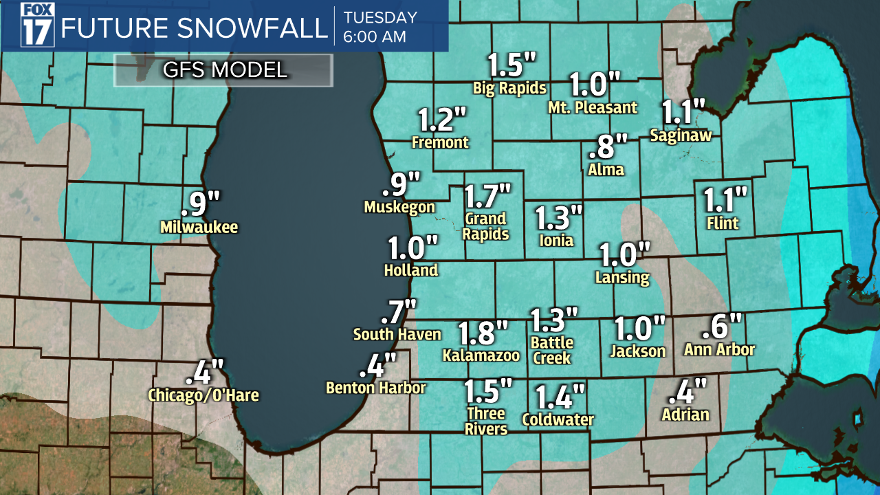
Another frontal system and low pressure area will spread cloud cover in here overnight with snow showers developing in time for the Monday morning commute. We expect grassy accumulations (about an inch or two), and some rain may mix in through the day as well. Travel is not expected to be impacted much as the pavement remains too warm for snow accumulation. See snow accumulation map below.
Our temperatures will warm throughout the week as another shot of precipitation arrives Wednesday evening/night as rain with highs in the lower 50s. By Saturday, temperatures could be pushing near 70! The warm up is expected to brief as Meteorologists from the Climate Prediction Center are forecasting cooler temperatures for the final week of April. See image below.

Easter 2022 will be on the dry and quiet side, but that hasn't always been the case. Below are Easter Sunday weather extremes for Grand Rapids over the last 100 years. The warmest, coldest, wettest, and snowiest.

Get the complete West Michigan forecast at www.fox17online.com/weather.
