


WEST MICHIGAN - As our team of FOX 17 Meteorologists have been advertising for days, a strong fall storm will be arriving in the Great Lakes on Thursday. Initially, it will bring wind, rain, and mild temperatures in the mid/upper 50s. Winds will likely be sustained on Thursday between 15 to 25 mph inland, and 20 to 30 mph at the immediate lakeshore from the south/west. They are expected to gust to 40 mph or better! See our wind graphic below. The image is valid for 6 A.M. Thursday. The larger, white numbers are sustained winds over two-minutes. The "G" number represents the gusts...although these tend to be underestimated by forecast models. The arrow represents the direction from which the wind comes. Map colors are tied to actual wind speeds. The warmer the tones (orange/red), the higher the wind speed.

Another wind image below is valid for 6 P.M. Thursday. The core of the strongest winds will likely traverse West Michigan during the late morning to early/mid afternoon hours.

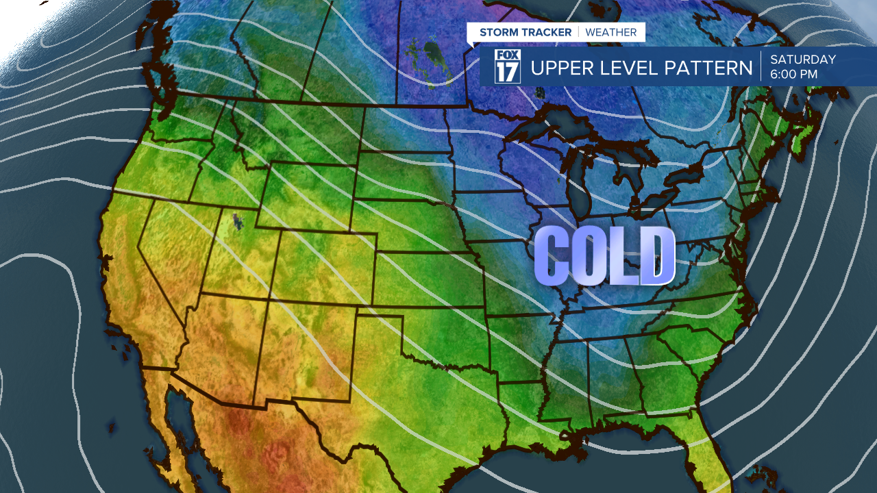
Breezy conditions will still exist on Friday and Saturday bringing in sharply colder air with lake effect rain/snow showers. We expect an inch or two, perhaps two to three inches of snow accumulation on vegetation and grassy areas over the weekend. Highs Friday/Saturday/Sunday will only be around 40 with wind chills well into the 20s! A strong area of low pressure coming out off the Central Plains will generate these conditions beginning Thursday. That system will force an upper level pattern change in our jet stream, creating a huge trough or dip over the Great Lakes. That will allow for cold, Canadian air to sink into Michigan this weekend and next week until the trough lifts out. See image below.
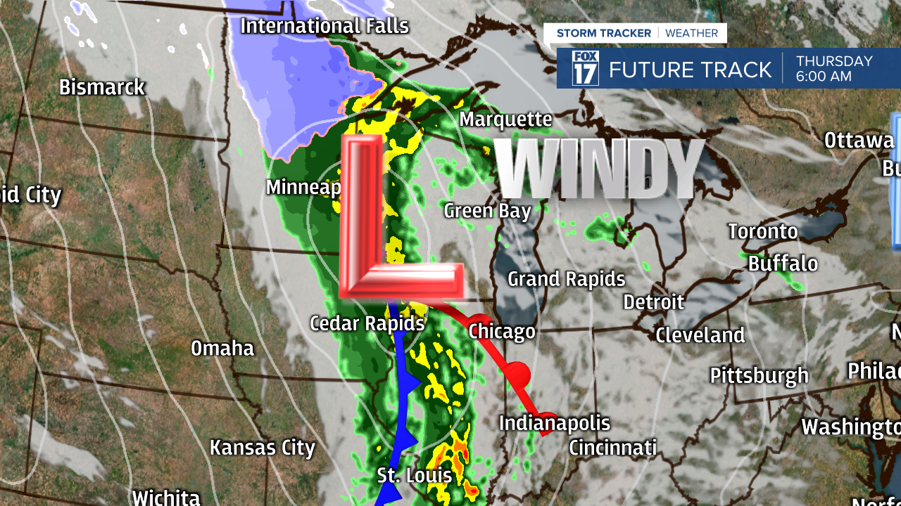
Below is an image of what this system looks like as it tracks into the Great Lakes. The first image is valid for 6 A.M. Thursday.
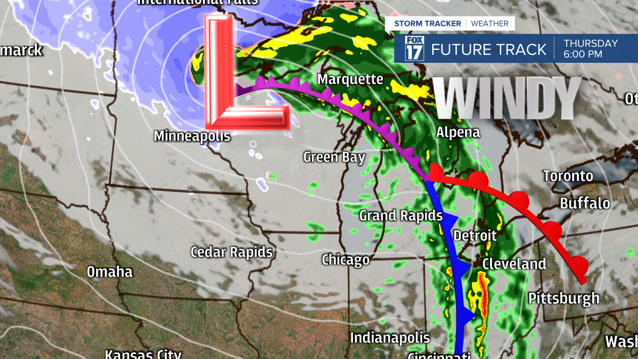
The next image below is valid for 6 P.M. Thursday. The cold front has just moved through with rain exiting the area, but windy conditions remain.
By Friday, sharply colder air along with blustery, raw conditions are expected with falling daytime temperatures and wind chills in the 20s! Rain effect rain and snow showers are likely. See image below.

Get the complete forecast at www.fox17online.com/weather.
