


WALKER, Mich. — One of the most devastating tornadoes in Michigan history carved a path of destruction through West Michigan 70 years ago, April 3, 1956.
After slamming through Hudsonville and killing more than a dozen neighbors, it flattened much of Standale. Three more people died, two in Walker and one in Comstock Park.
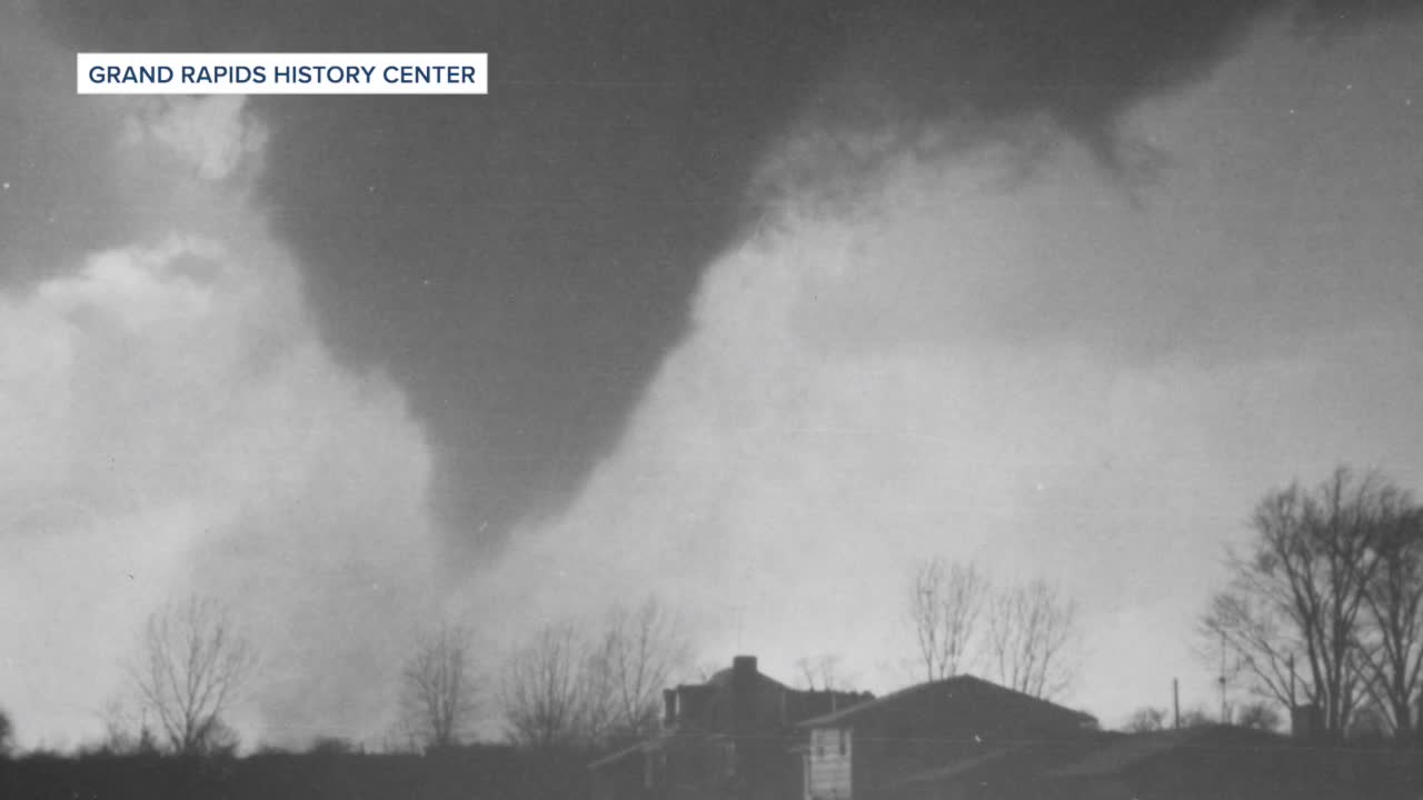
It was the last F5 tornado—the strongest category— to hit West Michigan to date. Today, it would be labeled an EF-5.
The morning of April 3, 1956, dawned warm and humid across the Midwest, with temperatures climbing into the 70s and approaching 80 degrees in Michigan. The atmospheric conditions were primed for disaster: warm, moist air collided with a powerful cold front moving across the western Great Lakes, creating the perfect recipe for severe weather.
Schools had dismissed early that Tuesday, sensing the approaching danger. By late afternoon, meteorologists tracked a potent storm system moving eastward, accompanied by a vigorous cold front. What they couldn't predict was the catastrophic tornado that would soon emerge from this volatile mix.
Today, meteorologists use Doppler radar and sophisticated computer models to track storms with precision that was unimaginable in 1956. The National Weather Service can now issue tornado warnings with much greater accuracy and lead time, giving communities precious minutes to seek shelter.
The National Weather Service Grand Rapids posted an excellent account of what happened that day.
Ernie Ostuno has an amazing Facebook page of images.
Ernie Ostuno, lead forecaster for the National Weather Service office in Grand Rapids, sat down with me, and here is the complete conversation:
This story was initially reported by a journalist and has been converted to this platform with the assistance of AI. Our editorial team verifies all reporting on all platforms for fairness and accuracy.
