

RICHLAND, MI. — Thunderstorms started to develop and fire across our southern counties early Saturday evening. It began in eastern Allegan County just before six o’clock. Storms intensified along a front and they had plenty of moisture, lift, and instability to feed off. A warm front was lifting in to the area at the time, dew point temperatures (a measure of moisture in the air) were around 70 degrees (very tropical), and the area had broken out in to a few hours of late afternoon sunshine to further destabilize things…all the necessary ingredients for strong/severe storms.
At 6:25 P.M. a SEVERE T’STORM WARNING was issued for portions of Allegan, Barry, Kalamazoo, and Calhoun Counties. The biggest threats were the possibility of one inch hail or larger and/or 60 mph winds. The storm cell continued to develop and intensify as it moved east with more than 300 lightning strikes, very heavy rain, and hail algorithms from radar indicating the possibility of golf ball size hail. At 6:53 P.M. the National Weather Service continued the warning, but added the possibility of a tornado (radar indicated) due to rotation being observed on radar. Below…possible lowering of cloud base and wall cloud forming as seen by Cheryl Martin Robinson.

By 7:04 P.M. a TORNADO WARNING was issued for portions of Barry, Calhoun, and Kalamazoo Counties for the stronger possibility of a tornado. By this time radar was showing a very pronounced “hook echo” and velocity data showing incoming and outbound winds were confirming stronger rotation. The attached photo to this story is the actual hook echo meteorologists look for on radar with these types of storms. It’s clear to see the hook in northeast Kalamazoo County at 7:13 P.M. being generated from inflow winds and wrapping around the possible tornado. I don’t know if there are actual percentages of tornadoes associated with hook echoes and how often one produces the other, but I’d estimate that more than half of radar indicated hook echoes are probably producing a tornado. It’s important to note there was NO confirmation by anyone of a tornado on the ground. Below…lowering of cloud base, possible wall cloud as seen by Justin Leroy and taken around the Galesburg area. Read more about wall clouds here from Wikipedia.
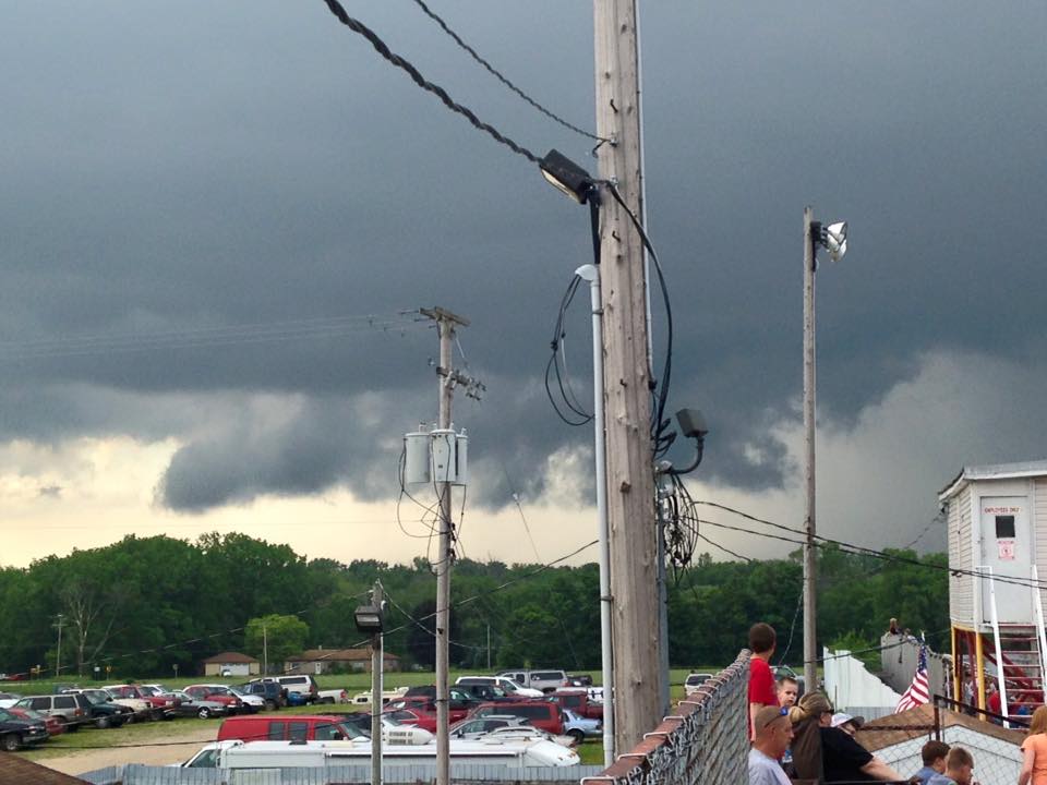
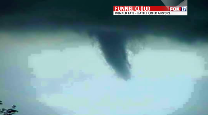
There were witnesses that claim to have seen a wall cloud (a low hanging cloud usually in the rear of the storm cell that sometimes rotates and produces a tornado). We also have had several reports of tree damage and power lines down across northeast Kalamazoo County around Gull Lake and Richland, and more damage around the southeast side of Battle Creek. Below is an image taken at/near the W.K. Kellogg Battle Creek airport from Donald Tate that appears to show a funnel. Remember that it is considered a funnel and not a tornado UNTIL in comes in contact with the surface!
In cases like this the National Weather Service will typically conduct a damage survey in an effort to determine whether straight line winds or an actual tornado was at fault. We’re sure to hear more on this Sunday. Click here for the Consumer’s Energy power outage map. If you have photos or video feel free to post it to our FOX 17 Facebook page.
There are more thunderstorm chances on Sunday and Monday with this entire system and most of our FOX 17 viewing area both days remains in a slight risk of more severe weather development. Click here for the complete forecast. Click here to see the outlook for the area issued by the Storm Prediction Center.
