

WEST MICHIGAN (February 19, 2014) — After winter temperatures that have been unusually cold, it’s finally nice to see a warm up to 40 or better these days. Grand Rapids made 43 Tuesday, we’ll be 40 or better today, and likely be pushing 50 or better from GR-south BRIEFLY on Thursday.
Even with a brief warm up and a little sunshine there are several issues we’re seeing. Ice coverage on the Great Lakes continues to retreat…perhaps most noticeable on Lake Michigan…so stay off the ice! While the roads cleared quickly after Monday’s heavy snow, the warm sun Tuesday left plenty of puddles and standing water in its wake.
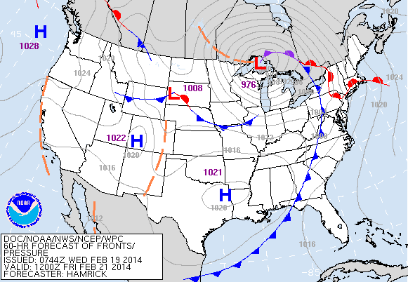
The snapshot of our computer forecast model attached to this story is valid for Thursday evening. A strong, developing, and strengthening low pressure system will come out of the Central/Southern Plains and blast in to the Great Lakes Thursday bringing unusually warm temperatures, very windy conditions, and the threat of heavy rain…perhaps even some thunderstorms too!
With all of the roof collapses that have occurred lately, keep in mind there’s at least four to five inches of liquid precipitation (water) locked up in the snowpack currently on the ground. Add to that the possibility of at least another one inch or more or rain Thursday and we’ll have plenty of standing water and puddling everywhere.
The existing snow will absorb some of the rain that falls, plus we’ll see temperatures tumble (again) behind this system Friday with very windy conditions the first part of the day as the “low” passes over Wisconsin to our west and lifts in to Canada growing stronger along the way. In fact, this particular system will be on the cusp of “bombing-out” or undergoing bombogenesis where the pressure falls 24 millibars (a unit of measurement) in a 24 hour period.
You’ll also notice on the attached photo all of the purple, blue, and green colors (from lightest to heaviest) which denotes accumulated precipitation. Note also the thin gray lines around the low (which we call isobars) that are packed closely together. These lines of equal or constant pressure indicate strong winds and will be peaking Thursday night/Friday morning at about 25 to 35 mile per hour sustained with higher gusts.
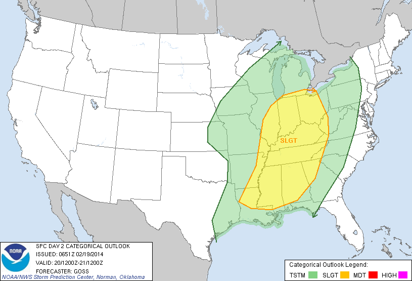
Take a look at the Storm Prediction Severe weather outlook for Thursday below. Note how the yellow hatched area extends all the way north in to southern/lower Michigan. The primary threat would be some strong damaging winds, but I would expect the possibility of tornadoes further south across Kentucky, Tennessee, and the deep south.
Take a look at the weather maps below of how this system will progress from Thursday morning, to Thursday evening, to Friday morning. Note the position of the “low” on each photo.


You can always get the complete forecast by going to www.fox17online.com/weather.
