


We have avoided any major signs of winter so far this March, with limited cold and no measurable snow since February 27. High temperatures have not been below freezing in March, with us even hitting 67° on March 10. We have truly been lucky with the weather lately, but we all knew it wouldn't last. Winter is expected to quickly return courtesy of a wintry mix on Monday.
The mixture of rain, freezing rain and snow will enter West Michigan from the south Monday evening. Temperatures at the begin of the precipitation will be in the upper 30s to lower 40s, so it will likely begin as rain/snow mix along and south of I-96. If you live north of I-96, this will be all snow and will start between 8 p.m. and midnight. The start of the mix will be between 4 p.m. and 8 p.m. for locations along & south of I-96. As temperatures fall and the mix continues, it is expected to completely shift over to freezing rain and snow between 8 p.m. and midnight in the central and southern counties.
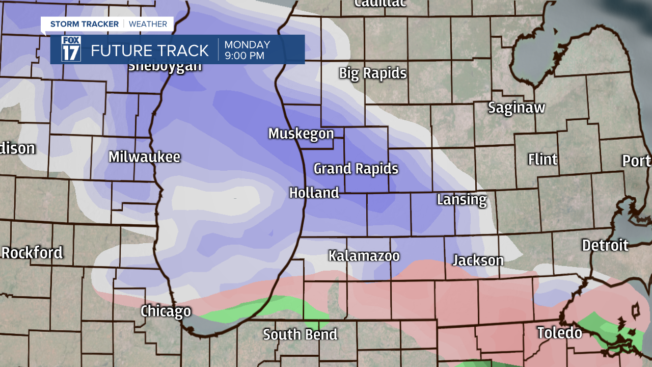
Minor impacts are possible with patchy slick spots developing thanks to the wintry mess. The further north that you live, the better chance you have of encountering slippery conditions. One thing that will help keep our impacts small will be the warmer ground temperatures. The milder temps will help melt what tries to stick. The grass and elevated surfaces will see the majority of the snow and ice, with the roads mainly just staying wet. Snowfall amounts could be up to around 1" with a light glazing of ice also possible.

The mix will end overnight Monday, with a second wave of precipitation moving through Tuesday morning and afternoon. The second wave is expected to have little to no impacts as it will be mainly rain.
