


WEST MICHIGAN — A mix of freezing rain, sleet, snow, and rain is creating slick travel for West Michigan this morning.
WINTER WEATHER ADVISORIES are in effect until 4 P.M.. For more information about your county, click here.

Just in time for the morning commute, the radar image has turned to a wet, heavy, high-moisture content snow from Grand Rapids northward. The area of freezing rain/sleet in pink remains along and south of I-96.

It's questionable how far north the rain/snow line will get, but it's possible the precipitation remains all snow from Grand Rapids northward through most of today. We expect about 1" to 3" of snow along/north of I-96. See our next forecast model image below, valid or 10 A.M. Tuesday.

Note the dark blue bands of heavier snow along and north of the I-96 corridor. Forecast models have it as mainly rain south of Grand Rapids. Our next image (below) is valid for 4 P.M. on Tuesday. Note the darker blue bands of snow still affecting areas from Grand Rapids northward. Some light rain could linger near the I-94 corridor.
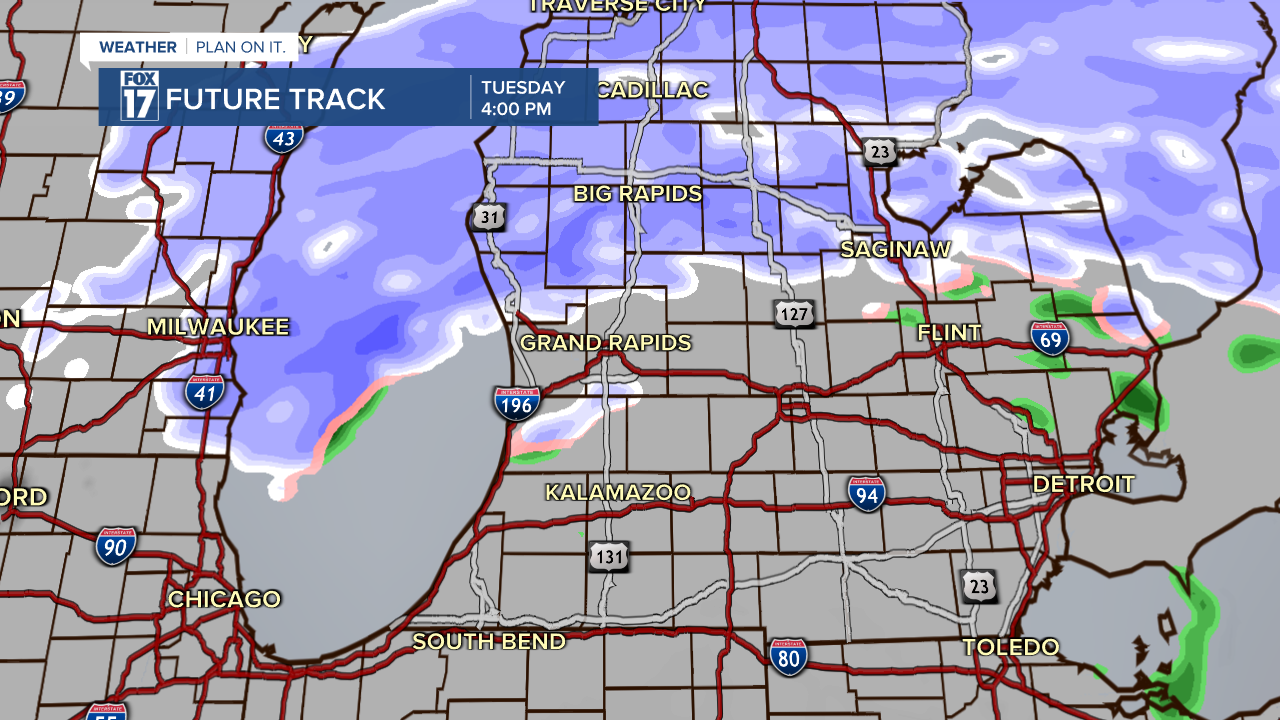
Total snowfall accumulations from Monday night through Tuesday afternoon will be on the order of 1" to 3", especially from Grand Rapids northwards if no mixing of sleet or rain occurs in these locations. This will be a thick, heavy, wet, high-moisture content snow. Higher snow accumulations are possible north of Grand Rapids, where some locations could pick up over 4" of snow by Tuesday evening.

Make sure to stay up on later forecasts as timing, precipitation amounts (and types) may change! Get more at www.fox17online.com/weather.
