


WEST MICHIGAN — A WINTER WEATHER ADVISORY is now in effect for counties that border Lake Michigan, along with Kalamazoo County until 7PM today. As road crews continue with snow removal efforts, Fox17 meteorologists are continuing the WEATHER READY ALERT for today as roads are snow-covered and very slippery.
Many areas have already picked up a widespread 5-10" of snow in West Michigan. As the storm system moves away, lake effect snow showers will continue today in areas west and southwest of Grand Rapids. Areas with the lake effect snow showers will receive an additional 1-4 inches of snow this afternoon.
For the second straight year, the Saturday of Thanksgiving weekend has featured a significant snow event. Ironically, last year on Saturday, November 29th, Grand Rapids had its snowiest day of the entire winter season; with 9.2" of snow.
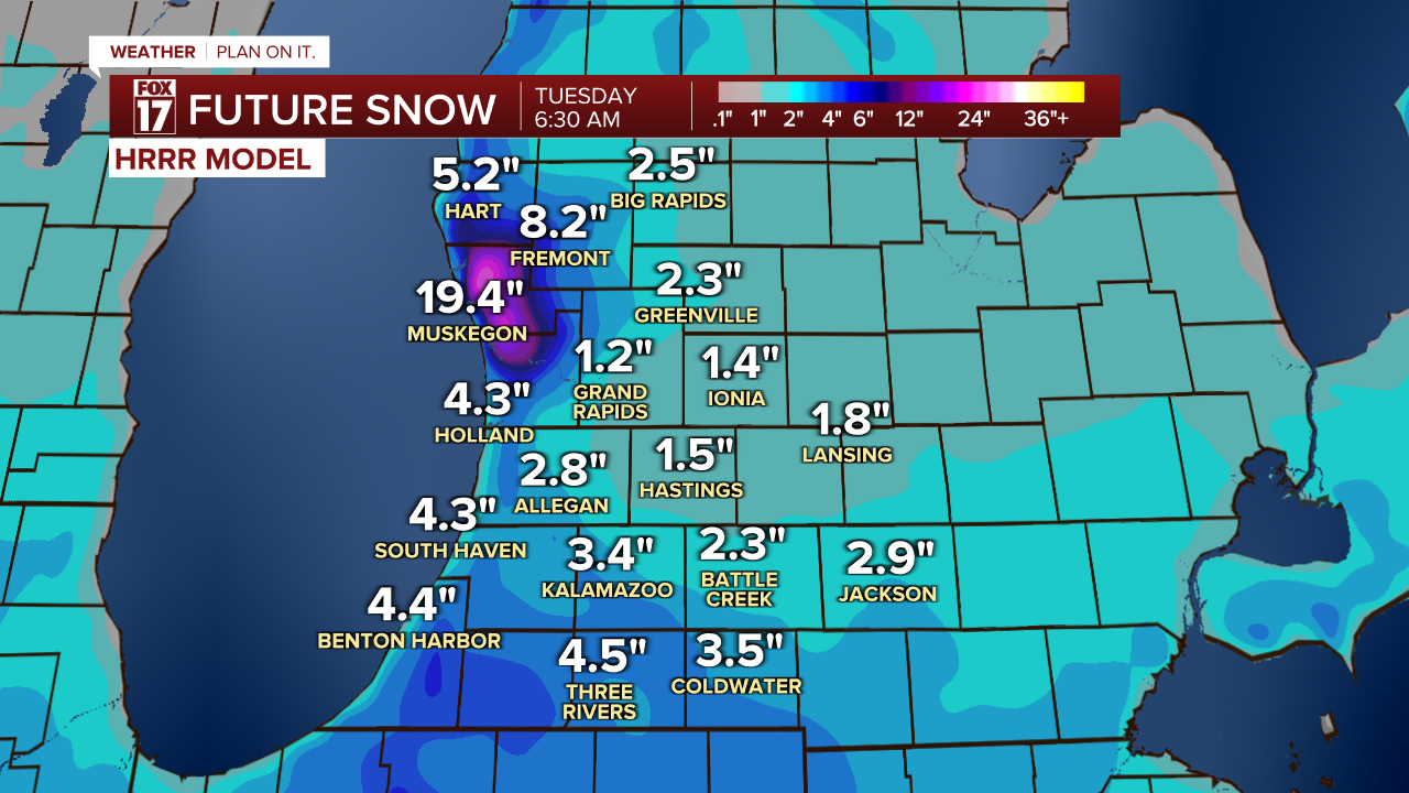
The map below shows one model's interpretation of additional snow we are expecting for today across West Michigan.

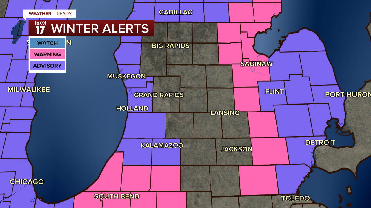
Expect difficult to impossible travel across the Upper Midwest and Great Lakes: slick spots on the roads, reduced visibility, and much slower going than normal. The map below shows all of the winter alerts this system is producing: all or part of 14 states. Here is the link to the Real Time Flight Tracker at the Gerald R. Ford International Airport, which continues to show multiple delays and cancellations on some regional flights.
Pockets of Lake Effect snow will develop in areas to the west of US-131. Here's a projection of additional snow totals through Tuesday morning. As you can see on this projection, this computer model is projecting a bulls-eye of additional very heavy snow in northern Ottawa and much of Muskegon Counties Monday evening through Tuesday morning. If you live in that area, be prepared for significant additional snow.
Even though the snow is winding down in most inland areas, road crews will need some time to catch up on the snow removal, so plan extra time to get to your destination, and be thinking about potential backup plans now. There will be wide swaths of snow totals nearing a foot by the end of the weekend.
Here are the updated regional warnings and advisory map as of midday Sunday.

STORM RECAP: THE SETUP AND TIMING
Here's a recap of the system and timing of the system that created all of this snow. It was a classic "Colorado Low" that moved out of the Rockies and into the Plains.

Snow became heavier and more widespread during the day Saturday.

The heaviest snow arrived Saturday evening and overnight as the center of the low moved over West Michigan. Snowfall rates were a half an inch to an inch per hour!

The widespread snow from the system began to wind down by Sunday mid-morning.

Lake effect snow showers are persisting as the low pressure system (center of the storm) moves into Canada.

Snow totals were quite impressive across the region, with most areas receiving at least 5 to 10 inches over a 24-hour period; and some spots getting 12"+ amounts. Road conditions were be very poor throughout the region through Sunday.

For the latest details on the weather in West Michigan, head to the FOX 17 Weather page.
Follow FOX 17: Facebook - X (formerly Twitter) - Instagram - YouTube
