
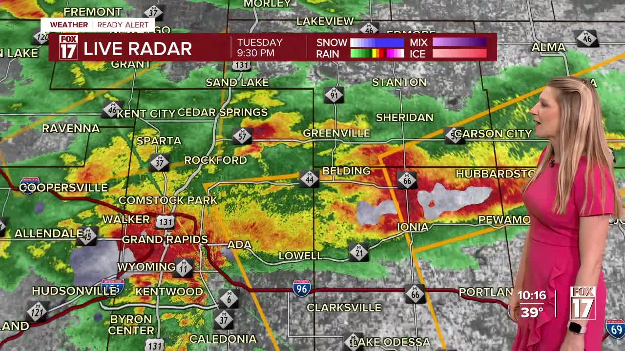


WEST MICHIGAN - After seeing severe weather in parts of West Michigan Tuesday evening, the threat for more storms will continue into the overnight.
Radar estimated rainfall of 2-4+ inches of rain came down Tuesday evening. There is more rain coming overnight which could lead to more flood concerns tonight. A Flash Flood Warning is in effect for the Grand Rapids area until early Wednesday morning.

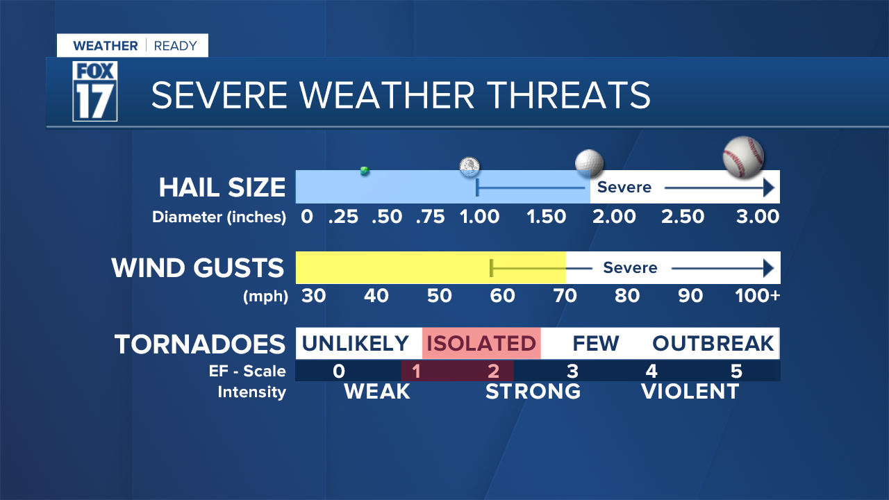
Overnight storms could bring gusty winds, hail and heavy rain. The tornado threat is not gone but has diminished greatly in West Michigan.

The Storm Prediction Center outlook has level 3 out of 5 (orange/enhanced) across Berrien, Cass, St. Joseph, and Branch Counties...the same areas hit last Friday. North to Grand Rapids is a level 2 out of 5 (yellow), while lesser chances for severe storms exist in areas north of Grand Rapids (green level 1 out of 5). Along and north of I-96, large hail and wind are the main threats. See image below.

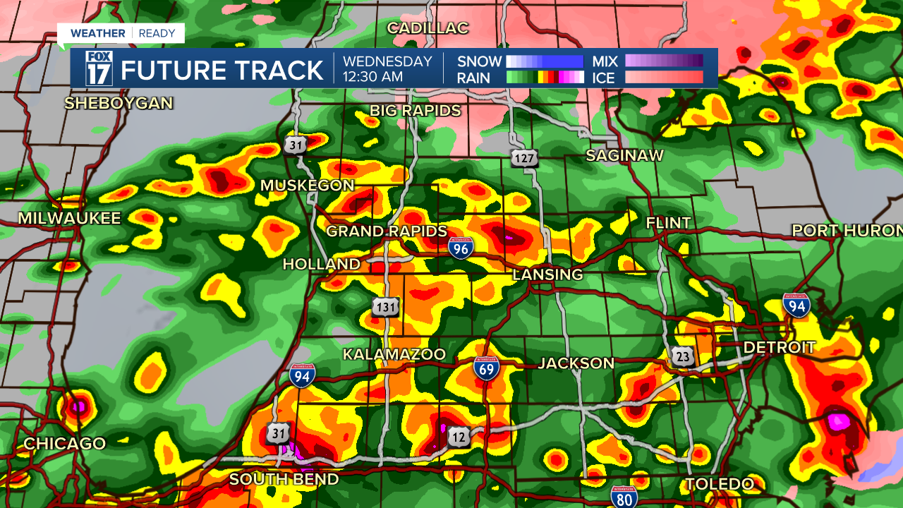
See forecast model images below for timing. Midnight, and 2 AM Wednesday.

This is a similar set up to what we saw last week Friday with a low pressure area and warm front lifting into the state. This can induce a spinning motion in the atmosphere and trigger a tornado or two. Hail and wind are also possible. See the severe weather threats below.
It's not uncommon to get early season tornadoes here in Michigan. Recall that in Marshall (Calhoun County) February 27, 2024 had an EF 1 tornado occur. Cass County had an EF 1 and Kent County an EF 0, both on March 30, 2025.
Make sure you have a way to get watches, warnings, and advisories. Download the FOX 17 weather APP, or use a NOAA weather radio.
For the latest details on the weather in West Michigan, head to the FOX 17 Weather page.
Follow FOX 17: Facebook - X (formerly Twitter) - Instagram - YouTube
