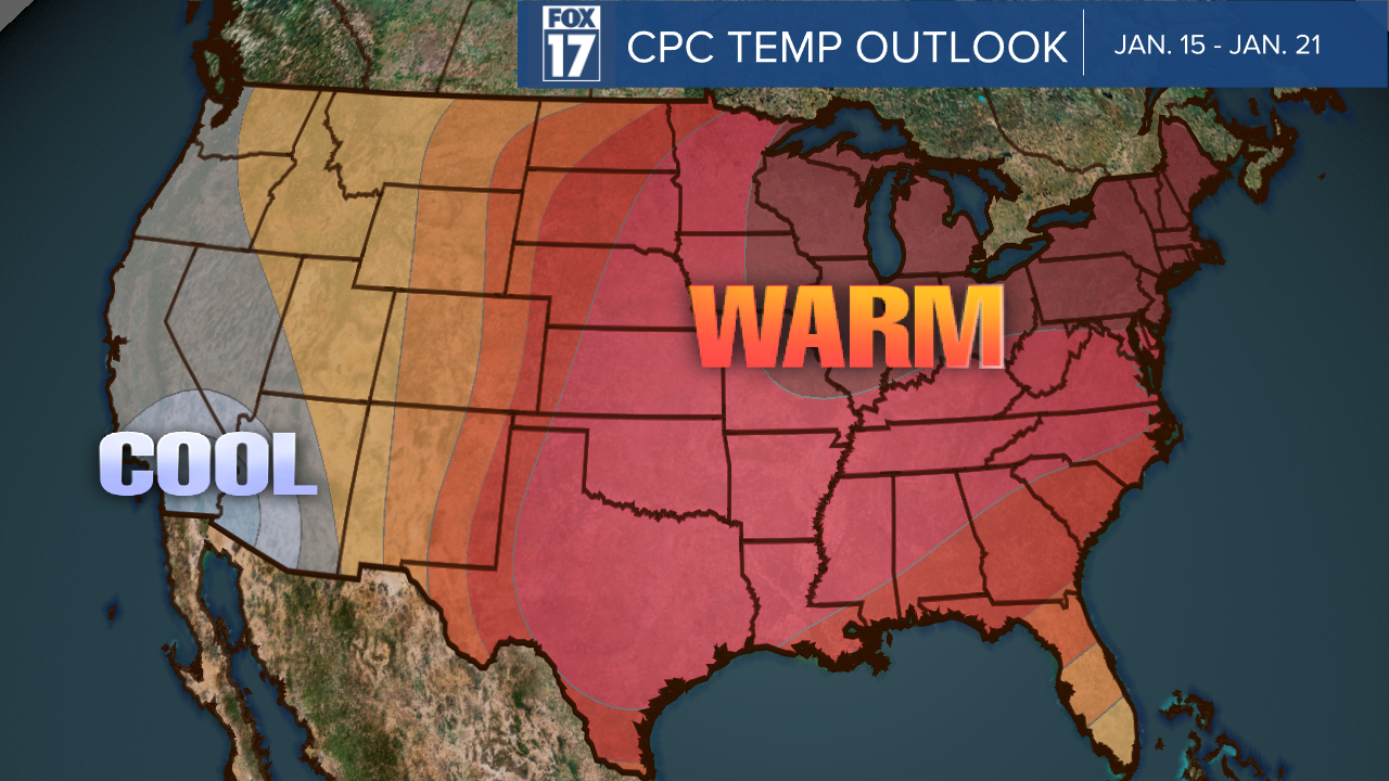
WEST MICHIGAN — The Climate Prediction Center releases a daily update to the temperature and precipitation outlook for the following two weeks. The January 8 update featured an outlook for Jan. 15 through Jan. 21.

This update reflects warmer temperatures being possible through the 21, and wetter conditions for our southern and some of our lake shore communities.

The Grand Rapids National Weather Service stated in a tweet on Friday, "Even out past January 14, the latest outlook favors warmer-than-normal temperatures in Lower Michigan, and leans toward above-normal precipitation. This would mean daytime temperatures often above freezing, and based on those temps, a tendency for rain/snow mix."
Even out past January 14, the latest outlook favors warmer-than-normal temperatures in Lower Michigan, and leans toward above-normal precipitation. This would mean daytime temperatures often above freezing, and based on those temps, a tendency for rain/snow mix. #wmiwx #miwx pic.twitter.com/xJZlwMztj4
— NWS Grand Rapids (@NWSGrandRapids) January 7, 2023


