
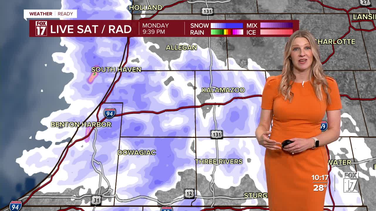


The FOX 17 Weather Ready Alert continues overnight as heavy lake effect snow is still falling along the lakeshore. A dominant lake effect band in southwest lower Michigan could bring another 2-4" of snow with locally higher totals possible by daybreak. We think some areas may see up to a foot of snow (total) by the time everything wraps up early Tuesday morning.
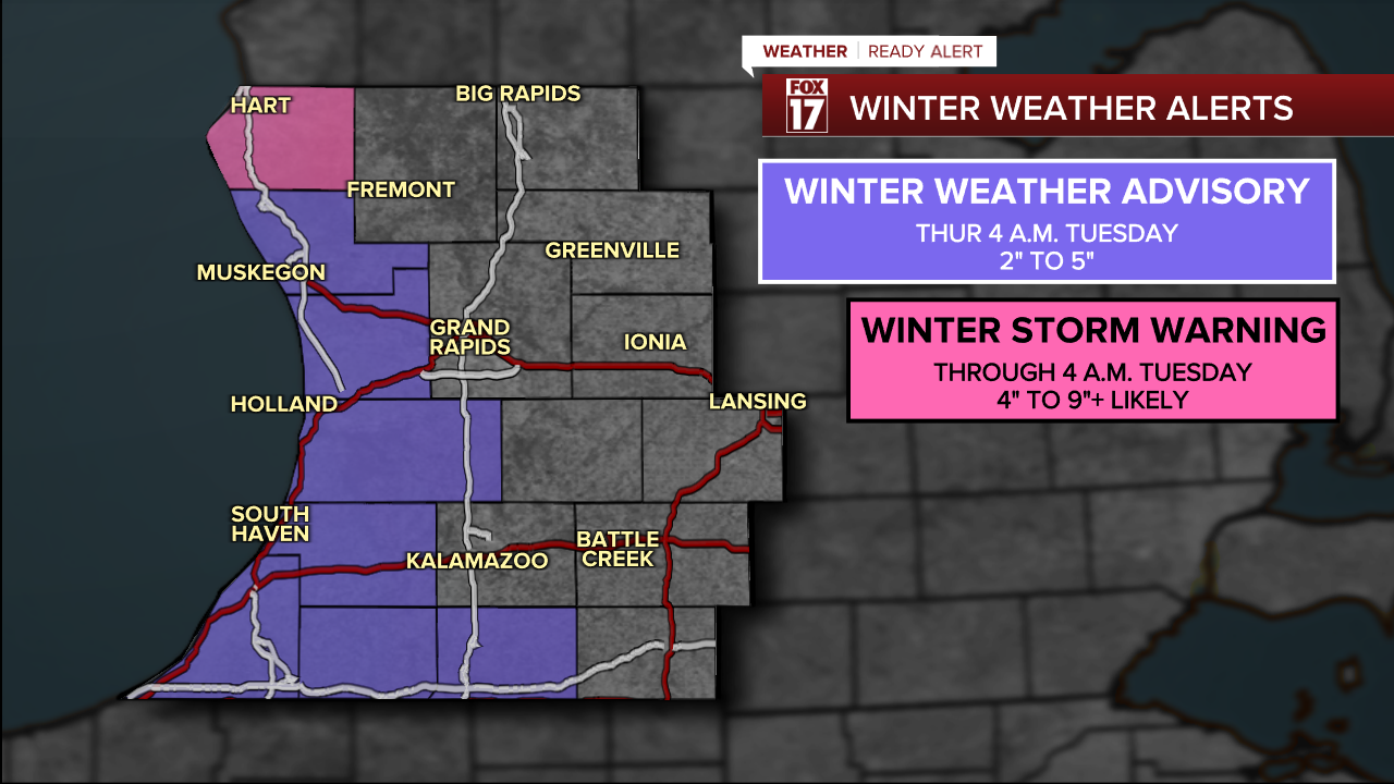
OCEANA COUNTY is under WINTER STORM WARNING. The heaviest snow will fall here. MUSKEGON, OTTAWA, ALLEGAN, VAN BUREN, BERRIEN and CASS COUNTIES are under WINTER WEATHER ADVISORIES until 4 A.M. Tuesday morning.
See snow totals map below. Again, 3" to 6"+ likely in the medium blue, but a few spots will measure up to a foot these areas. Lighter amounts (3" to 4"+) in the lightest blue, with a sharp cut-off further east in gray.

The big takeaway here? This is NOT a huge event for everyone. Areas east of U.S. 131 with see just snow showers or flurries, with a dusting to an inch total possible. The further west of U.S. 131 you travel, the heavier the snow and worse travel conditions will be. Visibility will be low, with blowing snow likely in addition to slippery roads. Please be safe. The snow will not stick around long, as we expect temperatures in the 50s this weekend.
For the latest details on the weather in West Michigan, head to the FOX 17 Weather page.
Follow FOX 17: Facebook - X (formerly Twitter) - Instagram - YouTube
