


WEST MICHIGAN — Hopefully you didn't put the snow shovel away yet! After two 70 degree days last week, winter returns with a vengeance and the very real chance of significant accumulating snow, continuing through tonight. The consistency will be a wet, heavy, high-moisture content snow.
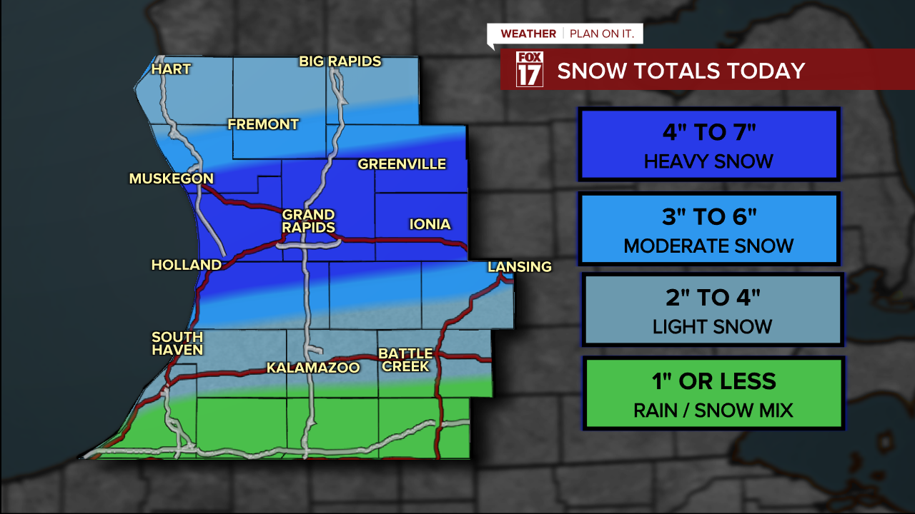
WINTER WEATHER ADVISORIES have been posted for parts of West Michigan until Midnight tonight. The advisory covers Oceana, Newaygo, Mecosta, Muskegon, Montcalm, Gratiot, Ottawa, Kent, Ionia, Clinton, Allegan, Barry, Eaton, and Ingham counties.

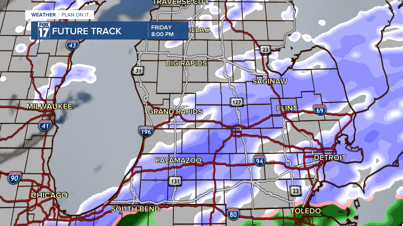
Widespread snow is currently falling over West Michigan this evening. Snow will shift further south by late tonight.
Take a look at the hand drawn snow map below...taking into account all of our forecast models. The heaviest snow of 6" or more will be possible primarily along I-96. Forecast models are indicating that is where the heaviest swath of snow will develop. The lightest amounts will occur along/south of I-94 with an inch or less falling.
Make sure to stay up on later forecasts. We are awaiting alerts from the National Weather Service, and will post them as soon as they are issued. Get more at www.fox17online.com/weather.
