


WEST MICHIGAN - A massive late season mid March winter storm will impact the Northern Plains, Upper Midwest, and Great Lakes this weekend into Monday. By massive, we're referring to the scope of it with several states and millions of people affected. In general, this will not be a winter storm for southern lower Michigan. While some snow is possible on Monday, we expect to escape the heavy snow and significant icing.
This system will track directly over Michigan on Sunday and Monday. West Michigan will be on the front side or warm side. We expect temperatures on Sunday around 60 or better, but unfortunately that sets the stage for the possibility of strong to severe storms. Take a look at where our forecast model is plotting the heaviest snow (below).
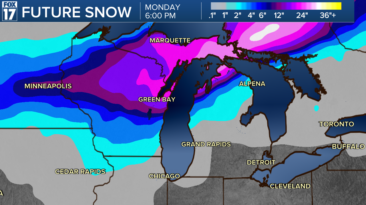
12" to 18" looks likely in Wisconsin and Michigan's Upper Peninsula, but some locations in that region will tally two to three feet!
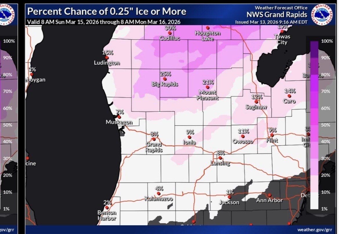
There may be up to a half inch of icing across northern lower Michigan too. Additionally, winds will gust on Sunday and Monday in the 40 to 50 mph range across the region.
Take a look below at our ice accumulation maps. It shows the chance or probability of .10" and .25" of ice.

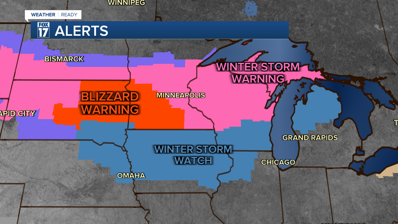
Take a look at all the watches, warnings, and advisories across the region from the winter storm (below).
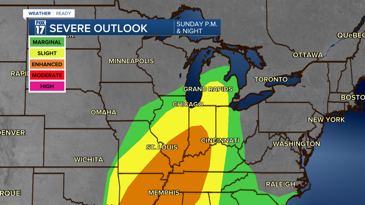
A look at the severe weather threat is below. Threat level 2 out of 5 in yellow with damaging wind gusts and a few tornadoes possible, especially south of Grand Rapids. See outlook below.
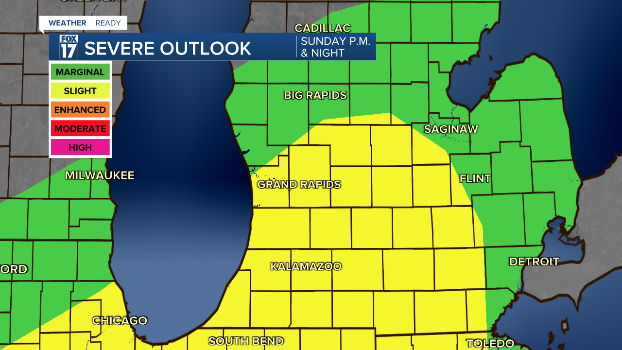
The threat extends much further south too. See image below.
Rainfall could be heavy (again) for southern lower Michigan as thunderstorms train over the same locations with repeating downpours. Take a look at our rain totals below. Don't get so caught up in the exact numbers, but rather the likelihood of widespread soaking rains.

Snow will likely start to accumulate for West Michigan on Monday. Temperatures will crash, winds may gust to 50 mph, and lake effect along with lake enhanced snow will fall. The ground is warm, but we think about 2" to 4" along/west of U.S. 131 will be possible on Monday. See image below.

A FOX 17 WEATHER READY ALERT has already been issued for both Sunday and Monday. Please be safe. For the latest details on the weather in West Michigan, head to the FOX 17 Weather page.
Follow FOX 17: Facebook - X (formerly Twitter) - Instagram - YouTube
