


WEST MICHIGAN — If this is a vacation week for you...you picked a good one!
High pressure over the Great Lakes and Ohio Valley keeps much of the region dry through Thursday. Highs will climb into the middle and upper 80s but relatively low humidity prevails as well. Isolated thunderstorms are possible tonight from 8 p.m. to around midnight, and again Thursday afternoon. Most will stay dry, but the few thunderstorms that do pop up could be on the stronger side with gusty winds and small hail.
July 4th itself (Friday) looks to be mainly dry and hot. Feels like temperatures will be in the mid to upper 90s, so stay cool and hydrated especially if you're out on the water or in the sun for a prolonged period of time.
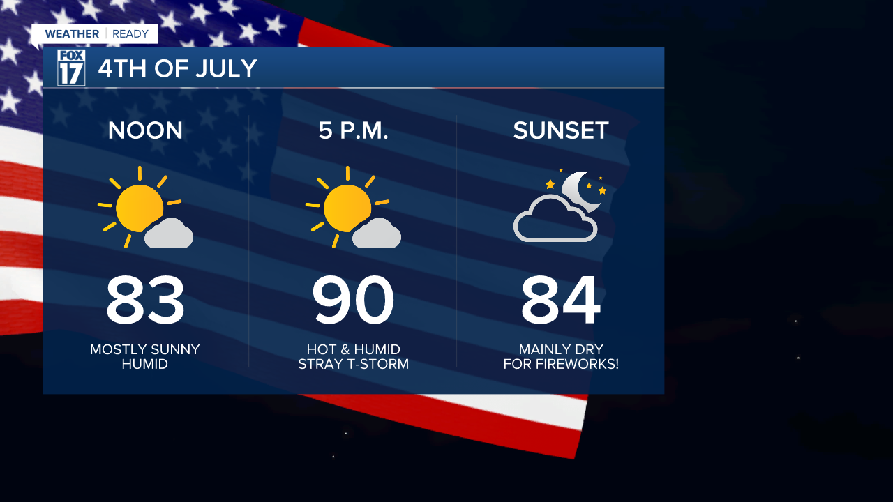
A pop-up shower or thunderstorm is possible Friday during the peak afternoon heating hours, but many look to stay dry. By sunset any rain will be diminishing, and the fireworks forecast looks good!

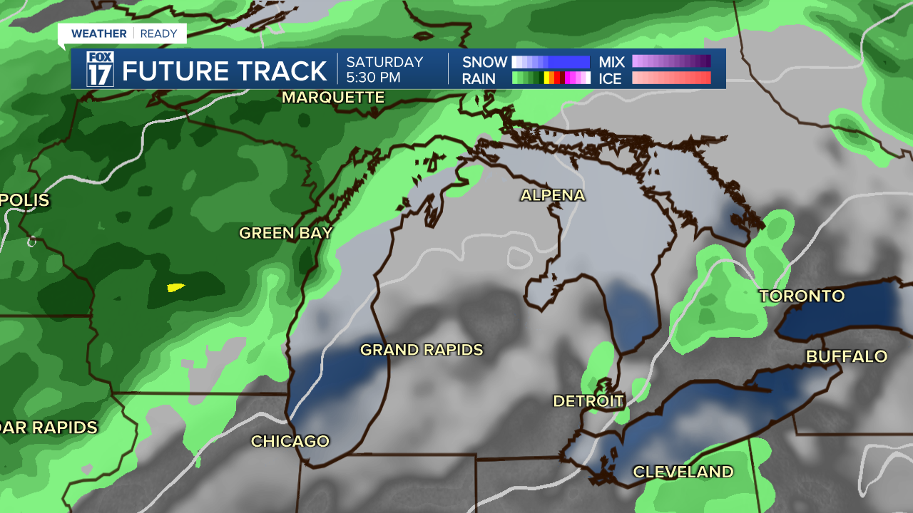
Saturday is a WEATHER READY ALERT day due to excessive heat and humidity. It will be a steamy day with highs in the low 90s and heat index temperatures pushing triple digits. An isolated shower or storm is also possible but most stay dry as a cold front stays to our north. Anyone going to the U.P. will have the best chance of rain for the weekend on Saturday, though.
Sunday as the front nudges closer, more widespread rain and thunderstorms will move in to West Michigan. This will be the best day of the 3 day holiday weekend for West Michigan to get rain and thunderstorms.
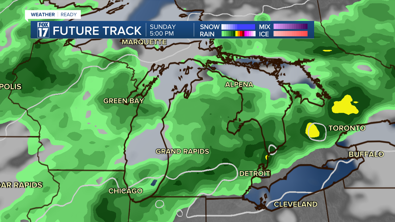
While it won't be a total washout, you may need to prepare some indoor backup plans as storm chances are highest through the afternoon and evening.
We will be fully staffed in the Fox 17 Weather Ready Forecast center, so for the latest details on the weather in West Michigan through the holiday week and weekend, head to the FOX 17 Weather page.
Follow FOX 17: Facebook - X (formerly Twitter) - Instagram - YouTube
