


WEST MICHIGAN — West Michigan woke up to the first snow of the season this morning. Lake effect snow showers will continue tonight into tomorrow, with several inches likely in the heaviest bands.

Most areas saw the snow on the grassy surfaces, with less than an inch of snow in many locations.

As this system cleared out, even colder air began to pour into the Great Lakes region, kicking the "lake effect snow machine" into gear for the first time this season.
Lake effect snow showers will produce locally heavy accumulations in some of our lakeshore counties over the next two days, with Berrien County under a WINTER STORM WARNING for Sunday night into Monday, as 6-12" of snow is possible from extreme southwest lower Michigan around the foot of Lake Michigan. As this band of locally heavy snow keeps producing snow into Monday, travels toward Chicago will become quite hazardous. A WINTER WEATHER ADVISORY is in effect for Van Buren, Cass, Oceana and Mason counties; with another locally heavy area of snow continuing from north of Lansing toward Saginaw.
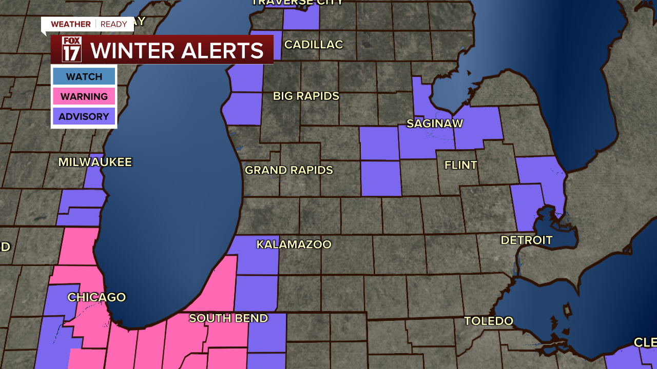
In addition, a WINTER WEATHER ADVISORY is in effect for Cass and Oceana counties; for as much as 3-5" of Lake Effect Snow.
Warmer air is on the horizon for next weekend.
For the latest details on the weather in West Michigan, head to the FOX 17 Weather page.
Follow FOX 17: Facebook - X (formerly Twitter) - Instagram - YouTube
