WEST MICHIGAN — Lots of sunshine is in the forecast yet again here on Saturday as temperatures jump into the upper 80s to near 90 degrees for most of West Michigan. Thin high clouds can pass overhead throughout the day but will not have any impact on our upward movement on the thermometer. Humidity will be in the moderate category but certainly nothing overwhelming.
Immediate lakeshore communities will be held back several degrees on a southwest wind at 10-15 mph. Expect waves generally between 1-2 feet if headed out into the waters today.
Mostly clear to partly cloudy skies can be anticipated this evening and overnight as a weak weather disturbance nears from the west and northwest. This system will serve to bring a few more clouds into the mix on Sunday and could be responsible for an isolated shower or thunderstorm particularly north and west of Grand Rapids in closer proximity to slightly higher moisture levels.
Even a slight chance for a shower cannot be dismissed locally in Grand Rapids but coverage would be minimal and nothing important is expected. Common highs on Sunday will likely land in the upper 80s once again.
This weak disturbance departs Monday morning but continued subtle troughiness over West Michigan means that we cannot totally dismiss the prospect for an additional rare afternoon shower or thunderstorm for someone. Again, this would be minor activity and the vast majority of the region stays rain-free. Highs on Monday land near 90 degrees under partly cloudy skies. An increase in humidity on Monday will have heat indices into the middle 90s.
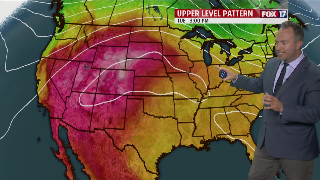
A more serious pool of heat will be gathering just out to our west on Monday and will try to fight into West Michigan through the day on Tuesday. Differences in the models present difficulties with trying to determine just how hot it will get on Tuesday. A consensus of information puts us on the periphery of the heat dome in a zone which is known as the ring of fire. Therefore, a slight chance does exist on Tuesday for a few occasional showers or thunderstorms to be nearby.
The aforementioned heat dome looks to expand into our region throughout the day on Wednesday continuing into Thursday. It is at this time when the potential exists for daytime temperatures to reach the lower to middle 90s. If this happens, coupled with humidity, heat indices can potentially exceed 100 degrees.
If, however, the ring of fire pattern gets hung up over West Michigan preventing the heat from fully blasting in, we will see temperatures get held down a bit due to more cloud cover and spotty wet weather. At the current time the expectation is for heat to arrive in full force by Wednesday afternoon and to remain into Thursday. Eventually a cold front will drop southward at some point later Thursday into Friday with a much better chance for areawide showers and thunderstorms.
Another wild card will be any tropical moisture ( remnants of Tropical Storm, potentially Hurricane Laura ) that attempts to get pulled northward from the Gulf of Mexico. Stay tuned to FOX 17 for further updates.


