
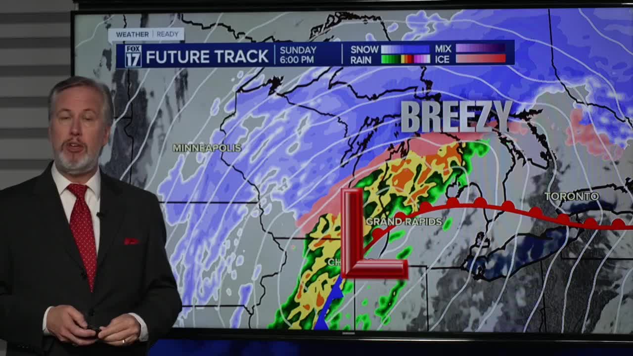


The forecast from FOX 17 Weather Ready Chief Meteorologist Kevin Craig: Most of Saturday looks dry and cool, but Saturday night into Sunday another system arrives. This systems bears watching as we are currently seeing rain, snow, wintry icy mix, and perhaps a thunderstorm in spots. Some models bring mostly rain and a little snow to West Michigan, while others bring more wintry weather. Any accumulation in our area would likely occur from Grand Rapids to the north. This will be a system to keep an eye on in the days to come as travel impacts could be possible Sunday. The system looks to produce very heavy snow across northern lower Michigan and north central lower Michigan. Beyond that system we cool down even further with some lake effect snow showers possible early next week.
SATURDAY: Some morning sunshine, otherwise P.M. clouds thicken. Highs in the upper 30s to near 40. Winds variable at 5 to 10 mph. Look for a quick burst of snow to develop after midnight as our next winter storm arrives.
TONIGHT: Cloudy with snow developing after midnight. Some light freezing rain or sleet may mix in. An inch or two possible from Grand Rapids northward. Lows in the lower 30s. Winds east at 10 to 15 mph.
SUNDAY: WEATHER WEATHER ALERT A chance of some early morning snow showers or light icy mix. Otherwise, mostly cloudy, breezy, and warm with rain and thunderstorms in the afternoon and evening. Some storms may be strong to possibly severe. Damaging wind gusts and a few tornadoes are possible, especially from Grand Rapids southward. This is all part of a major winter storm across northern lower Michigan and the upper peninsula. Highs around 60. Winds southeast/south at 15 to 25 mph. Gusts 35/40 mph.
MONDAY: Cloudy and windy with early morning rain changing to snow showers. 2" to 4" of snow possible along/west of U.S. 131. Temperatures in the predawn hours in the mid 50s, then falling into the 20s. Wind gusts 40 to 50 mph.
TUESDAY: Mostly cloudy, breezy, and cold with lake effect snow showers. Highs in the low/mid 20s.
WEDNESDAY: Mostly cloudy with chance snow showers. Highs in the mid 30s.
THURSDAY: Partly sunny to mostly cloudy. Chance of rain/snow showers. Highs in the mid/upper 40s.
FRIDAY: Partly cloudy with highs in the low 50s.
For the latest details on the weather in West Michigan, head to the FOX 17 Weather page.
Follow FOX 17: Facebook - X (formerly Twitter) - Instagram - YouTube
