
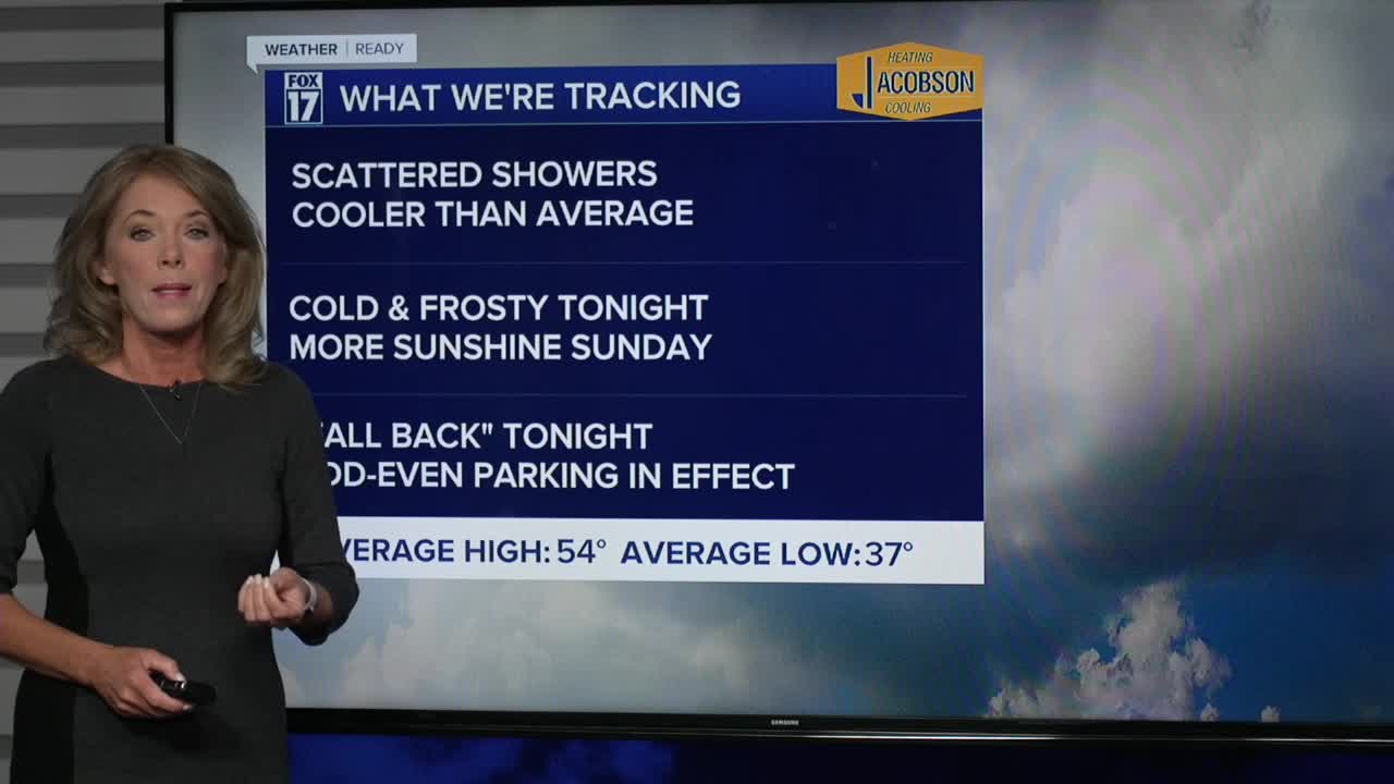


WEST MICHIGAN — The forecast from FOX 17 Weather Ready Meteorologist Terri DeBoer: After a chilly and "shower-y" Saturday, dry air will settle into West Michigan for the second half of the weekend. Any lingering rain showers will come to an end quickly, with clearing skies and cold temperatures overnight. Widespread frost is likely early Sunday morning. With more sunshine and a southwesterly breeze, highs will likely reach the low 50s Sunday. A few showers are possible Monday, Wednesday and Friday as a few weak systems zip through the area. Rain totals will be light, only around a quarter inch. Temperatures remain close to "average" through next week, with high temperatures in the low to mid-50s and mornings in the mid/upper 30s. Remember to "Fall Back" an hour at 2 a.m., as Eastern Standard Time Returns. Even though there's no snow in the forecast anytime soon, the Odd-Even Parking Rules are now in effect in Grand Rapids. Stay with the FOX 17 Weather Ready Team for your latest forecast updates.
TONIGHT: Clearing and colder. Lows in the low 30s. (Colder spots will drop into the upper 20s). Winds: SW 10-15 mph
SUNDAY: Remember to "Fall Back" an hour at 2 a.m., as Eastern Standard Time Returns. Partly sunny. Pleasant. Highs in the lower 50s. Winds: SW 10-15 mph
MONDAY: Morning clouds with a chance of showers, otherwise becoming partly sunny in the afternoon. Highs in the lower 50s.
TUESDAY: Mostly sunny to partly cloudy. Pleasant. Highs in the mid 50s.
WEDNESDAY: Partly sunny with isolated showers. Highs in the upper 50s.
THURSDAY: Partly cloudy. Highs in the low to mid 50s.
FRIDAY: Mostly cloudy with scattered showers. Highs in the mid 50s.
SATURDAY: Partly cloudy and cool. Highs near 50-degrees.
For the latest details on the weather in West Michigan, head to the FOX 17 Weather page.
Follow FOX 17: Facebook - X (formerly Twitter) - Instagram - YouTube
